Tuesday, July 31, 2012

Return to Maine - Sugarloaf, Spaulding, and Abraham - 7-21-12

It was time for the second scheduled weekend in Maine for peak-bagging in the Rangeley-Stratton area. First up was easily the longest dayhike of the 4 in this area. There are no loop options (at least along maintained trails) for the three high peaks on the East side of the Caribou Valley Road, and so most people looking to do Sugarloaf, Spaulding AND Abraham all in one dayhike do an out-and-back from the CVR along the Appalachian Trail and the Abraham Side Trail. This hike entails roughly 17.4 miles and 6000 feet of elevation gain, with a very steep section near the CVR. With the CVR closed 1/2 mile from the AT still, it meant a hike of a little over 18 miles!

A car-spot was discussed briefly for coming out over Mount Abraham on the Fire Warden's Trail, but that was going to be a really tough, out-of-the-way car spot, so that was abandoned. In planning this trip, Chris, the organizer once again, asked me to look into possible herd paths/bushwhacks down from Abraham to the CVR. This wouldn't save us much of anything in mileage, but it would save around 1500 feet of climbing on the way back, and the last several miles would be all along the washed-out, but easily-walked stretches of the CVR. With a little research and some Google Earth imagery, I constructed a couple of GPS traces of some logging cuts I saw there that we could try to navigate to to get down easily.

This time around there would be three of us for both hikes, as a gentleman named Will who had recently finished the NH 4000-footers and was now wanting to work on the New England 100 Highest joined us. It was a slow trip out of Massachusetts on that Friday night as there were tons of accidents, but we eventually rolled into Rangeley around 9PM.

Then we had to GET to the trail. While 2 weeks previously we found the Caribou Valley Road in decent shape up to the steel bridge, this time we found a different story. The lower 3 miles of the road had been covered in a thick layer of dirt, presumably to fill in holes and such, but it had become very rutted and washboarded, making for a much rougher ride than we had our last visit here. The last 0.9 miles to the parking area was just what we remembered, nothing that taking it slow couldn't handle.

A quick saddle up, and off we went on the CVR, and then a hard left onto the barely-noticable Appalachian Trail. We quickly crossed the Caribassett River, which was an easy rock-hop combined with a 2x10 board strapped to a pair of rocks. Then the grade soon steepened, with us passing over a scree slide a couple of times. There were some nice views across the valley though, which made for nice excuses to rest.

South and North Crocker

Redington trying to hide behind the shoulder of South Crocker
After a while, the grade moderates, and then runs nearly flat for a while until the Sugarloaf Side Trail diverges 0.6 miles to the open, rocky summit of Sugarloaf, the second-highest mountain in Maine (behind Katahdin of course).

Crockers and Redington

Saddleback and the Horn

Bigelow Range

Abraham (left-center) and Spaulding (right-center), the next stops
Sugarloaf is of course a well-known ski area in the North-east, and the slopes come nearly to the top, with numerous buildings scattered around the summit. Here we took a break before executing an about-face and heading back to the AT, and then on to Spaulding.

Dedication plaque between Sugarloaf and Spaulding

Spaulding has a new summit sign, but is listed at 4000 feet everywhere else...
After taking the short side trail to Spaulding's nearly view-less summit, we headed down to the Spaulding-Abraham col, where there is the Spaulding Mtn. Lean-to.

Fire pit at Spaulding Mtn. Lean-to

The Spaulding lean-to - yup, it was sunny out! Thru-hiker (North-bound) hanging out inside
We took a longish break here, spending a while chatting with a North-bound thru-hiker who was nearing the end of his journey. He is probably nearing Katahdin at this point, if he hasn't finished already. It is amazing just how many North-bound thru hikers we saw in our 2 weekends in Maine, July is very early for this many to be that far North, but the mild winter seemed to allow many to get an earlier-than-normal start.

From here we had a short distance more to drop to the col, where we saw a well-defined herd path heading towards the Caribou Valley (where the CVR is), and was very close to one of the traced logging cut routes we had identified as a route down. We decided this would be our way back down to the car (more on that later).

From here we began a brief climb to the Abraham Side Trail (Mount Abraham Trail), which diverges from the AT and goes right over the rocky summit of Mount Abraham. It travels over several false summits along the way, and crosses a couple of scree fields before attaining the summit. Many people have mentioned how Abraham is much like one of the Northern Presidentials in New Hampshire (in particular Mount Adams) and aside from the much lower elevation, it does indeed have that feel.

Views from Mount Abraham Trail

Mount Abraham from one of the scree fields

Cresting the first false summit on a scree field

Closer to Mount Abraham...

Spaulding (foreground) and Sugarloaf (center, distance) from Mount Abraham

Second, slightly-lower summit of Mount Abraham (has the carin oddly)

Roof of a shelter at the Abraham summit

Small entrance to the rock shelter on Abraham

South Crocker and Redington from Abraham (I think)

Tower remnants on the summit of Mount Abraham
Here we took a long snack break, enjoying the 360-degree views and the end of our intended climbing for the day (aside from the short ups on the Abraham Side Trail going back of course). We were a mere ~10 miles into our journey to this point! We eventually headed back to the AT.

Heading back down on the Abraham Side Trail

Some sort of old trail at the Abraham/Appalachian Trail junction
Back at the Appalachian Trail, we briefly discussed taking a wide, unmarked trail that left the AT across from the Abraham Side Trail. We knew there was a series of logging roads not too far down that eventually let to the CVR, but not before taking a significant detour South, the opposite direction from our car (Later, I discovered Google Earth was showing me old imagery despite having new imagery, and I found clear cuts and some roads roughly 3/10 mile from this intersection that would not go too far astray in getting to the CVR. It might be a very good option for getting down, next time here I intend to try it.) Thus, we opted to go back to the other herd path we had seen near the Spaulding lean-to, and headed there.

The herd path was easily followed for a while, though certainly not as defined as a real trail. It led through wide open woods to the crest of the ridgeline, after which it soon petered out. From here we cut towards what looked like a logging cut on Google Earth, hitting some thicker woods here and there. We crossed an AT boundary cut, which is a cleared swath that parallels the Appalachian Trail roughly 1000 feet on either side of it, marking the AT property. After crossing this, we soon cut to the swath on the imagery, finding not an old road or AT trail like we hoped, but a band of thick spruce. Not sure how that happened to be a cut on the satellite...

So we just decided to meander our way downhill, through whatever open woods we could find, hoping to hit another logging landing roughly half-way down. We hit the AT boundary cut again as we traversed above the spruce field trying to find better woods, then we went down. The woods progressively got worse, with abundant amounts of thick, dead branches. We took whatever relatively clear spots we could find, including skirting some boggy areas. While trying to cut over to the logging landing, the woods would not have any of it, so we just kept heading to the road. After a really long time (roughly 1hr 20min), we hit the CVR, a mere couple of tenths of a mile from the bridge over the Caribou Pond outlet where the road down from Redington comes out. We made quick work of the 3-mile road walk back to the car.

Aside from the bushwhack that didn't quite go to plan, it was a great hike, with some great views from Sugarloaf and Abraham.

Google Earth overlay of the track hiked, Abraham is the rocky peak on bottom-right


Summary:
Peaks: Sugarloaf (4240', NE4K), Spaulding (4000', NE4K), Abraham (4040', NE4K)
Mileage: ~17 miles
Elevation Gain: ~4400 feet

Thursday, July 12, 2012

A-Maine-Zing Weekend Part 2 - Crockers & Redington 7-8-12

Part 2 of the first Maine weekend organized through the Random Hikers Meetup Group was for the Crockers (North and South) and Redington. The Crockers themselves are fairly straight forward, accessed along the Appalachian Trail and only 1 mile by trail from each other. Redington, to the South along the same rough ridgeline, has no established trail to the summit, the only other summit like this on the New England 4000-footer list (Owl's Head in NH being the other).

There is a decent, though very brushy herd path from South Crocker to Redington's cleared summit (though not open - there were some structures here at one time). There is also a series of old logging roads (still wide open and very hike-able) leading from the Caribou Valley Road (aka the Caribou Pond Road) to the herd path near the summit.

The CVR itself has been in declining shape the last several years; being merely a logging road that happened to cross the Appalachian Trail at a convenient point for peak-baggers (only 2.1 miles by trail to South Crocker from the road) it has not been maintained at all. Many bridges leading up to the AT crossing have been getting weak and Hurricane Irene last fall made things even worse. Of late, only high-clearance vehicles have been able to get anywhere near the AT crossing, and after Irene even those were having trouble. It looked like this might be the last year to "easily" access Redington, and I was glad to get a shot at it. However, awesome news came through from other trip reports a mere week before the hike that the CVR had been largely repaired up to a point 1/2 mile from the AT crossing, and was barricaded to vehicular traffic beyond that point. Still, bridges and culverts had been repaired or replaced and even low-clearance vehicles had been getting up to the 3.9-mile mark (which is where the barricades were) with minimal trouble. I had ridden up with Chris, who had a Subaru Outback, so we were certainly in good shape there.

No cars beyond this point - drivable by any vehicle up to here with a little care
Between this spot and the AT crossing there are 2 more smaller bridges. One had been replaced and merely needed a little re-grading of the road to be good to go, the other bridge looked a little sketchy but probably fine really. The road up to the AT is likely going to be opened again soon. It seems this work, minimal as it is, was done for the 75th anniversary of the AT being finished near this road, and some ceremonies seem to be forthcoming. (Note this information is 3rd-hand, but as the AT was completed nearby between Sugarloaf and Spaulding Mountains - on the East side of the CVR from the Crockers-, it seems plausible.)

Bridge after barricade, before AT crossing

Replaced bridge shortly before AT crossing
Only Chris and I were on this hike. We left the car and made short work of the 1/2-mile on the road to the poorly-marked (as in not at all) AT crossing. Watch for a small parking lot on the right side of the CVR, the crossing is just down the road from that. We saw a motorcycle at this spot, hope he realizes he cannot legally count the ascent for the 4000-footer list!

After turning right (West) onto the AT, we began a moderate ascent to the Crocker Cirque Campsite spur path roughly 1 mile up from the road. Above here the trail ascends steeper, twice climbing briefly up a talus slide with nice views toward North Crocker and the Bigelow Peaks from yesterday.

The Bigelow Range - Avery Peak, West Peak, the Horns from right to left

Little Bigelow Mountain

North Crocker

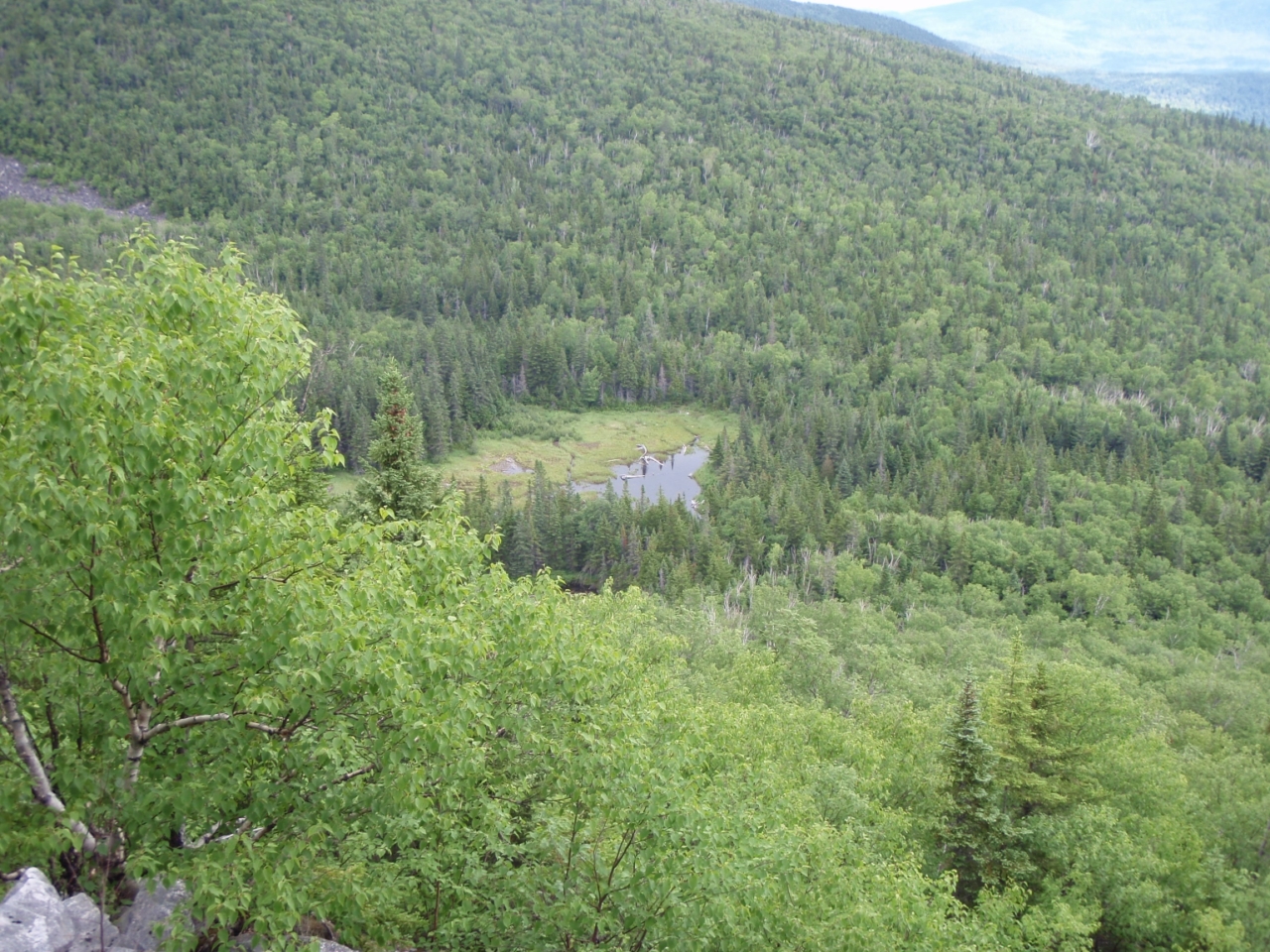
Crocker Cirque - campsite is near there

Looking down one of the talus slides you climb up
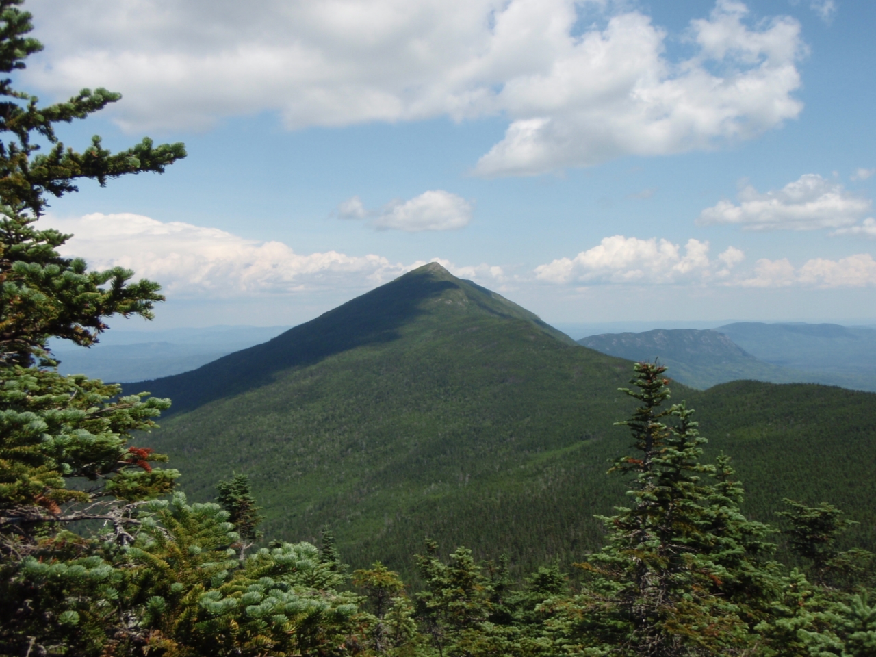
2 poor nights of sleep in a row and I was climbing slower than normal, but still at a solid pace. Roughly 1.5 hours and 2.6 miles from the car (and roughly 1900 feet of climbing) I reached South Crocker, several minutes behind Chris. Right by the summit is a man-made clearing towards the other side of the Caribou Valley, with good views of Sugarloaf, Spaulding, and Abraham (all 4000-footers themselves).

Sugarloaf

Spaulding, with the rocky summit of Abraham way off in the background

The ridge between Sugarloaf and Spaulding
A break here, where we met 3 guys backpacking along a section of the AT, hitting the 8 4000-footers in this region South of the Bigelows. They were in the process of dropping packs and taking the herd path to and from Redington before continuing over North Crocker and out to Maine Highway 27. We took a short break (Chris's was longer, haha) and then continued North to North Crocker, a mere 1 mile away. The col is fairly deep for a 1-mile trek, with a 480-foot descent and a 550-foot ascent in that span. But the going is pretty easy, and there is a unique artifact in the trail in this stretch.

An AT marker right in the center of the trail - these are mostly long gone now, it was cool to see one!
North Crocker was reached, where once again I met Chris talking to some thru-hikers, one whom we had met the day before on the Bigelows! The thru-hikers are a bit early this year, as the mild winter enabled an earlier start than usual for many of them. North Crocker is completely viewless, though a herd path to the Western direction had a very limited view. This path seemed to go all the way to the valley, my thought is it might be an approach from one of the logging roads in that direction.


We quickly executed a u-turn back to South Crocker.

Nice walk through the col between the Crockers
Now it was time for the fun part. The herd path off South Crocker is easily found at the summit, but it soon becomes less defined and pushes through a lot of needle-less spruce/pine branches. Shortly after the initial drop you come to the AT boundary corridor, a cleared swath of trees that parallels the AT on both sides (each is roughly 1000 feet from the AT). Here the herd path directly crosses, it does not follow the boundary at all! Many people report losing the herd path here, but if you cut straight across, you will find the herd path again. After a little while it turns into needled branches which were less painful, but still slow going. The path occasionally seems to just end, but a brief pause, short backtrack, and you find which way it is going again. This continues most of the way to the open col.

In the col, heading to Redington in the center

South Crocker from the col
Past the col, you soon come to an old logging road, which you follow to the left, uphill. Here we ran into the trio we had seen the first time on South Crocker, on their way back. A little way up the road, a carin and some tape marked a turn onto a herd path that continued up to the summit, with occasional blazes and tape (most orange). This side of the col is easier going overall, and we reached the flat summit area. There are a few building remants up here and a decent view towards what my map said was East Kennebago Mountain.

East Kennebago Mountain (I think)

Bigelows behind the Crockers col
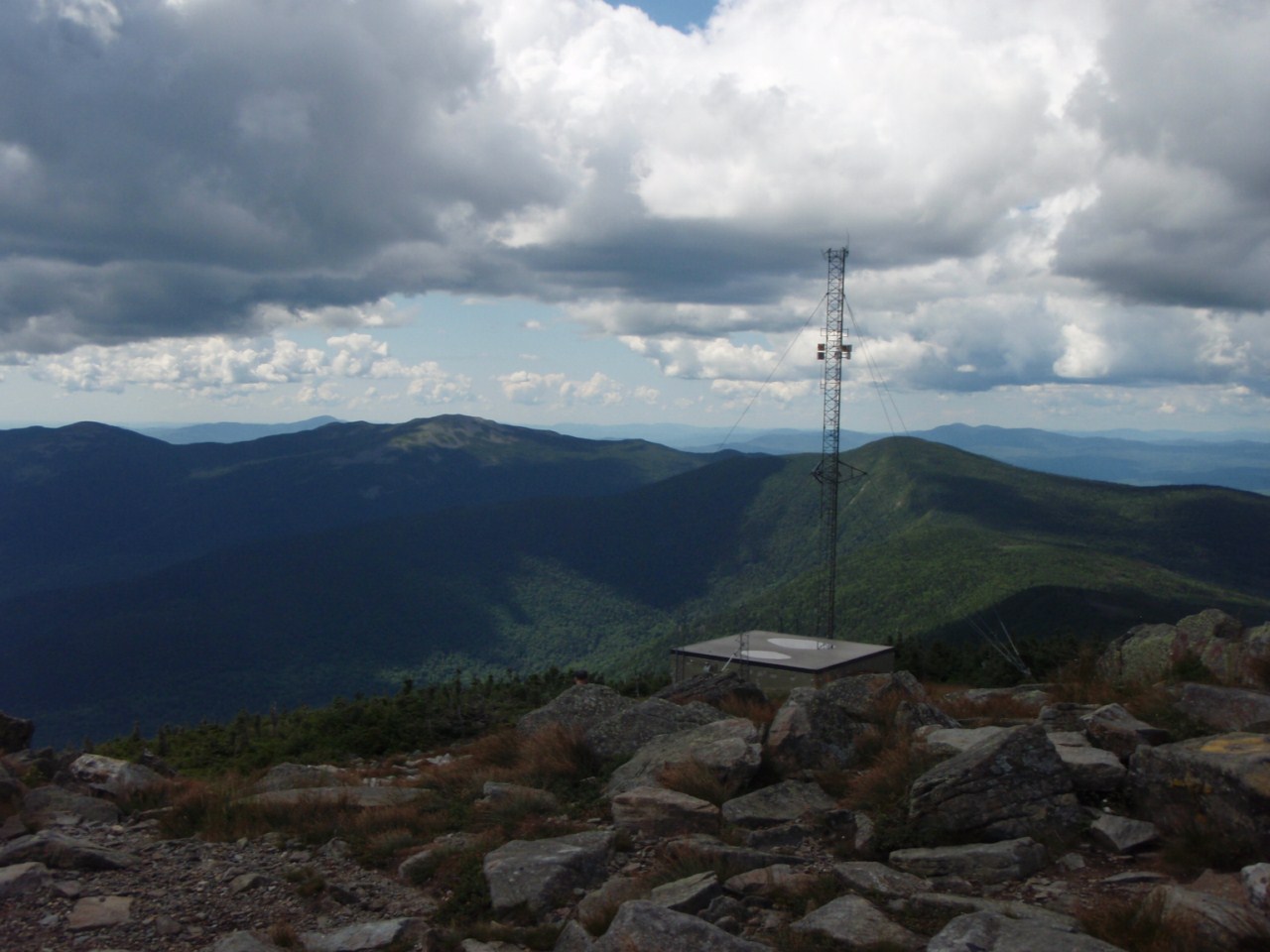
Near the summit in the trees toward the Crockers is a summit canister, the first I've gotten to see. Inside was a mere 2 sheets of paper with a few names dating back to December. It seems the old log has been removed. The canister, incidentally, had the year 1986 marked on it's bottom. You need to be fairly tall to get into it, the top lifts off and the "log" and pens and pencils are in a ziplock inside. I signed my name and put it back after looking through the handful of other entries.


While up here 2 other people showed up. So at least 7 visited this summit on this day! After the annoying bushwhack we opted to take the longer, but easy-going route down the myriad of logging roads. The directions are rather mixed up out there on the internet, most people say "right, right, left, left" at the various intersections, but I'm pretty sure there were 3 rights before the lefts. The first is where the herd path that we followed up from the logging road splits, to go back to the logging road we came from, or to the right which we followed. There are some carins and wood arrows marking the way uphill (from the CVR), but I'd suggest downloading my GPS track from Peakbagger.com for this peak and overlaying it on Google Earth. It will give you a better idea, and if you have a GPS, you can load it on there as extra help.

The lower left turn is onto the CVR near Caribou Pond. From here it is over 3 miles back to the car. Along the way we saw many washout sections, broken bridges, and altogether missing bridges. Needless to say, without work being done on this stretch (unlikely), even a Jeep right now might not be able to get to the pond for a shorter attack on Redington.


One of the old roads we descended to the CVR

Turned left here onto the CVR
It was a long, mostly boring grind out to the car, but we got there a mere 5.5 hours after leaving it, averaging 2 mph over the ~11-mile hike! The weather in the morning was threatening over the Crockers, but as can be seen in the last couple of pictures, blue sky prevailed, and it ended up being a very nice day. Much cooler than the day before, which was welcome.


Summary:
Peaks: South Crocker (4050', NE4K), North Crocker (4228', NE4K), Redington (4010', NE4K)
Mileage: ~11.3 miles
Elevation Gain: ~3400 feet
Time: 5.5 hours total, including breaks

An A-Maine-Zing Weekend Part 1 - Bigelows 7-7-12

Yea, okay, kinda corny line. I had originally planned to spend a week in Maine later this month with a friend of mine hiking the 10 4000-footers in the Rangeley-Stratton area of Maine. The Appalachian Trail runs over all of these save one, which doesn't actually have an official trail to it at all. However, the access to the trails for some of the peaks is best reached via a rather rough, unmaintained logging road with numerous decaying bridges. My friend has a Jeep, I have a low-clearance car. Need I explain that more? But we changed plans, with my friend understandably not really wanting to drive roughly 11 hours each way.

Almost simultaneously a Meetup Group that I joined a couple months back (mainly so I wasn't always hiking alone this coming winter) posted a pair of weekends to bag these 10 peaks. It means 2 separate 4.5-hour one-way trips up there, but it also means limited time needed to be taken off from work (basically just leaving early on the 2 Fridays). This weekend was weekend #1, and the Saturday hike was to the Bigelow Range.

There are 2 peaks rising over 4000 feet on this ridge, which rises high above man-made Flagstaff Lake at the Northern end of the Rangeley-Stratton region. These 2 peaks are a mere 0.7 miles apart, named Avery Peak (4088') and West Peak (4145'). One thing to note about the 14 Maine 4000-footers: none save the 2 major peaks of Katahdin rise very far over 4000 feet. In the case of the Bigelows, the summits are exposed, but the ridge is mostly treed-in.

A straight-forward approach is available to the 2 Bigelow peaks: the Fire Warden's Trail from the South leads right to the col between the 2 peaks, moderate in grade for most of it's 4.7 miles, but the last mile gains around 1300 feet in elevation. The footing is very good the entire way, however, with rock stairs in the steeps. A couple miles down the ridge from West Peak, however, there is a peak on the New England 100-Highest list, a list I am somewhat pursuing. This peak is called South Horn (3805') and has a twin just to its North called North Horn (shocker!) - 3792'. And just a little further down the ridge is Horns Pond, a nice pond with campsite near its shore, and a trail that cuts right back to the Fire Warden's Trail about 2 miles from its start. This was a loop I wanted to do, and lucky for me, the trip leader had planned for this loop as well.

The route

3 of us started out at the somewhat leisurely hour of 8:25. In addition to myself and the trip leader Chris, Pam from Hike-NH was along for the trip. It was great to finally get to hike with Pam after crossing paths a couple times on the trails this year.

The trail initially follows the road that the parking lot is on a bit further to Stratton Brook Pond, and people with good clearance vehicles could actually make it the extra 1/2 mile or so to the pond and save some walking. It crosses the wide outlet of the pond, which was an easy rock hop, and enters the woods. Aside from a few peeks through the trees to the col we were heading to, there isn't much to see other than a nice woods walk until you hit the col. From the col we turned East, and scrambled up some rough footing to the summit area. The foundation of an old fire tower is just past the summit, along with some broken glass and a few charred remains of it that were not removed from the summit.

Sugarloaf from Stratton Brook Pond

Fire Warden's Trail heads to that col - Avery Peak right, West left

West Peak as we headed up Avery Peak

Final push to Avery Peak

Rather faded summit sign
While the Maine Guidebook mentions a spectacular view at Avery Peak, one really needs to be there to understand how magnificent the 360 views are.


West Peak from Avery Peak

Little Bigelow Mountain


We hung out below the summit (out of the pretty stiff winds whipping around) and ate some lunch. It was 11:20. A long break at the summit, then we packed up and headed back to the col, where Chris retrieved a water bottle he left there, and then on to West Peak.

Heading back to the col, then West Peak
What the guidebook fails to mention is that West Peak has extremely good views as well.

Avery Peak from West Peak


The Horns

White blazes to The Horns


Avery Peak with Little Bigelow in the background

Chris heads off to the Horns

The Horns

The Horns
After a little break at this summit, we began the long trek to The Horns, roughly 2.3 miles to South Horn, still along the Appalachian Trail. The initial descent off West Peak, as can seen above, has a nice above-treeline trek. It soon drops into the trees, and is a long, gentle downhill followed by a gentle climb with a brief scramble to South Horn. South Horn has nice Southern and Eastern views from a ledge at the summit.

Looking back at West Peak

West Peak

The ridge from West Peak

Further West along the Bigelow Range

Horns Pond

Horns Pond

Check off another NE Hundred Highest!
From here, it is a short 0.3 miles to North Horn, which does not quite make the 200-foot col requirement to be a NEHH peak, but we visited anyway. It turned out to have better views (360 degrees) than South Horn anyway. And it was actually only a 0.2-mile each way detour as the AT goes 1/10 mile towards North Horn before dropping to the pond.

Sugarloaf from South Horn


South Horn from North Horn

The ridge towards West Peak

Ridge from West Peak to South Horn

Horns Pond - next stop


From North Horn we cut back to the AT and dropped to Horns Pond, where we took a break and topped up on water while relaxing by the pond (and someone took a swim...). It had been a warm day and both Pam and I were down to about 1/2 liter from our starting 3L. We were likely fine as it was all descent, but it's better to be safe than sorry. Chris somehow declined despite only bringing 2L with him. He would run out about 1 mile from the car, so not too bad.

Full "box spring" right along the trail just before hitting Horns Pond campsite. The campsite has a separate water source.
One interesting thing about Horns Pond Campsite: it has a caretaker during the summer, but is still a no-fee site! The pond was very nice and the site looked like a great place to spend a night, but we were on a dayhike, so eventually we headed down. The descent dragged on, but we reached the car at 5:20, not quite 9 hours from the start.

The weather forecast for the day had been for rain and scattered thunderstorms, but as can be seen, we lucked out with lots of blue sky, even if it was a little hazy. It was warm too, but not massively so. Really, it was hard to complain about anything on this day. What an amazing entry hike into the Maine 4000-footers!

Summary:
Peaks: Bigelow Avery Peak (4088', NE4K), Bigelow West Peak (4145', NE4K), South Horn (3805', NEHH), North Horn (3792')
Mileage: 13.8 miles
Elevation Gain: ~3900'
Total Time: 8hr 55min including breaks