Monday, September 24, 2012

Conquering the Owl - September 9, 2012

Owl's Head. Possibly the most dreaded peak on the New Hampshire 4000-footer list. The only one without an official, maintained trail to its summit. The mountain itself is a mere 4025 feet tall. And there is an un-official, semi-official herd path to the summit that isn't harder to follow than many other maintained trails. But to dayhike this peak still requires an 8-mile approach hike to the base of the Owl's Head Path (the aforementioned "unofficial trail"), followed by a steep climb up a slide and then steep woods. A roughly 18.5 mile round trip, with several large water crossings that are often tricky, even accounting for wading across. The saving grace is that the hike has less than 3000 feet of total elevation gain, as the approach is mostly along old railroad grades. At the same time this can get monotonous.

However, Owl's Head is merely long, not particularly tough all said. And it was time to visit the Owl. The only other time I'd hiked this mountain was as a day hike from 13 Falls Campsite, which wasn't bad aside from the Lincoln Brook Trail between 13 Falls and the Owl's Head Path being tough to follow in a few spots. The lower half of this trail was supposed to be fine.

A few weeks before Flags on the 48, I invited fellow Hike-NHer HossInNH along, as he'd been wanting to tackle it before he got too far into the 4000-footers (saving all the goodies for last!). He and I had met on the trails inadvertently a couple of times over the summer. He also participated in our group's 9-11 hike. He agreed (he'd wanted company for this, and not too many people hurry to the Owl!), though it would be his first back-to-back weekend that I'm aware of. And 2 tougher ones at that.

As there was heavy rain the night before the hike (roughly 1.5" fell between our finish of the Twins hike and about 4AM), I thought we would be better hiking via Black Pond and a roughly 1 mile bushwhack through what was supposed to be open woods to the Lincoln Brook Trail. This in fact would cut off about 1 mile each way and avoid what is normally the worst 2 river crossings. Hoss agreed, and we were off. We made good time to the end of the Black Pond Trail, which just sort of ends at its namesake, Black Pond, which has a nice view towards the Bonds.

Bridge at the Lincoln Woods area to begin the hike

Irene washout on the Lincoln Woods Trail

The Bonds over Black Pond
Then for the bushwhack. I had many trail reports to work from, as this is the normal route in winter and whenever water is high. Most indicated gaining a few hundred feet of elevation would avoid the boggy areas, and a compass bearing of roughly 340 magnetic would take you through the birch woods versus spruce and co. Well, here was snafu #1 for the day. My compass didn't seem to want to point anywhere near North. We knew from the trail, Black Pond, and a few other landmarks roughly which way was North and it wasn't what my compass was pointing to. Guess that needs fixing. But the nice thing about this bushwhack is that you can more or less pick your own line North and slightly westward, and you will hit the Lincoln Brook Trail (or at least the river, which the trail follows and crosses a few times).

Off we headed, scrambling up a bank near the pond and meandering our way NorthWest, somewhat following a couple tracks I traced from Google Earth into my GPS. We did a lot of sidehilling early, which wasn't pleasant for my bum knee (the one that had been bothering me since before Baxter State Park) or Hoss either. So we gained more elevation earlier than intended, to about 2000 feet, where we hit some better woods too. We kept this elevation for a while, slowly making our way through a few patches of thicker spruce and undergrowth. Eventually we started to drop some of the elevation in favor of better woods, and after way too long, we popped out onto the Lincoln Brook Trail, about 100 feet past the second stream crossing we were trying to avoid (yeay!). We were slow through the bushwhack, taking roughly 1.5 hours. We didn't quite follow the line envisioned, but it did do the job. We decided to give the main trails a go all the way back after summitting.

Fungus on a log on the Black Pond Bushwhack


The Lincoln Brook Trail from here was straight-forward enough. A couple more stream crossings, the last of which we waded. The cold water felt wonderful on the feet. A quick dry-off and re-application of boots and we were at the base of the slide in short order.


Start of the Owl's Head Path
The carin marking the herd path is sometimes not there, but it was on this day, and it seems for the most part it is being left (Wilderness Regulations technically prohibit marking of unofficial trails). The path quickly opens up onto the gravelly slide, which ascends 700 feet in 3/10 of a mile, before entering the woods and continuing at a steep rate until the ridge is reached. On this day the sky was nearly perfectly clear, and there was a slight chill in the air, the first real fall-like day of the year (fall hiking is wonderful!). The views of the back of Franconia Ridge from the slide are tremendous, and really the only views to be had on this hike.

Heading up the Owl's Head Path, which goes up a rock slide

Lincoln, Lafayette

Lincoln

Northward up the valley

No trickery here, it IS that steep!
It reaches the ridge, then levels out, and soon reaches the "old" summit of Owl's Head, which was the recognized one at the time of my previous visit in 2003.

At the "old" summit - follow the arrow!

Remnants of old signage at the "old" summit

The "new" summit
At the old summit, a couple of beaten herd paths lead to the new, slightly higher summit, marked by a large carin. We followed the most beaten-looking paths to the summit, but there were several others, and we briefly got off-track on the way back, but not long. We headed down to the slide to get a snack at the views.

Liberty from Owl's Head slide


Franconia Ridge

We still have to get down there!
We eventually made our way down, returning to the Lincoln Brook Trail just over 3 hours from leaving it. We were slow up the steep climb, and not much faster down, though my knee contributed to the delays coming down. Probably not a great idea to hike 18.5 miles into the middle of the Wilderness on a very sore knee...but it was fine on the flats so all was good.

Arrow carved in a tree marking the start of the Owl's Head Path
We ran into a dozen or so people on the mountain on our way down, and we spoke to several who said that the main trail stream crossings were fine, though one or two would need wading. No problem, our feet were looking forward to it. We made our way back to Lincoln Woods with no incidents, wading both of the lower crossings on the Lincoln Brook Trail (as well as the one near the Owl's Head Path as before), but rock-hopping everything else. The lower 2 crossings on the Lincoln Brook Trail are less than 1/2 mile apart, so I kept my water shoes on and just walked in those to the second one, which was a great change from my boots. It took 11 hours, well over the 8-9 I was figuring on, but we got it done! Slow time on the bushwhack and on the herd path contributed. #45 of 2012 for me, and #18 for Hoss. Congrats dude!

Second-lowest crossing on Lincoln Brook Trail

Current was pretty strong here, aside from this spot we could have rock-hopped

Remnant from a railroad bridge? At the lower Lincoln Brook Trail crossing

Lower stream crossing on Lincoln Brook Trail

Random pink rock in the stream


Hoss comes across the last crossing

Old railroad path

Wilderness boundary - 3 miles to the cars!

Crossing onto the Lincoln Woods Trail, 3 miles to go


The big bump in the middle is Owl's Head up and down the herd path...

Trails are the upper loop, stretch from the pond North on the lower loop was the bushwhack

It is long, but actually not that bad. 18.5 miles by trail, about 18 the way we went. I would not take the Black Pond 'whack again unless there was good snow coverage, or the streams were known to be dangerously high. We were about 30 minutes slower via the bushwhack despite 1/2-3/4 miles shorter.

Summary:
Peaks: Owl's Head Mountain (4025', NH4K)
Trails: Lincoln Woods Trail, Black Pond Trail, bushwhack, Lincoln Brook Trail, Owl's Head Path, Lincoln Brook Trail, Franconia Brook Trail, Lincoln Woods Trail
Mileage: 18 miles
Elevation Gain: 3200 feet
Time: 11 hours

Saturday, September 22, 2012

Flags on the 48 - North/South Twin 9-8-12

This year I was honored to be able to participate in the event Flags on the 48. This event was started as a way to remember those who were killed in the terrorist attacks on 9-11-2001. Basically, teams sign up to fly a US flag on each of the 48 4000-footers in New Hampshire, on the Saturday nearest to 9-11, or the day of should that date fall on a weekend (like last year, when the 11th was a Sunday). Many other summits also see flags on them, but the heart of the event is the 4000-footers. Last year I hiked with a friend of mine during the event and got to witness it, leading me to want to participate this year (and in years to follow).

I signed up along with a number of other people from Hike-NH, some of whom I'd met before, but most not. When the day came to sign up for a peak, we ended up getting North Twin. While initially it seemed to be a less-than-super choice, when one considers that the weather is always unknown 1 month out, North Twin was actually a perfect choice. It has some great views from ledges near the summit, while being sheltered the whole way up, and on the summit itself even. This turned out to be useful, as the weather going into the day was for cloudy and windy skies, with heavy rain beginning in the evening.

Our plan of attack was simple: we would take the North Twin Trail from the end of Haystack Road up and down, with most of us planning to visit South Twin (1.3 miles away) at some point during the day. We met at the trailhead and divided up lengths of PVC pipe that one person brought, while he carried the 5'x8' flag he had brought for the event himself.

The ascent went simply, though not entirely easily. We took the herd path bypassing the first 2 big crossings of Little River, and found a rock-hop site at the 3rd crossing. After this, the grade begins to steepen, and soon it gets pretty steep and loose footing at times. But we steadily made our way up, stopping occasionally to get the group back together. A mile or so from the summit one of our party turned around due to not feeling very good, he did make it back home fine though we all felt bad he drove all the way up and had to turn around so fast.

We made it to the ledges shortly before the summit where we saw that the cloud deck was low, but above us, but more importantly the winds were extremely high. We pressed on to the summit to check out the situation at the ledges right by the summit, which turned out to be no better. Eventually we just lashed the pipe pole to a tree right by the summit, with the flag hanging roughly at treetop level. We couldn't get it any higher due to a combination of factors, but needless to say the heavy winds were the biggest. Our flag was flying well before the 12:00 target time the event calls for, and now we were to wait until 2PM to head down.

Rock-hopping over Little River


Most of us then headed over to South Twin's open summit (a couple opted to stay behind), where we could see some of the neighboring peaks, and could even make out the flag on Mount Bond, about 3 miles away. South Twin had only a small flag on it, and it was stretched straight out for pretty much the whole time we were over there. A couple of us estimated the wind gusts to be in the 50mph range, and we would later find out that a hiker in the area with a hand-held anemometer was reading speeds over 55mph!

While we were at South Twin, a Blackhawk helicopter was flying around the various summits with a camera person inside taking pictures for a local paper. They did this last year as well, though this year they seemed to be staying a little further away from the peaks, understandably with the hefty, gusty wind. It was cool to see them out again, yet another part of this wonderful event.


South Twin's flag

Bond/Bondcliff

North Twin from South Twin

South Twin's flag


South Twin on way back to North Twin
We headed back to North Twin, and hung out for a while until the appointed time, when we took down and folded the flag, packed up (leave no trace!) and headed down to the cars. The descent went smoothly. Near the parking lot we felt some light rain here and there, but literally the second we stepped onto the pavement the rain started POURING. Perfect timing for us, though we later heard a few teams did get caught in the rain, though it seems everyone made it out fine.

Once again, every single one of the 48 4000-footers had a flag flying on it for a while on this day, though some teams cut their days short with the weather coming in (wisely so). We were thanked by so many people for doing this, but I think I speak for everyone who participates in this event by saying that it was our privelage to be able to remember the fallen people in such a terrific way.

Mark your calendars for September 14, 2013, next year's event date! For more information about the event, visit www.flagsonthe48.org.

More Baxter State Park - North Brother and Fort - August 30, 2012

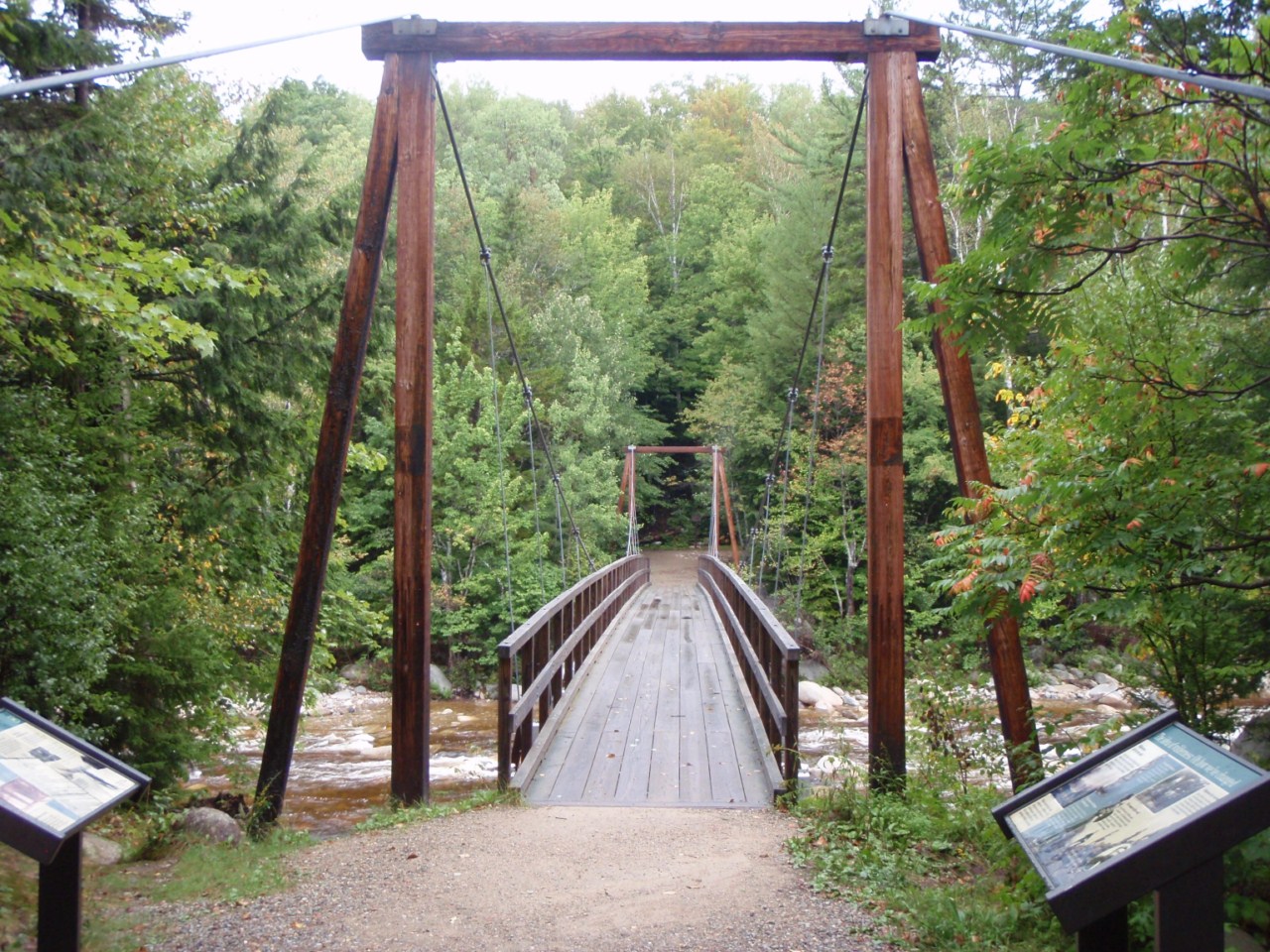
After getting out from our Katahdin hike, we took the 24-mile drive (1.5 hours on 15-20 mph roads!) over to the other side of Baxter State Park and Nesowadnehunk Campground, where we had 2 more nights reserved in a lean-to. It was very quiet on this side of the park, with only one other lean-to occupied and one or two tent sites in the entire campground. Water, we discovered, was available at a bridge near the ranger station (1/4 mile away, but you can drive there). You had to lower a bucket on a rope into the water and lift it up, then filter from there. Kind of fun at the end of a long day though, with terrific views all around.

Around our lean-to on both nights rabbits came out at dusk to munch on the grass. They were mostly un-afraid of us as long as we didn't do anything too crazy, we frequently walked within 5 feet of them without them doing more than pausing their eating momentarily to see what was up. Very nice experience with lots of coyotes howling at night too.

Rabbits at the neighboring lean-to

The Brothers/Coe from the lean-to at sunset

Doubletop Mountain

An example of the lean-to accommodations at Nesowadnehunk

The next morning (8-30) we woke up to do our final hike of the trip. The original goal had been to do not just North Brother, the only other 4000-footer in Baxter State Park, but also South Brother, Coe, and the trail-less Fort Mountain, all on the same ridgeline and on the New England 100-Highest List. In fact, there are only 6 peaks on said list in the park, these 4 and of course the 2 Katahdin peaks. But The hike to do all 4 of these mountains in one day was not something my dad was up to, and honestly, I had my doubts about even North Brother due to how my knee had been feeling all week.

We decided the day before to go for North Brother, and if time and energy permitted, Fort Mountain, which is reached from a faint herd path through thick spruce off of North Brother. I will return another time for more Baxter adventures (hopefully next summer!). We woke up to a nice-looking day, the best of the week so far. The Marston Trail starts about 4 miles down the road from Nesowadnehunk, and is a relatively short 15-minute drive away (again, the roads in Baxter are narrow, windy, and gravel, doing much over the posted speed limit of 20mph is optimistic at best).

Doubletop from the Marston Trailhead
Trailhead - we go to North Brother today since it is a 4000-footer

Earlier portion of Marston Trail - pretty nice
The Marston Trail was a nice change from the trails near Katahdin. Most of it was a fairly mild grade, with only a couple fairly brief steep stretches, and the footing was good for most of its duration. We actually made reasonable time despite the long climb (over 3000 feet, 4.5 miles to North Brother).

Trail junction, go right to Coe, left to the col between the Brothers

Doubletop Mountain from a ways up the Marston Trail

South Brother and Coe to the South


Doubletop Mountain from near the top of North Brother

South Brother

South Brother with Coe behind

Doubletop Mountain

  
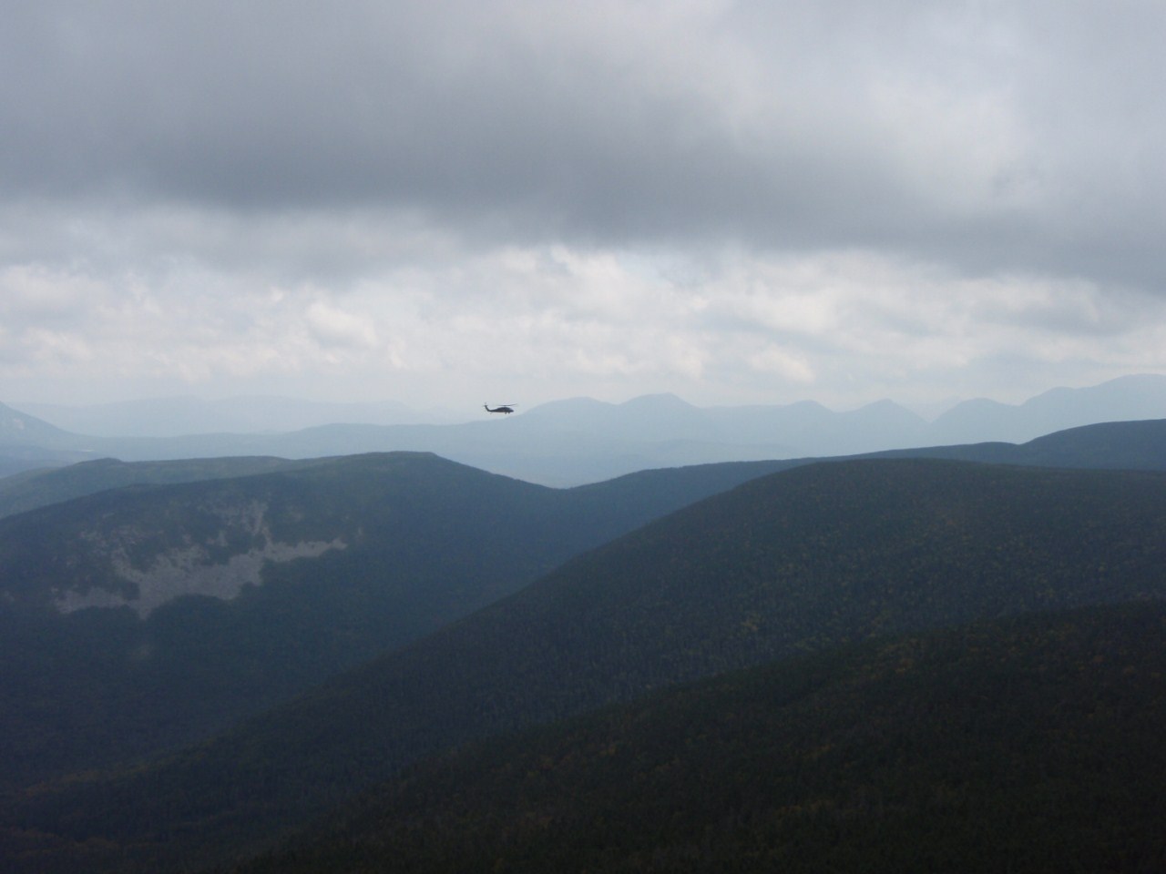
After a steep stretch following a small pond, you reach a flat stretch and eventually reach the col between the Brothers. Here the Marston Trail turns North to North Brother, while the Mount Coe Trail joins in from the South where it passes near South Brother and drops down a slide from the summit of Coe. From here, the Marston Trail was very overgrown and a few spots had rough footing. It would be nice if some brushing of the trail was done here, but it wasn't terribly hard to follow either. Eventually we reached the open summit of North Brother, with terrific 360-views. And winds near what we'd had the day before on Katahdin. We ducked down just past the summit to get out of the wind and snack.

South Brother and the tip of Coe from North Brother

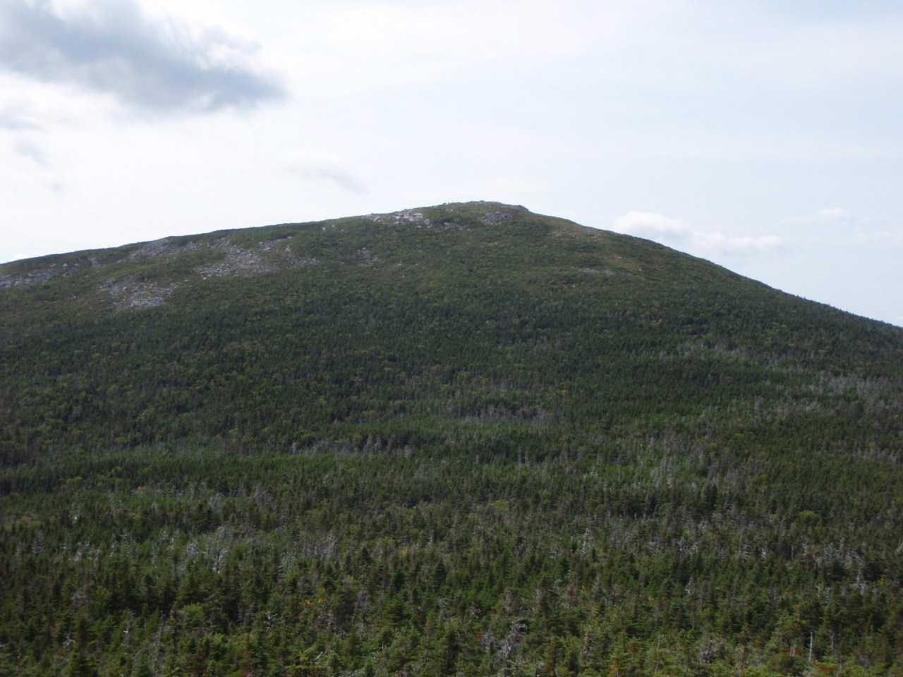
Fort Mountain - next up

Katahdin massif

The Travelers

Travelers behind Fort

From this spot we could see a few carins marking the start of the herd path over to Fort. Back in the 1940s, a mail plane blown off course in a storm, thinking it was over Bangor and thus flying around 4000 feet as a result, struck the side of Fort Mountain. Most of the plane is still there to this day, near the summit. We hoped as a part of our visit to go see this plane crash, and we could even see what looked to be the tailplane a little below the right summit (true summit is actually on left, despite what it looks like in the above pictures) from North Brother.

We followed the herd path, and it was certainly that. The trail is VERY thick and overgrown, and while we never lost the path, it was really tough to see in spots. Whenever it seemed to stop we'd have to look carefully in the brush around us around foot level to find the path. There were several orange flags along the way, but never at the questionable spots, so they really only served to confirm we were on the route. The descent off North Brother is about 500 feet, as Fort Mountain at 3867' just barely makes the 200-foot prominence rule. The col opened up a little for a short stretch, before a bunch of small scrambles to get to Fort's ridgeline.

There are only a couple pictures along this route, as for the most part all we had was branches in the face and the occasional glimpse of Fort or North Brother depending on which way one looked. Unless you are comfortable off-trail, I do not recommend going to Fort, it's very close to a bushwhack while not actually being a bushwhack. We took about 1hr 10 min in each direction between the summits, despite it only being roughly 1 mile long, due to the slow going.

North Brother from the North Brother/Fort col

Katahdin massif from Fort Mountain

Old relic form the plane crash someone brought to the main summit of Fort

One of 2 nearly-identical-height summits on Fort Mountain, picture taken form the true one (with the plane relic)

North Brother from Fort

Mullen Mountain

Travelers in distance

Main Fort Mountain summit region towards Katahdin
 We reached the main summit of Fort, with its 360-views (and wind as well) right at our pre-determined turn-around-time for the day. Thus we didn't venture down the ridge and drop to the plane crash, that would really have needed close to 2 more hours to get there and have a good amount of time to explore. Instead we waded through the brush back to North Brother and headed back to the car for the day.


We saw no one on the trails this entire day, and according to the log book at the trailhead, only one other person, over 1 hour before us, headed up that day, and they went to Coe. We were able to maintain roughly a book-time overall pace on everything except the herd path to Fort, pretty much in-line with when my father and I used to hike together before. The trail was far better for walking than the trails around Katahdin with all the bouldering.

That night we again slept in the lean-to at Nesowadnehunk and left early in the morning to head back to Massachusetts. Baxter State Park was absolutely incredible, and I am already working on figuring out how to get up there again next summer. There are a bunch of other things I'd love to hike, including Coe/South Brother, the Travelers, Doubletop, Katahdin again, and so on.

In all the days I spent in Maine hiking this summer, I never saw a single moose, which are more common than people in the state allegedly...hahaha!

That night while pumping some water at Nesowadnehunk's bridge, we played around with our cell phone's cameras a little (not the camera I normally take pictures with), and I got this stunning sunset picture using the HDR feature. Nice way to end on!

Sunset from Nesowadnehunk


Summary:
Peaks: North Brother (4151', NE4K), Fort Mountain (3867', NEHH)
Trails: Marston Trail and herd path out-and-back
Mileage: ~10.5 miles (9 miles r.t. for N. Brother, plus about 3/4 mile each way for Fort)
Elevation Gain: ~3700 feet