Fall tends to be busy for me. That said, I've managed to sneak in some hiking here and there, but still not the 2 hikes I've been trying to get to for nearly 2 months now to finish off a 2012 circuit of the New Hampshire 4000-Footers. This past weekend I could have done it, but I would like decent weather for both hikes, as both Moriah and Garfield have terrific views. Sunday wasn't predicted to be a great weather day (scattered showers, so likely socked in most of the day), and there were a few things I wanted to do over the weekend anyway. Saturday morning I actually ended up in Milford, NH to meet up with some people I know, but when that was set up Friday night, I decided to see what short hikes might be in that area.
Enter Monadnock. Said to be one of the most-climbed mountains in the world, it is supposed to offer tremendous views, and there are numerous ways to attain its summit. Late Friday night I determined that I could make a short, but interesting-sounding loop from the Western side, utilizing the Marlboro Trailhead. It was to be a nice afternoon, and it was mid-late October, so crowds would be less than normal, but probably still busy.
Owing to a number of factors, I got going about 1 hour later than intended from Milford. The drive was to the furthest trailhead, but likely to be one of the quieter ones I expected. Still, I had only about 5 miles and 2000 feet planned, so I figured I could get down by dark (preferring not to headlamp hike in leaf-strewn trails, too easy to get off-track that way). There was nothing tricky about finding the trailhead, except that Shaker Farm Road, which the trailhead is on, is quite rough in its last 1/3 of a mile (unmaintained for winter) and also had a fair amount of mud and large, car-sized puddles on it from the heavy overnight rain. Some people had parked their cars along the road in the few pull-over spots that weren't marked for "no parking", but I was able to carefully thread my way to the trailhead parking lot, which was spilling out onto the road, but a few spots were open as it was after 2PM.
Getting what is my latest start on a hike ever, I hit the trail at 2:30, up the Marlboro Trail. My plan was to take this trail to the Marian Trail, and take that to the Great Pasture Trail to Monte Rosa, and then the Smith Summit Trail to the main summit of Monadnock.
 |
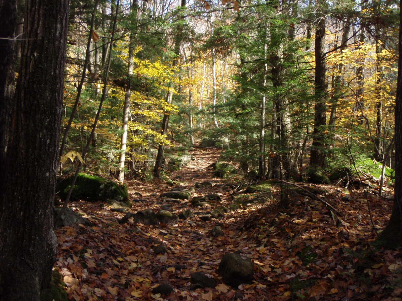
| Down low on the Marlboro Trail - pretty easy walking |
 |
| Early Western views - starting to cloud up |
 |
| Still some blue sky though |
 |
| Monte Rosa, a minor bump on the side of Monadnock |
 |
| Decision time |
 |
| Looking ahead towards Monadnock |
As I climbed, there were soon some nice views behind me to the West, where I saw the blue sky with puffy white clouds slowly becoming more overcast. In fact, as I climbed some ledgy areas near the Marian Trail split, I felt some very light rain. It looked like most of the stuff was going to miss South of me, with some blue skies still out to the South West, which the wind seemed to be more or less coming from. But I opted to take the direct route to the summit of Monadnock, and revisit the idea of looping over Monte Rosa on the way down.
 |
| Clearing up again West |
 |
| Still some nice color in the valley |
 |
| Steep pitch shortly before the Dublin Trail junction |
 |
| Out of the trees for good! |
 |
| Summit ahead - looks a little busy! |
It turned out I was right, as can seen above, as the skies cleared right back up as I neared the ledges of Monadnock. The grade was steady, but only really steep in a few short stretches, certainly nothing I wasn't used to from further North in the White Mountains. Soon I was at the junction with the Dublin Trail, which in 0.2 miles takes you to the summit of Monadnock. The views from here were absolutely incredible. I could also see a fair number of people at the summit.
 |
| Awesome-looking ridge that the Pumpelly Trail climbs up |
The 360-degree views off this summit totally blocked out the 60-70 people strewn about the summit. I hadn't really seen a crazy number of people on my way up, perhaps 15-20, all headed down. I was rather surprised to see so many people up here at 3:45 in the afternoon! It was a nice day though, with mild temps (a bit warm honestly) and a nice breeze. I found a spot on a ledge on the East side of the mountain and sat down to enjoy a snack-with-a-view.
While up there, a helicoptor flew by overhead and circled the mountain once or twice before landing on a ledge about 1/4-mile below the summit, where a few people were. Within a couple minutes, it took off again and was gone. Not sure what it was about, possibly an airlift rescue, or just a training mission, but interesting nonetheless. Shortly after that I took off down the White Dot/White Cross Trail, and got about 1/10 of a mile down before I realized my mistake. Doh! I climbed the 100 feet or so back to the summit, and eventually found the paint arrows for the Smith Summit Trail which actually came in a little down the Dublin Trail that I had previously come up. With that I was off to Monte Rosa, and initially scrambly and ledgy descent, followed by a nice short woods walk over to to bald knob of the summit.
 |
| Helicopter circling the summit |
 |
| Look just left of center, you can see the helicopter on a ledge |
 |
| Down the ridge that the Old Toll Road trails come up |
 |
| Heading to Monte Rosa, ahead |
 |
| Not too many signs, mostly paint markings on this mountain |
 |
| A Southerly knob of Monadnock from Monte Rosa |
 |
| Monadnock from Monte Rosa |
 |
| West from Monte Rosa |
 |
| Wind vane on Monte Rosa - nice workmanship on it |
 |
| House at the end of the Old Toll Road - private residence as I understand |
 |
| I'll take it! |
 |
| What I'm assuming is Wachusett Mountain South in Massachusetts |
 |
| Sun's heading down - time to get back to the car |

From here, I found the Great Pasture Trail and took that to the Marian Trail, which climbs a couple hundred feet to the Marlboro Trail, and I took that back to the car. The Great Pasture Trail was steep, and looking later in the Southern New Hampshire Trail Guide, it lists the 3/10-mile trail as dropping/gaining 400 feet of elevation. One thing I found interesting was that this trail was only marked for those heading UP, so I had to keep an eye out in a few spots for the plastic rectangles nailed to the backside of trees, as with all the leaves on the ground, and this being a lightly-traveled trail, the corridor was not completely obvious. Something to keep in mind to those hiking this trail. The Marian Trail was also lightly-traveled, but marked well in both directions, and in short order I was back at the Marlboro Trail, and from there I made quick time back to the car. I saw only one person between the summit of Monadnock and the Marlboro Trail on my descent, and only a couple people after that. The now-nearly empty parking lot was reached at about 5:45, and I was soon on the road headed home.
 |
| Lightly-traveled Great Pasture Trail - Steep! |
 |
| This was easily the largest fungus I've ever seen. For scale, the tree is about 18" in diameter, and the fungus was about 1/3 of the way around it! |
Now that I have finally climbed it (it seemed like everyone else BUT me had before this!), I can see why Monadnock is such a popular mountain. While I wouldn't say it is an easy climb (at least the trails I took were pretty normal for 4000-footer trails), it wasn't very hard either. It was a nice 3.5-hour afternoon jaunt. Next time I'd like to try some of the other trails, like the Pumpelly, but I think I'll wait for when the crowds are less likely to be around. I don't mind people on the trails, but this mountain can get absolutely packed from what I've read, and for a late-year afternoon hike, it was surprisingly busy. Most of the traffic seemed to come from the State Park side though.
Summary:
Peaks: Monadnock (3159', 52WAV), Monte Rosa (2510')
Trails: Marlboro Trail, Dublin Trail, White Dot Trail (short stretch oops!), Smith Summit Trail, Great pasture Trail, Marian Trail
Mileage: 5.2 miles
Elevation Gain: 2200 feet
Take off 0.2 miles and 100 feet for my goof on the White Dot Trail, the little tail to the right on the GPS overlay below.