Tuesday, March 8, 2016

Struggling up to the Bigelows - Jan. 2, 2016

Route: Stratton Brook Pond Road, Firewarden's Trail, Appalachian Trail
Peaks: Bigelow - Avery Peak (4090', NE4K), Bigelow - West Peak (4145', NE4K)
Mileage: 12.3 miles
Elevation Gain: 3400ft
Book Time: 7hr 50min (actual 7hr 30min)

The morning following our successful hike up to Saddleback and Saddleback-The Horn, we all headed out early in the morning for the 50-minute drive North to Stratton to hike the Bigelows. My recovering sprained ankle had reacted well to the hike the day before, with only a minor bit of swelling and soreness, so we were all going on this one: no splitting of the group was planned this year. The winter approach to the Bigelows is similar to the summer one for dayhikers: head up via the Firewarden’s Trail to the col between the 2 peaks, and then do a short out-and-back to each summit from there. In summer one can drive down Stratton Brook Pond Road to the start of the Firewarden’s Trail, but in winter this road is only plowed to the last house, maybe 1/10-mile from Rt. 27. There is limited parking at the start of the road for a couple of cars (take care not to block the driveways, nor the snowmobile trail which is the road itself). It is a 1.5 mile(ish) road walk to the trailhead. Alternatively, one can take the Appalachian Trail from where it crosses Rt. 27, though in past years this lot is almost never plowed. It is slightly shorter to access the trailhead this way, if you can access the lot. I did read after the fact that apparently this lot has been getting some plowing attention in the 2015/2016 winter, so perhaps this will be a more viable option in the future.

We pulled onto Stratton Brook Pond Road, and actually kept driving past the end of the plowed section, onto a hard-packed snowmobile path. The snow depth wasn't very deep yet, and with both vehicles being fairly high-clearance and having 4-wheel drive (a Jeep and a Subaru Forester), we were fine driving down the road. A little over 1/2-mile from the spot where the Appalachian Trail crosses the road, there is a road junction with lots of room to park. Here, the road drops down a small hill to this junction, and maybe 1/3 of the way up (back towards the highway) was a small low-clearance car stuck on the hill. He had come in the day before to hike, and got stuck at the bottom of the hill. They had gone on to do their hike, walked back out the road to where they were staying somewhat nearby, and he had just come back to work on getting it out. We had him roll back down the hill, got around him and parked (the road ahead looked softer than the hill even, and so we had no plans to go any further), then got to work with the shovels to make a path for him to get back up the small hill. 30 minutes of digging and pushing later, and he was up the hill and on his way out of there (he made it out just fine from there apparently - there was no sign of the car or trouble when we left).

Heading off on foot down the road to the trailhead.

Blue skies and some clouds on the Bigelow Range. West Peak is off to the right behind the trees.

South Horn from Stratton Brook Pond

Nice bridge over the Stratton Brook Pond outlet.

South Horn, and more of the ridge heading West.

Crocker Mountain to the South.

Sugarloaf Mountain and Ski Area.
We set off, once again with snowshoes on from the start, for a roughly 1-mile walk to first the trailhead, and then Stratton Brook Pond. On my only prior visit to the Bigelows in 2012, the crossing of the brook outlet was an open rock-hop, but a year or two ago there was a nice, fancy new bridge installed, which makes this crossing completely trivial. Blue skies teased us, though the forecast was for overcast skies. Still, it looked promising, and we continued on down the trail. After a while, the flat trail begins to climb, and my legs were not liking it. Every year it takes a few hikes for the "snowshoe legs" to get into shape, and not only was this one of the first, but I'd been pretty sedentary for the last month due to the injury. Thankfully the ankle wasn't really bothering me, it was just tired legs. Shortly before reaching the Moose Falls Campsite, the trail gets excessively steep, almost all the rest of the way to the ridge. This section was very slow-going, and I almost threw in the towel, but I plodded away, and did eventually make it to the col.

Heading up the steeps.

Heading UP the steeps...

Part of Avery peak as seen from near the col.
From the col, it is less than 1/2-mile to either of the main Bigelow summits. We opted to go to Avery Peak first, summitting inside of a cloud, as expected (the blue skies disappeared not terribly long after leaving the pond). Winds were very stiff, it was a full facemask, goggles, and shells stop for only a couple quick summit photos then back to the cover of the trees (the upper 1/10-mile is completely above the trees). Then it was another quick shot up the other direction to the West Peak, for a repeat of the quick-pictures-then-to-the-trees game. The night before there had been discussion of maybe heading across the ridge to the Horns, but with the lack of visibility (and there was no way I was going to be able to do so), the whole group opted to just head down. The Horns Pond Trail was broken out, so we likely would have had a relatively simple go of it, but as it was we got back just before dark, and we were all hungry anyway.

Brent approaches Avery Peak.

Descent off West Peak, part of Avery Peak visible in the background.
After a good snack break, it was off on the long trip back down. Some of the steeps were tricky with the moderate snow cover on top of icy rocks, and some involuntary sliding was done by all (I had to do my best to keep mine to a minimum), but we all got down fine. We did see a few folks heading up as we were coming down through the steeps, and there was a fair bit of snowmobile traffic on the road and the trail between the road and the bridge, but overall it was a quiet day. The drive out on the snowmobile-packed road was uneventful, but I can't say I'd recommend doing it, and definitely not if you don't have good snow tires, decent clearance, and 4-wheel drive. And even still, with any more snow on the ground, this would be a no-go move. The other hikers we had seen all parked in the small pullout off of Rt. 27, or may have taken the Appalachian Trail. We returned to the house, made dinner, and had a leisurely departure in the morning for the drive home, and back to work after the holiday vacation. But now I really need to rest the ankle, and get it fully healed for trips planned for later in the winter!

The Bigelow Range (Cranberry Peak perhaps, South Horn is on the right).

Of course the skies were clearer down here again...


Saturday, March 5, 2016

Socked in on Saddleback and The Horn for New Year's Day

Route: Saddleback Mountain Ski Trails, Appalachian Trail
Peaks: Saddleback (4120', NE4K), Saddleback - The Horn (4041', NE4K)
Mileage: 7.0mi
Elevation Gain: 3000'
Book Time: 5hr (actual 4hr 55min)

Last year following the turn of the calendar to the New Year, a group of us headed up to Stratton, Maine to hike some of the Maine 4000-Footers in winter. Due to really fast trail conditions, most of us visited all 6 of the highest peaks surrounding the Caribou Valley: The Crockers, Redington, Sugarloaf, Spaulding, and Abraham. Before leaving, we all agreed that we would return a year later to see if we could visit the remaining 4 4000-footers in the area: Saddleback and Saddleback The Horn, and the 2 highest peaks of the Bigelow Range (Avery and West). So, we set up a house rental in Rangeley, and on New Year’s morning we all headed off for Maine. The group was almost the same as last year: aside from myself, Chris, Whitney, Pam, and Tim returned from last year’s trip, and Brent was a new addition (Mike from last year was in the process of moving out West).

I’d been unfortunately off the trails, and mostly sedentary, for the 4 weeks preceding this trip thanks to the badly-sprained ankle I suffered in early December coming out from Carrigain. Thankfully, while certainly not at all fully-healed, I was able to hike nearly pain-free as long as I watched my footing (a short spin through the Blue Hills near Boston a couple days before the trip assured me of this), so with good ankle-supporting boots, I was still a go for the trip. I wasn’t sure I’d be able to hike both days, especially with having been sitting around for so long and not having carried a heavy pack yet this year either, but I was going to give it a go.

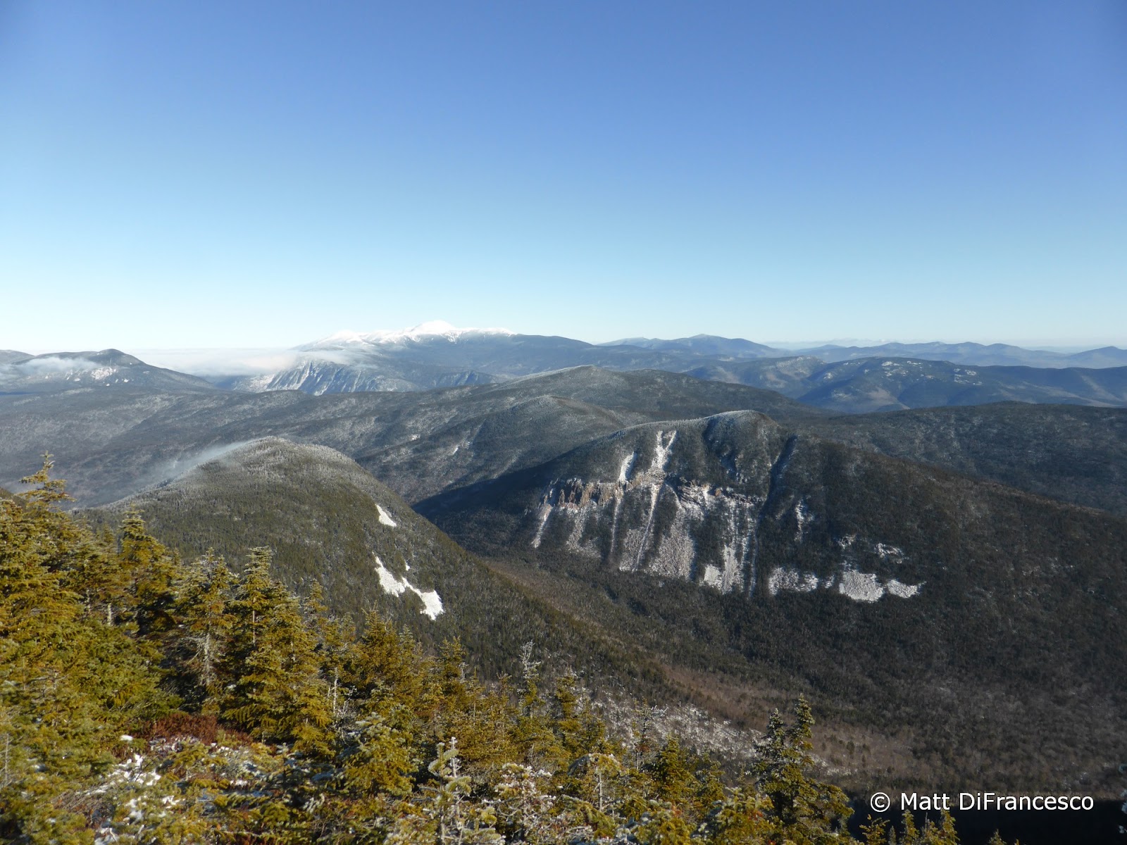
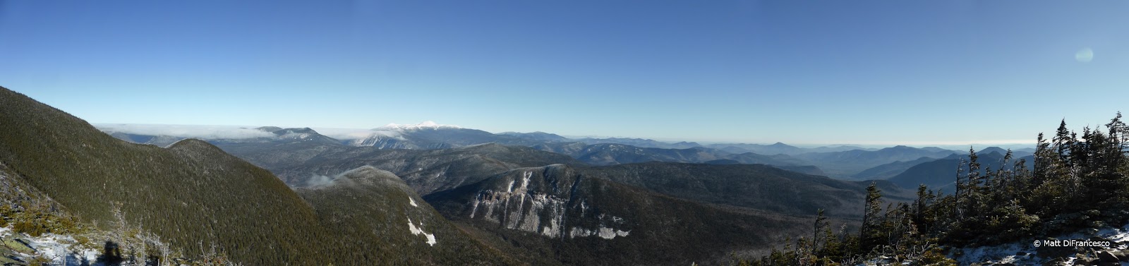
Unlike last year, when we merely had to drive on the first day, we planned to hike after the up-to 4.5-hour drive. Thankfully, the weather looked reasonable for visiting the shorter of the two hikes, to Saddleback and Saddleback-The Horn. The normal winter route ascends from the Saddleback Ski Area up the ski slopes to an extension that heads to the summit ¼-mile above the top of the slopes. From there, it is a 1.7-mile trek in and out of the scrub and over wide open ledges to The Horn, which is only a handful of feet lower in elevation. (The longer, but also much more scenic, route from Rt. 4 along the Appalachian Trail sees little to no use in winter, and in fact the lot was not even plowed out when we drove by it.) All in all, we expected this hike to take roughly 5 hours to complete thanks to the relatively short mileage, and as such it meant that we didn’t need to get a crazy early start (it was still too early for me!), meeting at the ski area around 10:00.

Most winters, one must get an uphill access pass from the ski area (in the last year or two they have started charging for this pass similarly to most other NorthEast ski areas), but the owners were/are in the middle of trying to sell, and as such the entire facility is closed. No snowmaking, no chairlifts running, no open warming huts, though the parking lots were still being plowed out. This meant that we had no trouble getting a parking spot in pole position, a mere handful of yards away from the main base lodge.

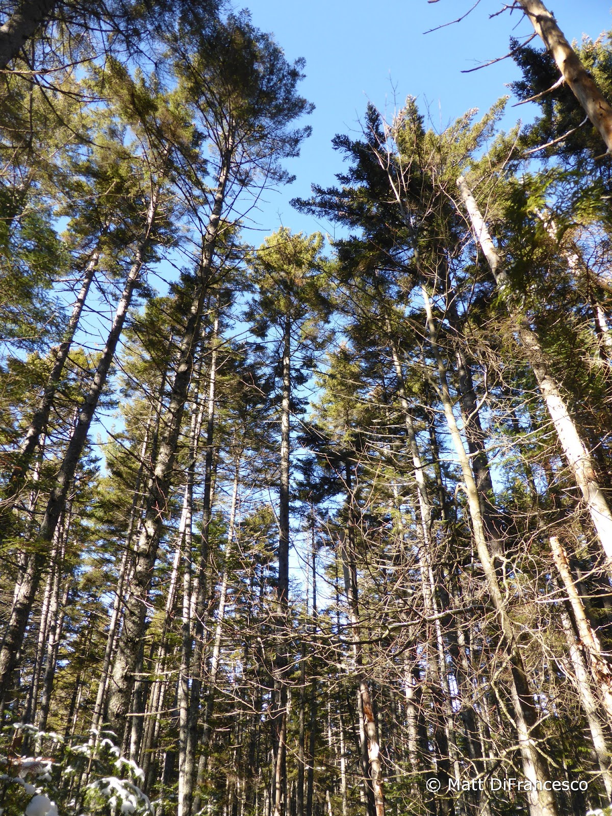
There was just barely enough snow on the ground to warrant snowshoes, so on they went in the parking lot, and up the ski slopes we went. The day was forecast to be a little windy up top, and it was also clear early on that we were not likely to get any views from the summit ridge, which on clear days holds magnificent views, but we expected conditions to be manageable thanks to mild-for-winter temperatures. Ski slopes are both good and bad for getting to the top of a mountain: they do it quickly (less than 2 miles in this case), but with that short distance comes steepness. Televators are very handy! The snowshoeing conditions were so-so, with the lack of natural snowfall so far this winter, and the lack of man-made snow-making occurring at Saddleback this year, there were some thin spots, and numerous rocks sticking up here and there. But overall, the snowshoes were definitely the way to go. Around 3000’ in elevation we entered the cloud deck, and shortly thereafter we encountered our first people of the day, 2 skiers who had skinned up and were heading down, plus their 2 friendly canine companions bounding about in the snow.

Starting up the vacant ski slopes. Weird to be on ski slopes in winter without the chairs running, other skiers around, etc.

We start to gain elevation.

And into the clouds we go.

No chairlifts didn't stop a few skiers. They just skinned up and rode (carefully) down, with their 2 dogs bounding down happily after them.
At the top of the slopes by the upper warming hut we took a snack break, and caught out breath: our ascent thus far had been fairly speedy, especially for those of us (cough cough, me) who were out of shape. We’d been feeling the wind at our back for a little while now, and knew it was about to be worse when we would leave the relative shelter of the slopes, so we also layered up and got the facemasks and goggles ready. Right next to the warming hut is the extension trail that meets the Appalachian Trail near the summit, and it soon breaks out into the open. The wind was blowing fairly strongly (maybe in the low 30s mph at most – it was strong, but we could still walk in it), but with full skin coverage (facemask, goggles, shell jackets, etc) it was fine. You just need to be careful to cover all exposed skin in such conditions. The bigger issue for us was the visibility, or rather the lack thereof. The rime-covered cairns were few and far between for a stretch, and they all looked similar to the rime-encrusted scrubby trees. But Chris and Whitney had come this way just a few months before, and Tim had a GPS track handy, so within a few minutes we found our way to the summit of Saddleback Mountain. Peak number one, check.

The summit of Saddleback Mountain. Yes, it really says Saddleback Mountain under that rime.
The cairn hide-and-seek continued across and down off Saddleback, which drops steeply at times into the col. Shortly above the col was a large, ice-covered ledge that we had to route carefully around, but thanks to the few inches of snow that had fallen in the last week, we were able to manage just fine without crampons (though we’d brought them just in case, especially after the incident on Abraham last year). Chris and Tim did a terrific job of keeping us on-course, with only one false route that we soon figured out. We even found a handful of the white Appalachian Trail blazes along the way. Conveniently, the wind once off the very summit of Saddleback was dramatically reduced. Even atop The Horn, which we eventually reached after a steady climb up from the col (it is a 600-foot-deep col between the peaks), the wind was not bad. We took a few pictures, then re-traced our steps. With our tracks visible most of the way back up to Saddleback, it was fairly simple going until the last ¼-mile, when the wind picked up again, and our tracks were blown away. Route-finding turned out to be less tricky since we had been through only an hour or so earlier and thus had a feel for where the trail went. It briefly looked like the clouds might burn off as we neared the summit, and there was even a very brief peek of blue skies, but we never got any views.

A large ice flow along the trail near the col.

Into the void...

Saddleback - The Horn.

Nearing the summit of Saddleback Mountain on the way back, it briefly looked like the skies might clear for us. This was about as close as it got though.
Leaving the summit for the ski trails is where it got a little interesting for me. I’d been having some goggle-fogging issues for the last few minutes and my vision was almost completely gone now – I could only see a few yards ahead, and footprints from those ahead were already filling in, so coupled with lagging a bit behind the group thanks to my slower pace, it was tough going for a couple minutes there. Luckily it held out just long enough to get down to the warming hut where I could remove the googles altogether, and I could see just fine again. The main issue was that across the ridge between the peaks I had taken the goggles off several times and hung them around my neck. Putting goggles up on your head while hiking is a good way to get them filled with moisture, which then fogs up when put back on your face, so hanging them seemed like a good idea. The problem was some snow fell during this time, which led to some accumulation in the goggles, and so the same fogging issue occurred when I put them on. If the goggles had simply fit more appropriately over my glasses and thus weren’t jamming them into my nose, I’d have left them on as is advised. Lesson learned: buy new goggles meant to go over the glasses. I’ve simply not needed to wear goggles very much the last couple of winters since I got newer, slightly larger glasses.

The rest of the descent was uneventful. We saw several groups of folks skinning up the slopes, and also one pair of hikers heading to the peaks (though they only ended up getting to Saddleback thanks to their very late start and the same poor visibility issues we had). One of the hikers was a familiar face even, one that had been in the group I took to Isolation last March. Once back to the car, it was off with the snowshoes and packs, and we all headed about 20 minutes away to our rented house where we had hot showers, cooked a good dinner, and relaxed for the evening. Plans were also laid for the next day’s long drive up to Stratton to hike the Bigelows.


Saturday, February 20, 2016

Visiting Carrigain and the Last Hike for a While - Dec. 5, 2015

Route: Signal Ridge Trail, Desolation Trail, Carrigain Notch Trail, Wilderness Trail, Pemi East Side Trail
Peaks: Carrigain (4700', NH4K)
Mileage: 17mi
Elevation Gain: 3900'
Book Time: 10hr 25min (actual 8hr)

With the year drawing to a close, the various forest roads around the White Mountains begin closing for the winter. But with a mostly snow-free year thus far, the roads were still open come early December, so Denise, her friend Joe, and myself spotted a car at Lincoln Woods and then headed down the Sawyer River Road to the trailhead for Mount Carrigain. Our plan was to summit Carrigain, then head through the Pemi Wilderness along old railroad grades back to Lincoln Woods, and perhaps exploring a logging camp or two along the way.

Having already been up Carrigain twice in 2015, there was not too much of a surprise for the ascent, aside from the blazing pace Denise set for us. The first 2 miles are flat, and we made quick work of them, including opting for the old, now closed, corridor of the Signal Ridge Trail at the old junction with the Carrigain Notch Trail (which was relocated 1/4-mile up the latter trail). Once into the ascent, we continued at a quick pace. As we neared Signal Ridge, snow appeared on the ground, though only a few inches worth at the most, and only a few small patches of ice, so we were able to hike without additional traction without issue. In just over 2.5 hours, we reached the summit, 5.25 miles from our starting point.

Pano from Signal Ridge - that's the Presidential Range on the left.

The Presidential peaks shining in white, Washington commanding them all.

Vose Spur and the cliff-scarred Mt. Lowell forming the other side of Carrigain Notch.

Undercast was visible in the distance in Crawford Notch, but not a cloud where we were!


Vose Spur (R) and the steep, narrow ridge up to Carrigain (off camera to the L). A few years ago a friend and I bushwhacked from Vose Spur along that ridge to the Carrigain summit tower.
The tower was caked in rime ice, and there was a chilly breeze, but there was not a cloud in the sky except off to the West were we could see what must have been a neat undercast for those in the Franconia Notch and Presidential Range vicinity. The views from the tower atop Carrigain are among the most wide-sweeping there are in the White Mountains. We took a nice break here before beginning the steep, sometimes tricky descent down the Desolation Trail. There was just enough snow on this trail to make us take our time, but not enough to put on microspikes or other traction. Once off the steepest portions of the trail, we picked up the pace, reaching the junction with the Carrigain Notch Trail.

Rime stairs to the summit.

More rime.

Franconia Ridge across the Pemi Wilderness

Bondcliff (L), Bond (C), West Bond and the point of Garfield between them, with the Twins off towards the right.


The East Pemi and more. And undercast visible on that side of the mountains.

Simply gorgeous views today!

The Osceola Range commanding the center of this pano. The double-top of Sandwich Dome is on the far left.


More of the Sandwich Range, encompassing from Mt. Chocorua (far L) through Passaconaway, Whiteface, the Tripyramids, and Sandwich Dome.

Undercast reached just into Zealand Notch

Crawford Notch partially filled with undercast.

Peek-a-view towards the Hancocks.


From here out to the car was almost completely new trails for me, aside from a brief section of the Wilderness Trail. First up we hiked the final stretch of the Carrigain Notch Trail to Stillwater Junction, traveling through a beautiful stand of spruce along the way. Stillwater Junction is at the confluence of several streams, feeding into the Pemigewasset River. It was a cool spot too look around a little bit before we continued on our way, now along the Wilderness Trail, which also mostly follows old portions of the East Branch Railroad. Along the way we passed through the middle of Camp 18, one of the old logging camps. A stove from this camp and a couple barrel hoops sit mere feet off the trail, so we stopped for a minute to look around. Chances are there are more artifacts to check out in the area, but with the snow cover we didn't look long or hard. (Note that removal of any artifacts from the forest is illegal, basically the policy is look, but put back where you found it.)

Bear tracks on the Desolation Trail


Large, tall trees enroute to Stillwater Junction.

What a neat spot to walk through

Stillwater Junction


River crossing near Stillwater Junction


This old stove lies right along the trail near the site of the old Camp 18 logging camp.

Barrel hoops were also near the stove.


Just mere minutes after departing from the camp clearing, I stepped awkwardly on a rock in the trail that rolled, and my ankle rolled with it. Included along the way was a wonderful "pop" sound from my ankle, and, well, that was that. Luckily, after a few minutes of severe pain, I was able to clear my head, and determine that I could still move the ankle, though any side-to-side rolling was extremely painful. Luckily there was hardly any pain in the directions that normal walking required, and I was also able to bear weight on the ankle. The most important thing to do with such injuries, I knew, was to keep the boot on, because if I took it off, I would never get it back on due to swelling. The final 7-ish mile walkout along the remainder of the Wilderness Trail and the Pemi East Side Trail was luckily fairly flat, and interestingly I was still able to walk at a decent pace, though far from what I normally could do on such stretches. Of course, focused on simply walking, there was little time for looking around and enjoying the new sights. I will have to return someday for the Wilderness Trail, and to explore some of the logging camps more thoroughly. That night, in my motel room, I took off the boot and soon had a roughly baseball-sized lump on the side of the ankle. Needless to say, this will keep me off the trails for a while. In fact, as I write this nearly 3 months later (yes, I'm still bad about writing these trip reports despite having more time), I still have some pain in the ankle, though it is getting close. I got a (very!) badly-sprained ankle, but it could have been worse: nothing was broken, and no surgery is needed. Just rest. 3 months and counting of it...

Bond (pointy peak on R) and Bondcliff sort of visible from near Camp 18.
The Pemi East Branch


Huge washout along the Wilderness Trail (from Hurricane Irene in 2011 perhaps?)