Route: Lincoln Woods Trail, Black Pond Trail, Bushwhack, Lincoln Brook Trail, Owl's Head Path, Bushwhack, Bushwhack, Franconia Falls Trail
Peaks: Owl's Head (4025', NH4K)
Mileage: ~17 miles
Elevation Gain: 3000ft
Book Time: 10 hours (actual 8hr 20min)
Ah, good 'ol Owl's Head. The bane of so many hikers working on their 4000-footers list. The longest hike to a single 4000-footer in New Hampshire (via "standard" routes). And no view from the top after the 9-mile trek in. Mud, huge water crossings, a rock slide to climb, it all makes this most folks' least-favorite of all 48 high peaks in NH, but it really isn't that bad. Yes, it is 9 miles via the trails to the summit, but the first 7.5-8 of that are on old railroad grades (read: pretty darn flat), most of the climbing is at the end (and yes, it involves a gravely rock slide and some steep climbing). While certainly not a favorite peak, I definitely don't dislike Owl's Head, it is always an adventure!
In trying to finish the New Hampshire 4000-Footers in Spring, Owl's Head loomed. With the many water crossings en-route to this peak, Spring can be a very hard time to make a safe trip in. 2 of the water crossings are wide, fairly deep, and raging even at low-to-moderate water levels, and definitely dangerous at higher water levels. With an extremely deep snowpack from this winter, and the melt a little slow in starting, getting this one was going to be a trick, especially since the last 2 weekends of May were unavailable for me. But, the main melt ended just in time, and the water levels on the
Pemi River Streamgage steadily dropped during the week leading up to this hike. On Friday, they finally dropped under 500cfs, which is my limit from past experience for attempting this hike via the bushwhacks (at least without needing to wade a couple of the crossings). The Black Pond Bushwhack saves you from having to cross the 2 biggest crossings on the Lincoln Brook Trail, otherwise a much lower water level would be needed.
Not surprisingly, I got no bites when I put out an invite for this hike, so shortly before 7:30 I set off solo (for the first time for this peak!) across the bridge onto the Lincoln Woods Trail. I left the snowshoes behind in the car, hoping that the snowline would be high enough to not be an issue, as I really didn't want to carry them for 15-16 miles (at worst I was only going to need them above the slide). The first 3.6 miles to Black Pond flew by, and I reached the pond in under an hour. The skies were lightening a little, despite the forecast calling for a little light rain during the day, and after snapping a few pictures, I was off on the bushwhack. I messed up the line on this bushwhack the first time I did it in non-snow conditions a few years back, and was hoping to do better this time around. But I immediately got off track, following a herd path into a not-totally-legal campsite near the pond, then into a swampy area. From there I meandered all over the place, but never really on the right line. At least I found good woods the whole way this time, but I did end up hitting the river too far East, and had to follow the herd path that forms part of the Fisherman's Bushwhack back to the trail.
 |
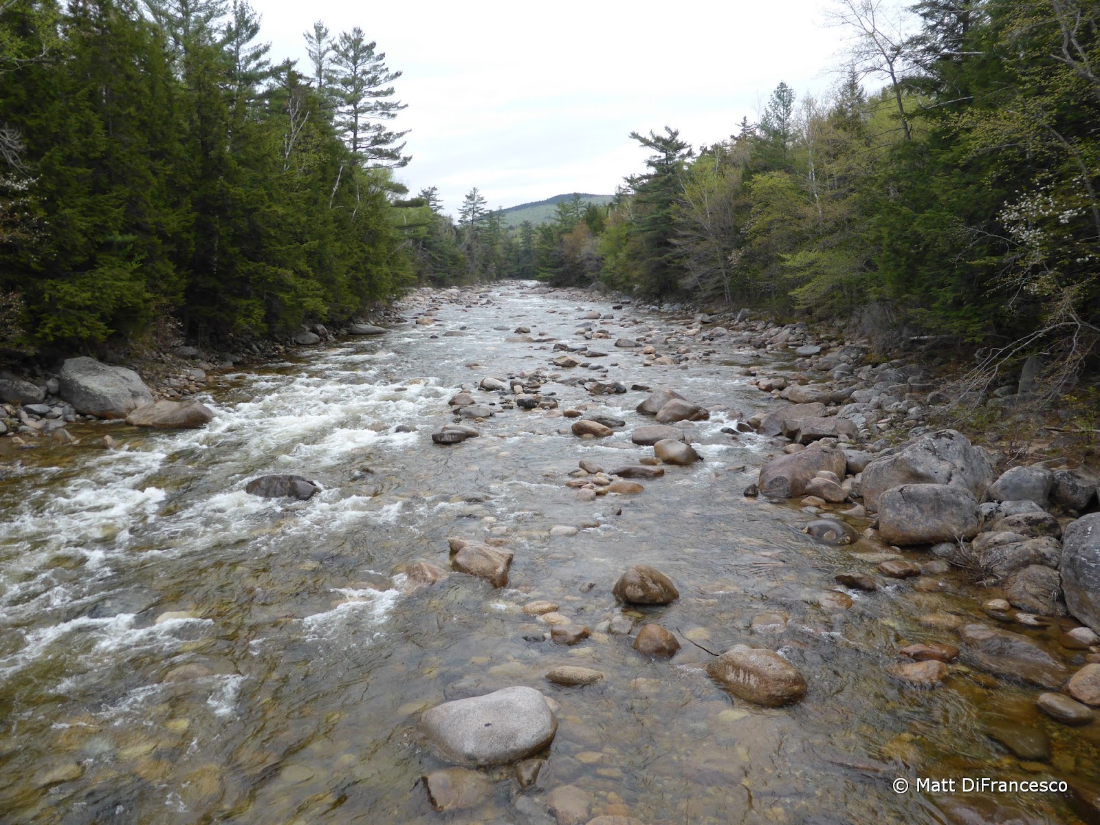
| The Pemi River from Lincoln Woods |
 |
| Segment #1: 2.6 miles of flat to the Black Pond Trail. |
 |
| The Lincoln Woods Trail. 3 miles long, and aside from lots of railroad ties further out, it is just like this. |
 |
| Segment #2: 1 mile of mild climbing to Black Pond |
 |
| A mallard couple eating breakfast in Ice Pond. |
 |
| Ice Pond |
 |
| Lots of Purple Trillium seen on this hike. |
 |
| There was also some Painted Trillium. |
 |
| Owl's Head as seen from the outlet of Black Pond |
 |
| The Bonds from Black Pond |
 |
| A campsite near Black Pond along my bushwhack to the Lincoln Brook Trail. |
 |
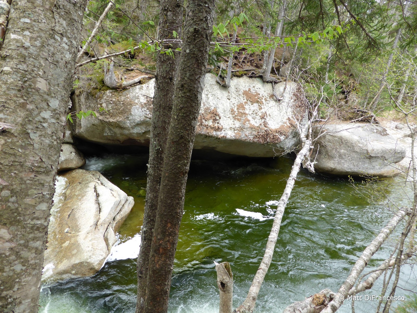
| This was a massive boulder (10'+ tall) seen enroute to the Lincoln Brook Trail. |
Now on proper trail, I charged away, dodging the numerous mud pits and narrow eroded streambanks. Shortly into this stretch the rain started coming, lightly, but it lasted for only about 5 minutes, and never rained even remotely hard. Eventually I came to the first of the 3 big crossings I still had to do despite the bushwhack, which is a small tributary and was not too hard to get across. A little while later, and I came to the second crossing, which is of the Liberty Brook tributary. This one I have never had trouble with, even at comparable water flow levels, but this time I had to search hard for a place to cross that didn't involve drowning my feet. I eventually found a spot where I made it across with a bit of a pole vault onto a flat (and slippery!) rock on the far side, but I was across with dry feet. Something seems to have changed in the rock placement since my last non-winter visit to this peak.
 |
| Crossing #1 (#3 if coming via only the trails). |
 |
| A nice cascade just above the crossing. |
 |
| Crossing Liberty Brook. It looks easy, but every spot had one missing rock to make it reasonably hoppable... |
The final crossing, a quarter mile or so from the start of the Owl's Head Path, was the most interesting yet. This crossing is of the actual Lincoln Brook, a major feeder stream into the Pemi River a few miles downstream. The trail crossing was a definite no-go. I eventually found a spot a few dozen yards downstream that looked manageable. But in planting my trekking poles to aid in getting across the one tricky spot of this chosen route, I lost my grip on one pole, and down the stream it went. It's my own fault for not having my hand through the strap (I've mostly not been using the straps for a year or so now), and for also having a bad grip on the pole with the swift-moving water. As it floated downstream, I noted that I also still had the snowbaskets on my poles... I headed downstream to the last spot I had seen the pole, but it was nowhere to be seen. This was a much easier spot to cross though, and cross I did without further mishap (making sure to put my hand through the strap this time...), and up to the bottom of the unofficial Owl's Head Path.
 |
| The final crossing, Lincoln Brook, shortly before the Owl's Head Path. You can see the trail corridor on the other side. |
 |
| The start of the Owl's Head Path, currently marked by 2 cairns and a bunch of logs blocking the Lincoln Brook Trail to the North... |
 |
| An old bucket at the start of the Owl's Head Path. |
A snack break later, and I headed up the fairly easy-to-follow path, which hits the gravelly slide very quickly. It ascends steeply, but for the first time (in 3 trips now), the slide didn't suck all the energy out of me, though I did take numerous breaks to look at the view behind me (basically the only big view of this route). I re-entered the woods above the slide, and made my way up to the ridge. Shortly below the left turn onto the ridge I hit the first snow/ice patches, which were short and easy to deal with. Once on the ridge, I ran into a little more consistent of a short monorail up to the clearing at the "old" summit, where many people still stop despite no cairn being there anymore. From here to the "new" summit, the trail was a mix of bare ground and deep snow drifts, up to 4 feet in places! It was solid enough to support me most of the time, I think I only sank in 2 or 3 times in all, definitely the right move leaving the snowshoes behind!
 |
| Lincoln (L), Lafayette (R) and the long Lincoln Slide. |
 |
| Franconia Ridge from the Owl's Head Slide. |
 |
| Looking down the Owl's Head Slide. |
 |
| This sort of gives an idea of how steep the slide is! |
At the summit with its large cairn, I took a snack break, during which the only other hiker I would see on this day outside of the Lincoln Woods and Franconia Falls Trails arrived. He didn't stay long, and I finished my snack before leaving. Back across the ridge and down the path, I took a left turn into the woods at the large boulder just above the slide that marks the traditional end of the Brutus Bushwhack, the usual winter route. I opted to try descending this route instead of the slide, as I have managed to injure my knee both times I've descended that loose slide. The Brutus Bushwhack is still steep, but the footing was much better than the slide overall. I had a pretty good herd path all the way until just before the ravine, where I cut down and eventually intersected a skidder road that led out to the end of the bushwhack. This was definitely the better way to descend!
 |
| The summit of Owl's Head. |
 |
| This was right behind where the above picture was taken from. Several feet of snow! |
 |
| I never noticed this before, but these 2 bolts were in a tree near the summit cairn, over 12 feet off the ground! |
I grabbed a small blowdown to use as a second pole to make the upper crossing, but the second one just wasn't happening for me. So I took off the boots and socks and waded across. That was why I had been waiting for low water levels, so I didn't have to do this. In summer, wading the crossings actually feels kind of nice on the feet, but not in Spring when the water is mostly snow melt and FREEZING COLD! Now across these crossings, and soon the final one, I cruised all the way to the first of the 2 big crossings. Instead of taking the Black Pond Bushwhack back, I opted to try the Fisherman's Bushwhack, which I've heard of before but never taken. It basically follows a branch of the river to the end of the Franconia Falls Trail. Initially there were herd paths that came and went, but eventually I lost it altogether. Still, sticking within sight of the river was easy, and eventually I picked it up again, and it became extremely easy to follow all the way to the Falls.
I didn't check the falls out long as there were a few people hanging around the rocks smoking cigarettes, and the smoke was bothersome. Getting this new redline was nice though, and the rest of the hike out was uneventful and easy enough, though man does the Lincoln Woods Trail drag on at the end of the day!
 |
| The end of the Franconia Falls Trail, where the Fisherman's Bushwhack begins towards the Lincoln Brook Trail. |
 |
| A deep jumping pool at Franconia Falls. Looks like a great spot to cool off in the summer! |
 |
| Franconia Falls |
 |
| The route. In the middle of the track, the left side was the Black Pond Bushwhack, the right side the Fisherman's Bushwhack and Franconia Falls Trail. Up top, the top side of the loop is the Owl's Head Path, while the lower part is the Brutus Bushwhack. |