Wednesday, December 3, 2014

A Clockwise Carters Loop - November 9, 2014

Route: Route 16 Roadwalk, Camp Dodge Shortcut, Imp Trail (South), North Carter Trail, Carter-Moriah Trail, Carter Dome Trail, 19-Mile Brook Trail
Peaks: Middle Carter (4610', NH4K), South Carter (4430', NH4K), Carter Dome (4832', NH4K)
Mileage: 13.1 miles
Elevation Gain: 4400ft
Book Time: 8hr 45min (actual 7hr 15min)

After a good night's sleep, I was ready to take on another hike in the Pinkham Notch area before heading home. The Carters were one of those hikes I was thinking of, and when Bruce and Ed, whom I'd met and hiked with a bunch the day before on Isolation, had mentioned they were going to the Carters, I decided to join them. I was a few minutes late getting to the trailhead and so they had already left (I had never committed to whether I would be there or not so they had no reason to wait), so I geared up and headed down Route 16 to the access road to Camp Dodge. Every other time I had hiked the 3 Carters as a day hike (3 other times before this one), I had done the loop counterclockwise, so I was interested to see if the hike felt all that different going clockwise.

The first obstacle of the day was at the start of the road into Camp Dodge, where the bridge had been removed and the footings for the new bridge were poured. But it looked tougher than it really was at first glance, and it was easy to get across Cowboy Brook without the bridge. I also noted Bruce's car at the start of the entrance road (before the dead bridge of course), meaning that they were likely at least 15 minutes ahead of me since they didn't need to do the roadwalk. The old logging road over towards the Imp Trail was easy to locate since I had been on it several times before, and in short order I was heading up the Imp Trail itself. I have never been a fan of this trail, as the footing is rough higher up, that same section is usually also a stream, and the trail just goes on and on. Ascending, well, it still went on and on, but the rough footing was easier to deal with. The snow depth gradually increased with elevation, and I wasn't climbing all that efficiently on this day, but I still steadily gained elevation.


Walking in a winter wonderland...
 As expected the upper section of the Imp Trail was wet with lots of standing water, but I made it through the wet spots without dunking my boots, and I soon reached the junction with the North Carter Trail. This trail starts off tame enough, but soon climbs in a hurry, eventually reaching the Carter-Moriah Trail a short distance South of North Carter. The snow depth once again was near 6", and still coated some of the trees in that magical snow cloak that winter brings. Yes, I think I am ready for snowshoe season again!

I made short work of the final short climb to Middle Carter, enjoying the open view ledges on the way and also checking out the viewpoint right at the summit (which was marked with a small cairn this time around. I didn't see the stick sign that used to be on a blowdown around this spot). Moving onward, it was time for the long descent to the col with South Carter. In this stretch are a couple of tricky scrambles, in particular one ledge that is always tricky descending when coming from South Carter, but this time around I was able to get up it without needing any traction. I had to watch the ice on a few ledges on the descent, but overall it wasn't bad and there was no need for the microspikes just yet.


Approaching Middle Carter

Looking back towards Lethe, which the Carter-Moriah Trail skirts but does not actually summit


This was the state of the Northern Presis pretty much all day - in the clouds

Mount Washington and its ravines

The Moriahs

Old Speck Mountain (in Maine) - I believe the bald-topped peak on the right is Goose Eye, another fabulous hike

The Baldface Range

Wild River Wilderness


The Baldfaces - long on my to-do list

The cairn at the summit of Middle Carter
The climb from the col to South Carter is fairly short, and soon I was in the small trailside clearing at the stick sign, and checking out the couple small viewpoints in the area. I still hadn't caught Bruce and Ed, despite the fact that once I had reached the ridge, my pace had dramatically picked up (my ascent time to the ridge had been nothing special). But I had run into a few nice people along the way, all heading the opposite direction, so I had had a really nice peaceful couple of hours to myself. And just a few minutes before reaching Zeta Pass, I came up behind them!


South Carter

South Carter summit cairn

Carter Dome (R) and Mount Hight (L) from South Carter

The Baldfaces from South Carter

Looking back towards South and Middle Carter (R) and Mount Hight (R)

The bald summit of Mount Hight - well worth a visit on a nice day!
The three of us had an enjoyable push up to Carter Dome, chatting some more about this and that, and we reached the summit where we had a break. On our way out, shortly past the start of the loop over to Mount Hight (which I opted to forgo since the clouds were thickening up and it looked like the rain/snow showers forecast for overnight were coming a bit early) we ran into a pair of grid finishers whom I had also met before. Our chat was short, as we all had places to be, and so on we went. The trail conditions never got to the point where I felt it necessary to put on the microspikes, and in fact we made really good time and got out before 3PM! I think I prefer the loop in this direction, clockwise means you climb the steeper sections and then have a nice, easy, graded hike out.

Carter Dome summit

Bruce and Ed taking a snack break on Carter Dome

This was the site of the nice wide footbridge that was wiped out by Hurricane Irene in 2011. 3 years later, they finally "fixed" it. Hope your balance beam skills are good!


Tuesday, December 2, 2014

The First Snow Hike of the Year - Isolation - Nov. 8, 2014

Route: Rocky Branch Trail, Bushwhack, Isolation (East) Trail, Davis Path, Isolation Spur
Peaks: Isolation (4004', NH4K)
Mileage: 13miles
Elevation Gain: 3350'
Book Time: 8hr 10min (actual: 7hr 55min)

With the calendar flipping over to November, I still sat with 2 peaks left for a full round of the New Hampshire 4000-Footers in the year 2014: Isolation and Garfield. So for this day, I set my sights on Mount Isolation, which barely makes the 4000-foot threshold, but has tremendous views from its summit. In the interest of hiking new trails (and avoiding the Rocky Branch Trail that is soaking wet every day it isn't frozen solid), I intended to go via the Glen Boulder Trail, but a high winds forecast sent me back to the same trailhead I've used the other 3 times I've visited this peak. However, the weather had been cold of late, and in fact several inches of snow had recently fallen in the higher elevations, so I decided to at least see how viable the winter bushwhack route along the side of Engine Hill through the awesome birch glades there was going to be this time of the year.

Setting off a few minutes behind a pair of other gentlemen, one of whom looked rather familiar but I couldn't place him, I chugged up the trail. There was a light dusting of snow in the woods at the trailhead, but it soon began increasing steadily. Sadly the depth never increased enough to bury all the rocks, it was generally just enough to hide the smaller rocks for me to trip on, but it was a reminder that smoother trails are not far away!

I passed the 2 gentleman partway up to the height-of-land, and continued on my way, reaching the initial height-of-land that signifies a lengthy contour around to the actual height-of-land a little ways past the Wilderness Boundary. This stretch, which descends some, climbs some, but overall doesn't change much in elevation, was pretty wet in places, and in others a thin coating of ice covered several inches of water, so tip-toing on the rocks (some of which had a little black ice) was the order of the hour all the way to the height-of-land and the traditional start of the bushwhack. Here I ran into a fellow hiker whom I hadn't seen in quite a while, JustJoe, who was on his way into the birch glades to explore some ledges. We chatted for a few minutes, it was great to run into him again! Read his trip report here.

After Joe took off I had a snack, during which time the 2 gentlemen from the trailhead caught up and I finally realized that I knew the one from a group hike back in February, and he was working towards a grid completion in a few months. The other one, it turned out, was a grid finisher! With such experience with this peak in front of me, I opted to hang with them and let them lead the way through the bushwhack, curious as to how their route would compare to the one some friends and I broke out back in late December 2013. The route was different, and wandered a bit more than the other 2 times I'd been through this bushwhack, but in places it was also right on top of those prior trips. I love the birch glades in here, and once again they didn't disappoint!

Trekking through the birch glades along the bushwhack

Winter is coming!
 Exiting the bushwhack onto the Isolation Trail, we bypassed the nasty-looking 3rd and 4th crossings via the herd path on the bank (helpfully marked by the Forest Service as a revegetation area...), made the final crossing, punched a few holes through ice into the mud below (OK, that was just me), and eventually made it to the Davis Path junction where we ran into the first people we'd seen on the trail (other than Joe). They had come via Glen Boulder and said that while windy, it had been manageable. Oh well, one of these days I will go via that route!

The final 0.9-mile push on the Davis Path always seems to drag on, and the snow depth increased to roughly 6", but we made it up, dropped our packs, and scrambled up to the awesome views under mostly overcast skies. Unlike my last 2 visits, the wind wasn't even that bad, and so I hung out for a while taking pictures and enjoying the views.

Mount Washington and the Southern Presidentials

Carrigain


Mount Lafayette


The Doubleheads and Kearsarge North

The Baldfaces

Monroe, Washington, and Boott Spur

Mount Pierce

Mizpah Hut below Mount Pierce


The Wildcat Range


The exit hike was uneventful, and the reverse bushwhack was easy to navigate given our footprints from the morning though the minor ups and downs drove us all nuts. The muddy stretch between the height-of-lands on the Rocky Branch Trail had dried up a fair bit and was far simpler to negotiate this time around, and in fairly short order I was off to dinner.

There were a bunch of these birds hanging out below the summit of Isolation


Hiking through the birch glades on the way out


Monday, November 10, 2014

A Beautiful Fall Day on Franconia Ridge - October 25, 2014

Route: Bike Path, Falling Waters Trail, Franconia Ridge Trail, Greenleaf Trail
Peaks: Little Haystack Mountain (4760', TW72), Mount Lincoln (5089', NH4K), Mount Truman (5020', TW72), Mount Lafayette (5260', NH4K)
Mileage: 11.5 miles
Elevation Gain: 4200ft
Book Time: 7hr 50min (7hr 30min actual)

Fall is usually a rather busy time for me and I'm lucky to get out more than once a month. This year has been a little different and this made for my 3rd hiking trip of October, which is one of my favorite hiking months of the whole year. Snow hasn't generally fallen or at least amounted to much, the temperatures are cool but generally not bitter, and clear days yield crisp blue skies with far-reaching views similar to those of winter. And so, while I only had one day free on this weekend, I had to be in Southern NH the next morning so a trip to the Whites was in order given the terrific forecast.

For this day, my sole target was Lincoln, the only peak on Franconia Ridge I hadn't visited in 2014, but of course one has to visit Lafayette while they are up there. For a little variety I decided to park at the Greenleaf Trailhead (aka the Cannon Mountain Tramway lot) and walk 2.5 miles on the bike path to the Falling Waters Trailhead at Lafayette Place. After ascending to and crossing the ridge, I would descend on the Greenleaf Trail back to my car (I prefer to do any necessary roadwalks in the morning rather than the end of the day, and let's be honest, the bike path in Franconia Notch is effectively a road).

With it being just me on this hike, I had no set time to be on-trail, and so I slept in a little bit more than normal and was at the parking lot around 8:40. While getting ready, I recognized another hiker getting ready that I knew from various online hiking groups; he was getting set to meet his group for a hike of Cannon Mountain. It was great to finally meet and talk to you Dingo!


Where the Old Man of the Mountain used to reside, from the bike path

R.I.P. Old Man of the Mountain

The "big wall" of New Hampshire


The bike path walk was nothing special, but it did offer a few nice views of Cannon's massive cliffs, and there was an interesting newspaper article mounted to a plaque along the way that talked about a huge boulder that let loose from the cliffs a decade or so back that came to rest a mere couple of feet from the bike path (it was indeed huge!). It's a sign of a great mood and a good day when even the walk on the bike path is enjoyable! Still, I was glad to reach the Falling Waters Trailhead roughly 40 minutes later, and I was very surprised to see that despite it being nearly 10AM on a nice day, the parking lot was still a long way from overflowing!

I hadn't been up this trail since I got back into hiking in late 2011. On that day, climbing this trail took a ton out of me and was a huge grind. I was curious to see how I would feel about it now that I am hiking regularly, and I was pleased to find it was far less of a grind. The trail was wet from rains earlier in the week, but the water crossings weren't bad and the various waterfalls and cascades that adorn the lower portion of this trail were flowing nicely. On such a nice day where I was gung-ho to get above treeline, I spent a surprising amount of time looking at all of these water features.

Stairs Falls

Swiftwater Falls


Cloudland Falls

Cloudland Falls


Above Cloudland Falls, the last major waterfall, the trail still spent some time alongside the brook for a short while until it finally diverged and broke into the switchbacks that had previously nearly broken me. I saw a lot of people in this stretch, some prepared, many not - basically, the usual situation for this loop. I powered right through the switchbacks, noting that one or two of them were clearly old logging grades, and in good order I was at the spur to Shining Rock. Naturally I checked out this feature, which was amazingly devoid of any other humans, and so I took a nice break here at the edge of the giant rock.

Looking South from Shining Rock
Moosilauke (L) and the Kinsmans (R)
It isn't terribly far from the Shining Rock spur to treeline, where the views open up quickly and the wind just as quickly ramped up. I had known it was supposed to be windy, but boy was it ever! In fact, I'd say it was roughly as windy as it was the day we flew a flag on Mount Lafayette a month before for Flags on the 48, only this time the wind was gusting hard, instead of just a steady roaring wind. Consequently the walking was tricky, and with the chilly temperatures it was actually pretty cold up there and I had to put a long sleeve layer on for the ridge walk.

First views from treeline - Mount Lincoln

South and North Kinsman, Cannon Mountain

Ridgewalk to Lincoln

Flume (L) and Liberty (R)


Love this trail


Carrigain on the far side of the Pemi Wilderness


Twins and Bonds behind Owl's Head

The infamous Owl's Head slide used to access the summit


Heading towards Mt. Lincoln

The Bonds

Mt. Guyot in center, with the slide-scarred Redrock Ravine


As usual, the ridge was busy, and the wind made the walking tricky at times, but I found a nice spot out of the wind just below Lincoln to sit down and enjoy the day for a while. The views across the Pemi from the ridge is simply amazing (to be fair the views are great in all directions). Continuing across Lincoln, then the small bump often referred to as Mt. Truman (between Lincoln and Lafayette), I made the final ascent up to Mount Lafayette. Taking in the views for a little while, I then headed off down the Greenleaf Trail to the hut. There was a little black ice glazing the rocks here and there above treeline on the descent, but it was too sparse to warrant putting on the microspikes, and before long it was gone anyway.

Mount Washington behind the Twins

Looking South along Franconia Ridge


Lafayette

Pano across the Pemi

Lincoln Slide - this long slide reaches all the way down to near Lincoln Brook


Mt. Garfield

Greenleaf Hut perched on the side of Mt. Lafayette

Lonesome Lake and the Lonesome Lake Hut


Busy Mt. Lafayette summit

The old foundation atop Mt. Lafayette


North Lafayette

The final descent down from the hut was uneventful though a bit rockier and more tedious than I recalled from the ascent a month before. I ran into a solo gentleman just above Eagle Pass and we chatted all the way down to our cars. It's hard to beat a bluebird day on Franconia Ridge, and I've had several, but this might have been my favorite trip to the ridge to date. Just an all-around terrific day.

My car is down there...

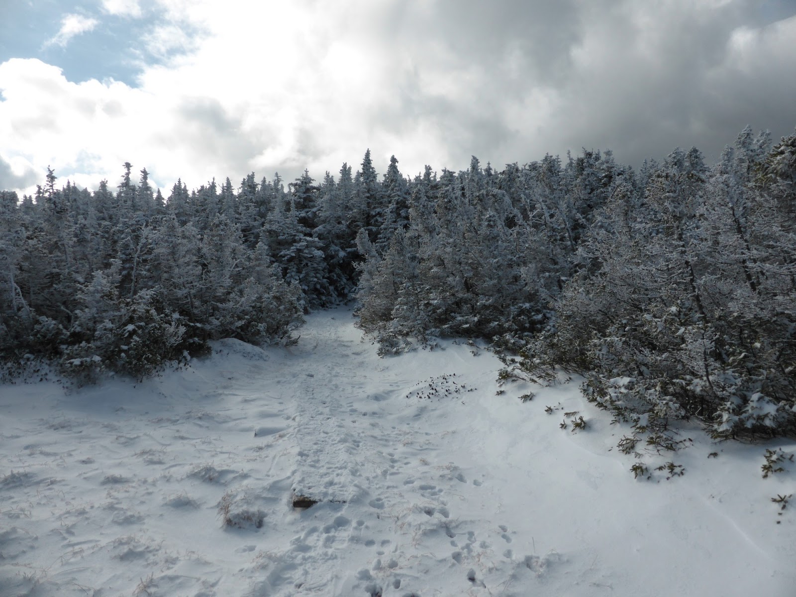
A reminder that winter is coming

Climbing to the clouds

Franconia Ridge from Greenleaf Hut

Shining Rock

There is a viewpoint spur just below Greenleaf Hut. It seems to have grown in pretty heavily from my memory from 2001.