Route: Signal Ridge Trail, Desolation Trail, Carrigain Notch Trail, Wilderness Trail, Pemi East Side Trail
Peaks: Carrigain (4700', NH4K)
Mileage: 17mi
Elevation Gain: 3900'
Book Time: 10hr 25min (actual 8hr)
With the year drawing to a close, the various forest roads around the White Mountains begin closing for the winter. But with a mostly snow-free year thus far, the roads were still open come early December, so Denise, her friend Joe, and myself spotted a car at Lincoln Woods and then headed down the Sawyer River Road to the trailhead for Mount Carrigain. Our plan was to summit Carrigain, then head through the Pemi Wilderness along old railroad grades back to Lincoln Woods, and perhaps exploring a logging camp or two along the way.
Having already been up Carrigain twice in 2015, there was not too much of a surprise for the ascent, aside from the blazing pace Denise set for us. The first 2 miles are flat, and we made quick work of them, including opting for the old, now closed, corridor of the Signal Ridge Trail at the old junction with the Carrigain Notch Trail (which was relocated 1/4-mile up the latter trail). Once into the ascent, we continued at a quick pace. As we neared Signal Ridge, snow appeared on the ground, though only a few inches worth at the most, and only a few small patches of ice, so we were able to hike without additional traction without issue. In just over 2.5 hours, we reached the summit, 5.25 miles from our starting point.
 |
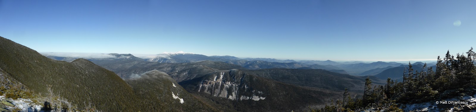
| Pano from Signal Ridge - that's the Presidential Range on the left. |
 |
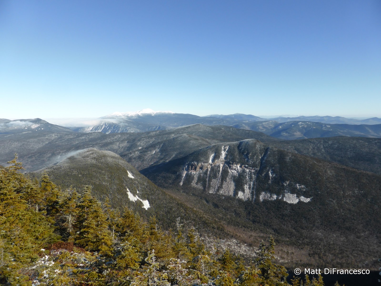
| The Presidential peaks shining in white, Washington commanding them all. |
 |
| Vose Spur and the cliff-scarred Mt. Lowell forming the other side of Carrigain Notch. |
 |
| Undercast was visible in the distance in Crawford Notch, but not a cloud where we were! |
 |
| Vose Spur (R) and the steep, narrow ridge up to Carrigain (off camera to the L). A few years ago a friend and I bushwhacked from Vose Spur along that ridge to the Carrigain summit tower. |
The tower was caked in rime ice, and there was a chilly breeze, but there was not a cloud in the sky except off to the West were we could see what must have been a neat undercast for those in the Franconia Notch and Presidential Range vicinity. The views from the tower atop Carrigain are among the most wide-sweeping there are in the White Mountains. We took a nice break here before beginning the steep, sometimes tricky descent down the Desolation Trail. There was just enough snow on this trail to make us take our time, but not enough to put on microspikes or other traction. Once off the steepest portions of the trail, we picked up the pace, reaching the junction with the Carrigain Notch Trail.
 |
| Rime stairs to the summit. |
 |
| More rime. |
 |
| Franconia Ridge across the Pemi Wilderness |
 |
| Bondcliff (L), Bond (C), West Bond and the point of Garfield between them, with the Twins off towards the right. |
 |
| The East Pemi and more. And undercast visible on that side of the mountains. |
 |
| Simply gorgeous views today! |
 |
| The Osceola Range commanding the center of this pano. The double-top of Sandwich Dome is on the far left. |
 |
| More of the Sandwich Range, encompassing from Mt. Chocorua (far L) through Passaconaway, Whiteface, the Tripyramids, and Sandwich Dome. |
 |
| Undercast reached just into Zealand Notch |
 |
| Crawford Notch partially filled with undercast. |
 |
| Peek-a-view towards the Hancocks. |


From here out to the car was almost completely new trails for me, aside from a brief section of the Wilderness Trail. First up we hiked the final stretch of the Carrigain Notch Trail to Stillwater Junction, traveling through a beautiful stand of spruce along the way. Stillwater Junction is at the confluence of several streams, feeding into the Pemigewasset River. It was a cool spot too look around a little bit before we continued on our way, now along the Wilderness Trail, which also mostly follows old portions of the East Branch Railroad. Along the way we passed through the middle of Camp 18, one of the old logging camps. A stove from this camp and a couple barrel hoops sit mere feet off the trail, so we stopped for a minute to look around. Chances are there are more artifacts to check out in the area, but with the snow cover we didn't look long or hard. (Note that removal of any artifacts from the forest is illegal, basically the policy is look, but put back where you found it.)
 |
| Bear tracks on the Desolation Trail |
 |
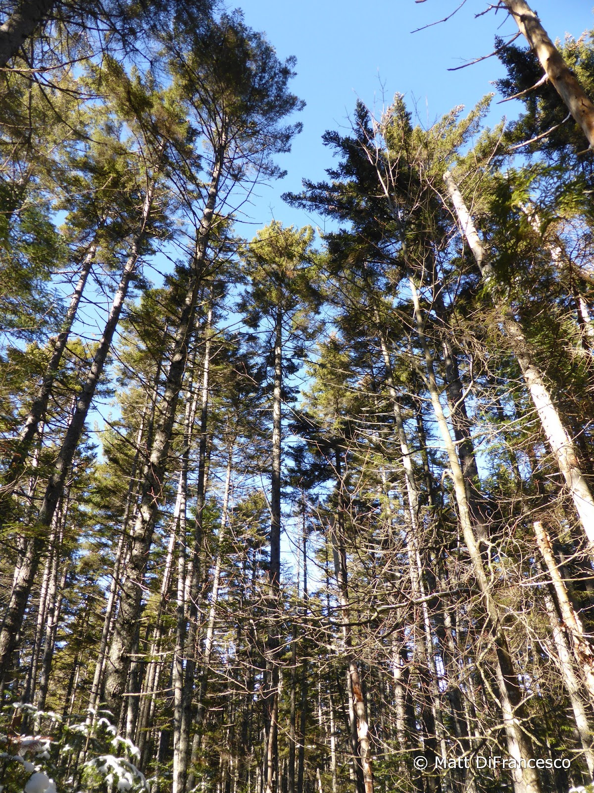
| Large, tall trees enroute to Stillwater Junction. |
 |
| What a neat spot to walk through |
 |
| Stillwater Junction |
 |
| River crossing near Stillwater Junction |
 |
| This old stove lies right along the trail near the site of the old Camp 18 logging camp. |
 |
| Barrel hoops were also near the stove. |

Just mere minutes after departing from the camp clearing, I stepped awkwardly on a rock in the trail that rolled, and my ankle rolled with it. Included along the way was a wonderful "pop" sound from my ankle, and, well, that was that. Luckily, after a few minutes of severe pain, I was able to clear my head, and determine that I could still move the ankle, though any side-to-side rolling was extremely painful. Luckily there was hardly any pain in the directions that normal walking required, and I was also able to bear weight on the ankle. The most important thing to do with such injuries, I knew, was to keep the boot on, because if I took it off, I would never get it back on due to swelling. The final 7-ish mile walkout along the remainder of the Wilderness Trail and the Pemi East Side Trail was luckily fairly flat, and interestingly I was still able to walk at a decent pace, though far from what I normally could do on such stretches. Of course, focused on simply walking, there was little time for looking around and enjoying the new sights. I will have to return someday for the Wilderness Trail, and to explore some of the logging camps more thoroughly. That night, in my motel room, I took off the boot and soon had a roughly baseball-sized lump on the side of the ankle. Needless to say, this will keep me off the trails for a while. In fact, as I write this nearly 3 months later (yes, I'm still bad about writing these trip reports despite having more time), I still have some pain in the ankle, though it is getting close. I got a (very!) badly-sprained ankle, but it could have been worse: nothing was broken, and no surgery is needed. Just rest. 3 months and counting of it...
 |
| Bond (pointy peak on R) and Bondcliff sort of visible from near Camp 18. |
 |
| The Pemi East Branch |
 |
| Huge washout along the Wilderness Trail (from Hurricane Irene in 2011 perhaps?) |