Showing posts with label 52WAV. Show all posts

Sunday, February 15, 2015

Winter Wonderland on Waumbek - Jan. 25, 2015

Route: Starr King Trail
Peaks: Starr King (3900', 52WAV), Waumbek (4006', NH4K)
Mileage: 7.2 miles
Elevation Gain: 2800ft
Book Time: 5 hours (actual: 4hr 20min)

After a long day on the Bonds the day before, Theresa and I were still looking to do one more hike on Sunday. But after nearly 24 miles, it was not going to be a long or hard one. Mount Waumbek fit both of our various list goals and fit the bill on being fairly short and easy. With a sub-8 mile hike on the docket, we slept in and met at the parking lot around 8:30. We found out that the summer parking lot, while not plowed (it is not normally plowed in winter anyway), had so little snow in it that it was actually accessible, which allowed us to save a short roadwalk. Also, from trip reports from the previous couple of days, we knew that the trail was well-packed and so we left the snowshoes at the car and put on the microspikes instead. Aside from a minor bit of drifting along the ridge where there were ~3" of loose snow on top of the trench, the trail was well-packed and so leaving the snowshoes was a good call.

It was a cold morning, but there was sun in the skies, and it was looking like a fairly nice day overall. We were sore from the day before, but steadily made our way up the steady grade to Mount Starr King, passing one or two groups and being passed by many others. I had hopes of getting nice bluebird sky views from these 2 peaks for the first time ever (this was my 6th trip now), but reaching the old cabin clearing near the summit of Waumbek, we found nothing but clouds at the viewpoint. Oh well.

Sunny, though chilly, with a nice packed trail to walk on.

The packed trail continued, the clear skies did not.

The trip across the ridge, with a short drop off Starr King and then a short ascent to Waumbek, is always a very pleasant walk in the woods, and this time was no exception. It is also an easy mile to the wooded summit, and number 30 on the 4000-footer list for Theresa in winter! We walked the extra couple dozen yards to the blowdown patch just past the summit where there is a nice if restricted view, but it too was in the clouds.

The view from the blowdown path near Waumbek's summit. The skies were trying hard to clear, but couldn't manage it yet!
Waumbek Summit. The cairn is mostly buried.
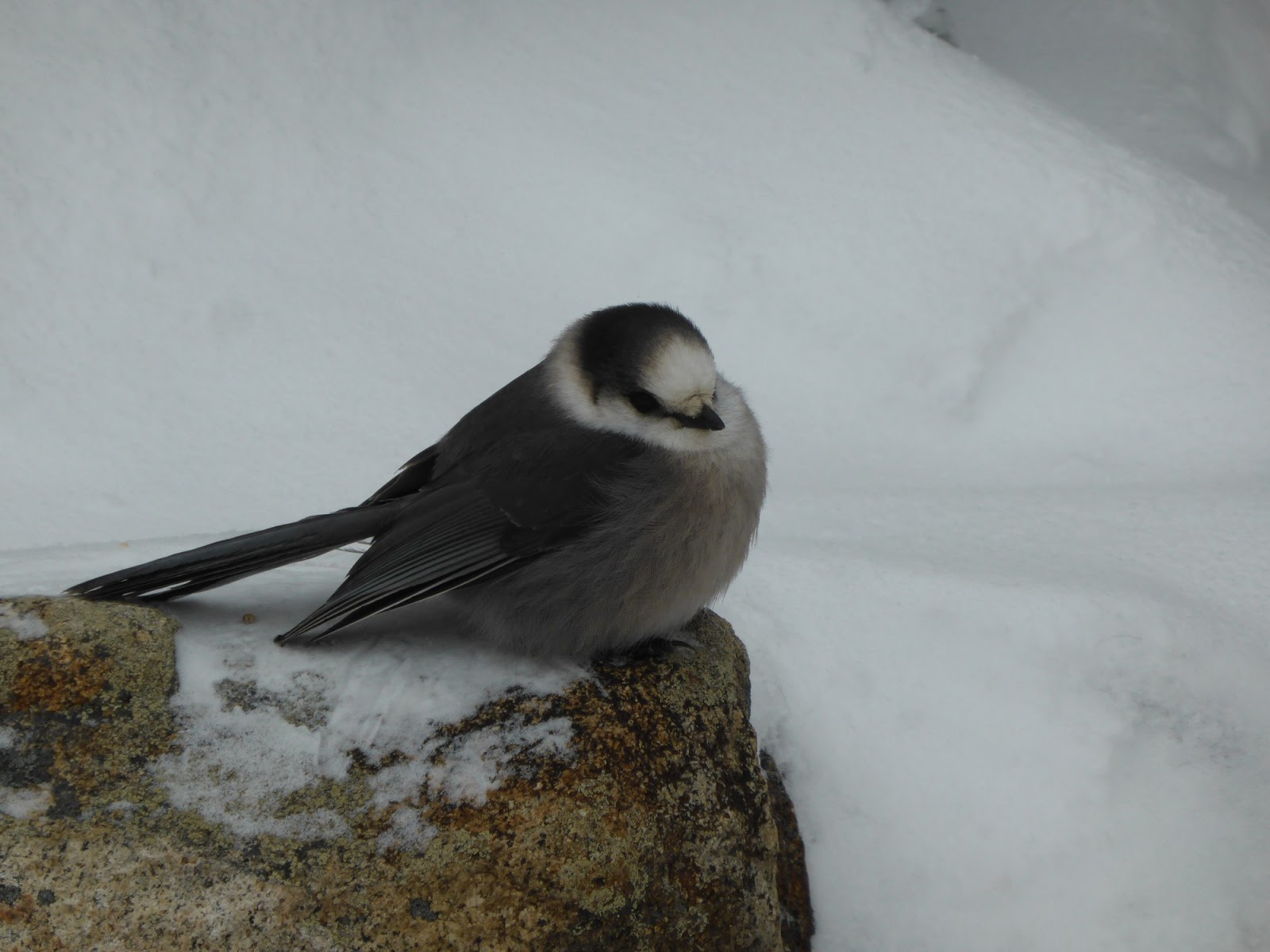
Returning to Starr King, we arrived to an empty summit, aside from the 3 gray jays hanging out. One was one of the fattest gray jays I've ever seen! We played with the jays for a few minutes while eating our own snack, then headed off on the descent back to the car. After an uneventful descent, we arrived to the cars, changed into more comfortable driving footwear, and hit the road for our respective homes and work the next day. While driving South on Route 115A, I noticed that the summit ridge was now completely in the clear with blue skies all around. I've lost track of how many times I've had that happen on various hikes, but really this one was all about the hike, not the views. The woods were nice, the conversation and company was nice, and we were back home before dark!

Gray Jays!

This one was especially fat.


The skies are clearing even more during the descent as we near the cars.


Sunday, January 11, 2015

Mount Chocorua - Nov. 16, 2014

After a fun but tiring day on the Baldfaces the day before, our group split ways for various goals. Pam, Mike, and I opted to head for a shorter hike on the way home, which ended up being Mount Chocorua. This was yet another 52-With-a-View peak, so I was excited to see the views from this summit that seemingly everyone I knew had been to, but I hadn't. There are a myriad of ways to summit this peak, but we opted to go with what we hoped would be the least icy option, or at least the least steep: the Champney Falls Trail from the Kancamagus Highway. This would be a "simple" out-and-back on this trail and then we would head home, getting back at a nice reasonable hour for once.

Owing to having to clean out the cabin and a variety of other chores, we didn't get an early start, but we were still on-trail by around 10. Right off the bat there is a water crossing at the site of an old bridge, which was easily rock-hopped thankfully. This trail started off gradually, and ice-free, but a short time before we reached the falls loop we had to put the traction on, which largely remained on until back to this spot again.

Part of Champney Falls
Champney Falls
We did take the falls loop, which re-connects back to the main trail in a few tenths of a mile. With the mid-fall water levels (low), but lack of abundant cold, the falls were neither flowing that impressively nor iced up nicely. Still, in the right conditions they look like they could be a nice sight. We also had a bit of a mini snow-squall blow overhead while we were ascending through this stretch, though it was short-lived and didn't leave much snow behind. So much for the sunny morning that was predicted!

Middle Sister
Kearsarge North


Approaching the summit
The Sandwich Range - Paugus in front, Passaconaway(R)/Whiteface(L) in back, Tripyramids and Sandwich Dome even further back.
Passaconaway (R) and Whiteface (L) behind Paugus.


While somewhat steep in places, this trail overall was relatively gradual, utilizing several (icy) switchbacks to gain the ridge. From there it was a series of intermittently icy and bare rock ledges to the summit. The skies had cleared some just as we got to treeline, and we were treated to a taste, though not the full picture, of what views can be had from this rocky summit.

The Chocorua Ridge

Survey marker on the summit

The Moats and Kearsarge North

We found a spot down out of the wind to hang out for a short while, enjoying the views. But seeing clouds rolling in from the west and snow in the afternoon forecast, we headed down before too long to get a head-start on the drive home. Just as we got below treeline, the clouds socked things in pretty well, so it seems we hit the summit at exactly the right time for once! This is definitely a peak that I need to revisit on a nice day, and via some of the many other routes!


The Sisters from Chocorua
Middle Sister's old firetower site


The Baldface Circle - Nov. 15, 2014

One hiking friend I have shared more than a few miles with over the last year or so recently announced that he was moving to Portland (Oregon, not Maine!). Needless to say, those of us that know him were bummed, but almost immediately talk turned to a weekend hiking get-together to send him off in style! And thus was born a plan to rent a cabin near the NH-ME border for a weekend, do some hiking, and hang out together. I was originally going to join them for the first day of hiking on Friday to Goose Eye Mountain, a New England 100 Highest peak just over the border into Maine, but a hand injury earlier in the week caused me to change plans and head up in the afternoon to meet the gang for dinner at the cabin instead. But the next morning we were slated to do a hike that has been on my to-do list for far too long: the Baldfaces! There are a total of 4 peaks on the 52-With-a-View list on the Baldface Range, headed by South and North Baldface.

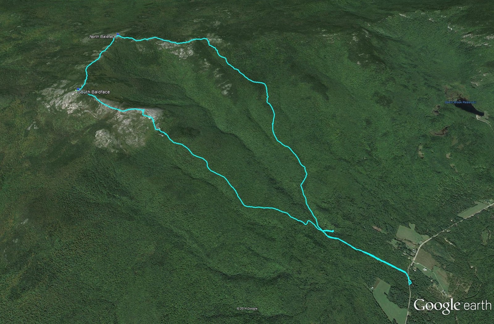
We decided that we would keep it "simple" and hike the entirety of the Baldface Circle Trail, which loops over both main peaks of Baldface, with miles of mostly above-treeline ledge walking along the NH-ME border. The first stretch of trail to the Circle Junction is flat and was an easy warm-up. At the junction, a side spur leads a short way to Emerald Pool, a worth while diversion.

Emerald Pool matches the jacket!


Inlet to Emerald Pool

Circle Junction
From the Circle Junction we headed up towards South Baldface first, which is the recommended direction to do this loop due to a very steep stretch of ledges ascending this peak. Up to the Baldface Shelter is a fairly easy hike, but right behind the shelter is where the climbing begins. Here we put on the microspikes since there was a lot of mixed ice, and they ended up staying on a good portion of the day until we were off the initial descent off of North Baldface.

Ascending the South Baldface Ledges
Looking NorthEast into Maine - Royces on the left, Speckled Mountain on the right


West (L) and East (R) Royce - the Maine-NH border runs between them.


North Baldface and Bicknell Ridge
North Baldface

South Baldface


Flintstone Furniture approaching South Baldfcae


Baldface Knob Trail Junction
The guidebook mentions steep ledges and some scrambles above the shelter and it isn't kidding! Especially with the mixed ice and rock it was a tricky ascent, one in which we all took our time and watched our footing. The views, however, are amazing and we took ample opportunity to enjoy them. From the junction with the Baldface Knob Trail the grade eases and was more reasonable for the final ascent to South Baldface, where we took in the sweeping 360-degree views.


North Baldface dead ahead.

Mount Washington towering over the end of the Wildcat Range

Sable Mountain, a trail-less peak near South Baldface.

North Baldface with the Moriahs behind

The Carter Range behind North Baldface.

Leaving for North Baldface
Looking ahead to North Baldface from the main col on the ridge.
The ridge over to North Baldface ducks into the scrub now and then, but has good views for most of its stretch, with some minor extra ups and downs and a few tiny scrambles. We made good time to North Baldface where we again enjoyed terrific 360-degree views on this chilly but fairly wind-less day. Being right on the border between New Hampshire and Maine with great views into both was very cool, there was a lot of new (to me) stuff to see, along with unique angles on some familiar stuff. I really need to explore the Evans Notch area some more in the future, it is really cool in there!

Looking back towards South Baldface from the main col.
South Baldface
North Baldface!
More views: across the Wild River Wilderness towards the Carters and Presidentials.
The Royces and Speckled Mountain

Old Speck Mountain (a Maine 4000-footer)
The Moriahs
Carter Dome (L) and Mount Hight (R)
Where's George?
South Baldface from North Baldface

After dropping off North Baldface and continuing along the ridge for a while, we began the descent down, which was initially fairly steep (though nowhere near as steep as the ascent to the ridge had been), and then eased up. The rest of the descent was uneventful aside from seeming to never end, and shortly before sunset we were back at the cars.

Time to head down.