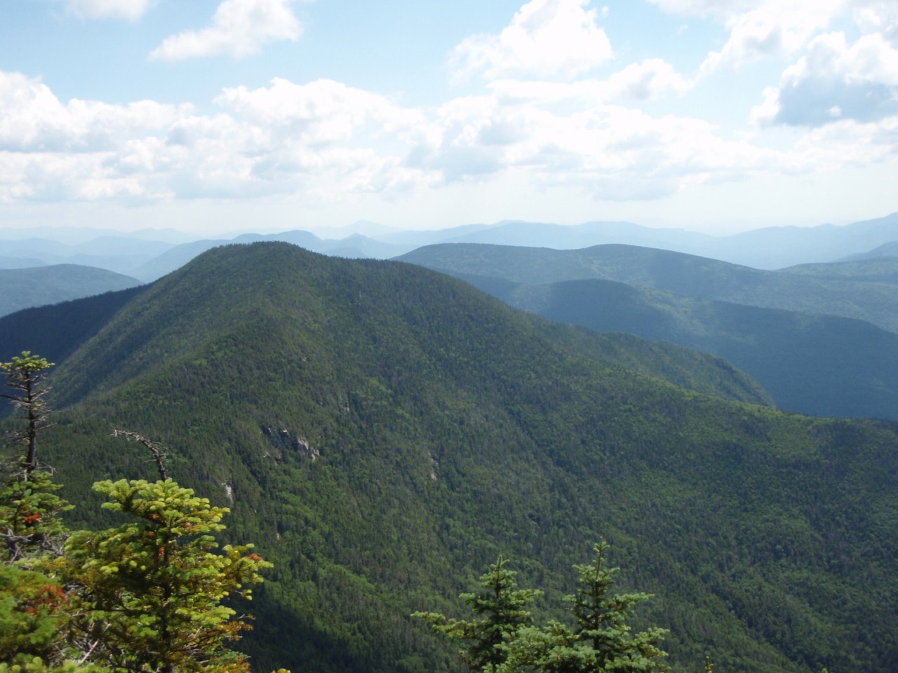
Wednesday, July 4, 2012

Doubling Down in Waterville Valley - July 1, 2012

The goal for day 2 of this weekend was to hike the Osceolas from the Kancamangus Highway, which meant going up the very steep ascent to East Osceola. However, with Tripoli Road closed in winter, this approach is what almost everyone takes to hike the Osceolas in that season, and I wanted to do it to know what I was in for this winter. However, as I constantly seem to do, I changed plans.

After being pretty fast on the Hancocks the day before, I figured I would be roughly the same time to complete the Osceolas from either direction (Tripoli Road being the common summer route). I had a half-day 4000-footer left on my 2012 list in Mount Tecumseh, which is a mere handful of miles down the road from the Mount Osceola Trailhead on Tripoli Road. If I completed the Osceolas in good order, there was no reason I could not add Tecumseh afterwards and still get home at a decent hour. This would also accomplish giving me a longer, harder day, as I have a very long, hard hike upcoming in Maine in a couple weeks (roughly 18 miles, and 5-6000 feet elevation gain!) - Abraham, Sugarloaf, and Spaulding.

So with that in mind I struck out on the Mount Osceola Trail at the "early" hour of 8:45. This approach does not have any steep spots, just poor footing in the lower mile or so with a lot of jumbled rocks. However, I was feeling good again on this day and made short work of the 3.2-mile, 2050-foot climb, hitting the summit of Osceola in a mere 1.5 hours!

I made sure to check out the Northern overlook, which is found via a beaten herd path from the old fire tower ledge at what most think is the summit. The actual summit seems to be at this Northern overlook, which has wonderful views of the Hancocks, Bonds, Franconia Ridge, basically all of the Pemi Wilderness.

Hancocks (left) and Carrigain (dead center)

Up the valley I hiked through the day before towards the Hancocks

The Bonds off in the distance behind Mount Hitchcock

Franconia Ridge, Owl's Head, Garfield, South Twin, Bonds

Franconia Ridge with the Kinsmans and Cannon off to the left partially behind the trees
Then I continued on to the massive East-facing ledge just past the summit along the trail that has awesome views of Waterville Valley.
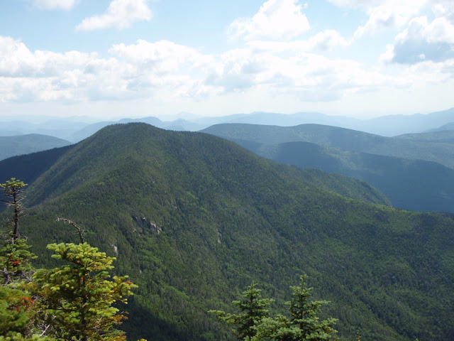
East Osceola - next destination

Tripyramids

Sandwich Dome behind the base of the Waterville Ski Area
A short refuel break here, with only a couple of people up here yet. A few more came in from East Osceola during my break, but I kept it short with the day I had planned. Plus I planned to stay a little when I got back anyway.

Beginning the approach to East Osceola

A little closer to East Osceola
Right before you reach the col between the 2 main Osceola peaks, there is a chimney, a near-vertical rock cleft in the trail. There is a rocky bypass around it that I used to descend, but on the way back I made sure to climb up the chimney itself. It's not hard, there is an abundance of good hand-and-footholds to use to get up, and it's pretty fun honestly. No roping needed.

The bottom approach to the chimney - bypass to the right
The summit of East Osceola is in the woods and pretty boring. The only thing of note was I remembered the carin being smaller there, it's a couple feet tall now which makes it hard to miss. Upon returning to the ledges on Osceola, I snacked and chatted with several people that were there trying to ID peaks (a game I am slowly getting better at). 30 minutes later I finally excused myself and began my descent. You have to spend some time on that ledge on a nice day.

I made good time out, and arrived at the car around 1:45, for a 5 hour time, which I was happy with. I was still feeling OK, though the humidity was building and I only had about 1 Liter of water left. I knew I could fill a bottle up on-trail on Tecumseh, so cruised down the road to the Waterville Valley Ski Area, where the Mount Tecumseh Trail departs.

The weather was getting dark to the North, but there were still plenty of blue skies, so after a call home to get the radar picture (which said I ought to be OK for a few hours), I hit the trail, at 2:25...a bit later than I wanted, but I was going.

The first ~mile of the trail is moderate in grade and with clear footing overall. Shortly before the second major stream crossing that begins the hard climbing, I came across Sue and Earl, bailing on their own double-hike attempt (Waumbek in the morning). Good to see them again, getting close to their grid finish!

After a brief visit, I was off to that stream crossing to fill up a water bottle and drop some Aqua Mira in to purify it. Good excuse for a snack break too! Then the climbing began. The stretch after the upper crossing isn't horribly steep, but it is steepish and it just goes on and on. I passed a lot of people heading down of course, and I wasn't going up particularly fast. But along the way is some of the most impressive rock work I have ever seen on a trail.


Rock-lined drainage bars (even the bottoms), a beautiful, tall rock staircase, there was a little of everything! Huge kudos to the trail adopter Rocket21 (Jeremy Clark) who has been doing this work this year.

Near the top, you meet the Sosman Trail, and shortly thereafter the trail splits with 2 ways to the summit.

I went to the left, which I believe is the Sosman Trail portion, which gets there a little quicker, albeit over some rather rough footing. Soon I was at the summit though, completing the 2.5-mile, 2200-fdoot climb in 2 hours. At the top was a father and son who had come up from the other end of this trail, from Tripoli Road. Someday I plan to take that approach to this peak, it is a little longer with a little more elevation gain, but is far less traveled.

Tecumseh is always bashed for its poor views, which could be expected for the shortest 4000-footer (4003'), but there was actually a nice view towards the Tripyramids that I did not remember from my 2004 visit.

Tripyramids, Sleepers

Whiteface behind the Sleepers
Summit carin
I headed down after a short break. Just above the upper stream crossing there is a short side trail to the ski slopes which offers some nice, if limited, views.

Tripyramids from the ski slopes

Rather not walk down this!
Shortly after crossing the stream, I began to hear some thunder in the distance, which quickened what had been a slow descent to this point (knees were pretty tired). I made it back to the car, got the trunk opened, and it began to pour. Perfect timing! It was 6:00, and my day was done, and the cold rain felt good to stand under for a minute or so before finishing the packing and heading home.

Down to 10 peaks (7 days of hiking) for a 2012 4000-footer finish!

Summary:
Peaks: Mount Osceola (4340', NH4K), East Osceola (4156', NH4K), Mount Tecumseh (4003', NH4K)
Mileage: 8.4 miles (Osceolas), 5.0 miles (Tecumseh), 13.4 miles total
Elevation gain: 2950 feet (Osceolas), 2250 feet (Tecumseh),  5200 feet total

A Quick Trip to the Hancocks - June 30, 2012

Saturday it was time to get back to some New Hampshire 4000-footers. I am still wanting to finish a full round of the 48 before the end of the calendar year, and had 15 left coming into the weekend. Most of these are the peaks in the Sandwich Range, but the Hancocks are very close by as well. The plan was a standard out-and-back of the 2 Hancock peaks (North and South).

There is really only one way to dayhike these peaks, aside from some very long approaches from Lincoln Woods or the Sawyer River Valley. Therefore, I would not be getting any new sections of trail checked off on this hike, but that is perfectly fine with me. The hike would involve the Hancock Notch, Cedar Brook, and Hancock Loop Trails. Just under 10 miles, with 2700 feet of elevation gain, but nearly half of that gain is after the Hancock Loop Trail splits, with a 0.7-mile, 1100-foot climb (all in 0.6 miles) to North Hancock, or a 0.5-mile, 900-foot climb to South Hancock. Thus, this hike really isn't too hard, the approach is flat and easy, just a short, stiff climb and descent in the middle of the hike.

It was a warm, but not terribly humid day, already 65 degrees when I left the trailhead at 8:40 on the Kancamangus Highway, at the hairpin turn. The Hancock Notch Trail mostly follows old railroad grades, and so is flat, wide, and mostly empty of rocks. The 1.8 miles flew by, despite me not trying to break speed records, and I reached the Cedar Brook Trail in roughly 35 minutes. Just before hitting this junction I came upon a group of SCA (Student Conservation Association, or something to that effect), a volunteer student trail crew group working on putting a rock staircase in an eroded section of the trail (due to Hurricane Irene last fall). Thanks again to all those that do trail work out there!

Stream crossing near the Hancock Notch/Cedar Brook Trail junction

Cedar Brook is also flat, but crosses a stream numerous times, and was heavily impacted by Irene. While passable, there are many eroded spots that will eventually need to be addressed. Also, there are several bog bridges in this stretch, and one was apparently moved mostly off-trail by the excessive water from the hurricane.

The trail is to the left, this bog bridge got moved!
Shortly past this spot I ran into the first hiker of the day, on his way out. He beat the heat I guess, and I later found out that I knew him through Hike-NH. Wish I could get such early starts, but I have a 2.5-3 hour drive to the Whites most Saturdays.

Cedar Brook Trail past the Hancock Loop Trail to the wilderness - path less traveled

Cedar Brook Trail towards Kanc from Hancock Loop Trail

I hit the Hancock Loop Trail in a mere 55 minutes from the road, at the 2.5-mile mark and ~800 feet of elevation gain for the day. Now the trail gets a little rockier, but still not bad. 2/3 of the way to the split in the trail I ran into Phil, a local hiker whom I'd had a long conversation with on the summit of Moosilauke back on St. Patty's Day. We had another nice chat before we parted ways, as he too was on the way out.

After hitting the fork and taking a short snack break, I descended the 100 feet on the North Branch of the Hancock Loop Trail and began the steep climb. Nothing fancy here, it is all in the woods with reasonable footing most of the way. Just steep at 1100 feet gained in 0.6 miles. I saw a couple of people descending as I slowly ground my way up, but it only took about 45 minutes to complete this climb, which is not bad.

An eroded section of the North Hancock Branch

Rock staircase heading up to North Hancock
The summit itself is treed-in, though with a few feet of snow this would have some great views, so maybe this winter I'll get some nice views of the Bonds! There is, however, a short spur path to a South-facing ledge that provides some nice views.

Scaur Peak and the Tripyramids

Next destination - South Hancock on the right

Scar Ridge

Sandwich Dome on the horizon, Osceolas to the right
I was visited by a handful of black flies at this ledge, but they weren't too bad overall and I stayed for about 15 minutes in the sun, enjoying some food and the view. Then it was off to South Hancock. There isn't anything tricky about the ridge here, it drops about 300 feet, hops over a minor know that I'll call Middle Hancock, and then climbs up briefly to South Hancock. South Hancock in all surveys I have ever seen only has at best 199 feet of prominence relative to North Hancock, which ought to exclude it from the 4000-footer list (200 optimistic prominence is the cut-off), but it is on the list. There are a few mud pits, one pretty significant and deep, around both sides of Middle Hancock, but the walk overall is easy and took a "leisurely" 35 minutes for the 1.4 miles.

South Hancock is also viewless, and has only a small overlook towards the Sawyer River Valley.

Moat Range, Chocoura on far right

Chocoura
South Hancock summit
I'd seen a couple people on the ridge going the opposite way, but now is when the crowds started in. It was near lunch time now. I took another break, and then began the tricky descent down the South Peak. I did not realize the South Branch was loose rubble like it is, had I known this I would have done the loop in reverse. But I made it down, stopping to take a partially obscured picture of Franconia Ridge first.

Franconia Ridge
I decided at the bottom to see if I could get back to the car in under 5 hours total, which would mean a 1:20 exit from this point. I charged away, and sure enough hit the car right at the 5 hour mark. A nice time, despite taking plenty of time to enjoy the few views, and I briefly toyed with visiting Tecumseh, a 3-4 hour hike in Waterville Valley, but by the time I would have gotten there and back out, it would be after 7 before I'd make it to camp, so I opted to just call it a day and enjoy the afternoon at camp.

Summary:
Peaks: North Hancock (4420', NH4K), South Hancock (4319', NH4K)
Mileage: 9.8 miles
Elevation Gain: 2700 feet
Time Taken: 5 hours (6:15 is book time) which includes 3 15-minute stops.

13 left for a 2012 NH48 finish!

Tuesday, June 19, 2012

Mount Nancy - June 16, 2012

With yet another beautiful June weekend forecast, I couldn't decide on a peak to visit. Having visited 33 of the 48 4000-footers in New Hampshire thus far this year, I've decided I'm going to visit the remaining 15 before the end of 2012 for a calendar-year finish. It is 10 more hikes left for that, and I've got plenty of time, and for this weekend's opening hike I decided to visit a peak on the New England 100 Highest list. This list has all 67 of the New England 4000-footers (naturally) and the next-highest 33 peaks in New Hampshire, Maine, and Vermont that meet the usual 200-foot prominence rule. Many of the 33 sub-4ks are in New Hampshire, with all but 4 having maintained trails to their summits, and one of those has a well-defined herd path.

That peak is Mount Nancy. Nancy is situated just South of Crawford Notch, a couple miles from route 302. The normal approach to this summit uses the first 4.3 miles of the Nancy Pond Trail, and upon reaching the outlet of Norcross Pond, a herd path diverges steeply to the summit.

This trail has a lot for everyone. A short, fairly easy trek gets you to the base of Nancy Cascades, a beautiful waterfall alongside the trail.


There is a nice pool at the bottom of the falls that would make a wonderful swimming hole. I reached this part of the trail in short order, as it is 2.4 miles and about 1450 feet of climbing, mostly along old road grades. A half-mile before the falls the trail becomes rougher and there are several heavily-eroded sections from the 2011 Hurricane Irene that roared through the North East.

At this point the trail begins to climb hard to the top of the cascades, utilizing numerous switchbacks to accomplish this. You know it is steep if the trail in the White Mountain uses switchbacks!

After this climbing, the grades moderate nicely up to the first of 2 picturesque ponds, Nancy Pond. Here the trail runs mostly level over many bog bridges along the shore of first this pond, and then Norcross Pond.

Nancy Pond

Norcross Pond

Mount Anderson
There have been several trail re-routes away from the shores as there are some rather industrious beavers up here, especially at Norcross Pond. The water level in places is still only inches below and a few feet from the trail. I imagine in early spring run-off this can get extremely muddy. On this day it wasn't bad, the majority of the mud was bridged by the bog bridges.

At this point I had seen all of one person today, an older gentleman shortly before the base of the falls who looked to be only heading that far. I didn't really expect to see anyone above the falls, or at least not beyond the ponds. Nancy is not officially trailed, and this is a bit of a tucked-away spot. There had been 2 cars in the lot when I left though, so there was at least one more person ahead of me most likely (unless it was a car spot for someone) Nevertheless, as I neared the Norcross Pond outlet, I heard voices. There was a hiking duo resting at the outlet enjoying the view over the Pemi Wilderness towards the Bonds, where I had just been a week before!

View to the Bonds from the Norcross Pond outlet
This duo was on their way to Mount Nancy too. I was rolling well today, having completed the 4.3 miles and 2200 feet of climbing in just over 2 hours. It was time for a break, and the views were great. The only not-so-great was the black flies buzzing about, but some bug spray kept them mostly at bay.

As I mentioned, Norcross Pond has some beavers hanging around. While I never saw a beaver, I did see a lodge near the edge of the pond (not far from the trail in fact) and they had a nice dam built along the outlet of the pond, raising the water level easily a solid foot.

Busy beavers
There was some foam forming in one of the streamlets coming off the dam that had some wood chips in it, it looked somewhat like the top of a coffee or something. I wouldn't drink it though!

Foamy goodness
After a break here for food and water, I began to head up the steep Nancy herd path that diverges from the main trail to the right right before crossing this outlet. The people that were here before me started up at the same time.

The herd path splits early on, with the real path going left with a spur to a well-used campsite to the right. After initially following this false spur despite knowing it wasn't right, we were soon heading up the herd path. Early on it comes to a gravel slide, where the herd path continues alongside of, one can go up the slide or up the herd path. I intended to go up the slide and down the herd path, but the slide was such loose stuff that I opted not to (it was 1 step forward, 2 steps backward territory - that loose!). But first I ventured out onto it to get some shots of Mount Anderson sitting right there on the other side of the outlet.

Mount Anderson from the Mount Nancy slide
Then began the STEEP ascent up the herd path. The path itself was brushed in but still very easy to follow, I'd venture to say most anyone experienced with White Mountain trails could follow this without trouble. There is little that I have been on that was this steep, the North leg of the Mount Hancock Loop and the Owl's Head slide are the only ones that come close. That said, it is fairly short-lived at roughly 3/4 miles long. It levels out near the top, and it was just below this section that we ran into 2 guys heading down from their visit.

The summit of Nancy has a nice ledge overlooking the bottom of Crawford Notch.

Stairs Mountain. Mount Resolution, and more from Nancy's summit

Mount Washington in the clouds
We took turns taking summit shots, then ate some food. Unfortunately, the black flies were here too, and this time bug spray did little to stop them. It seemed that I was the only one they were looking for, but it always seems that way, no?

After a break, it was time for the steep descent down, much harder than going up. But it was quicker! Then came the hike out, with a lengthy visit at the falls on the way down.

1/2 mile below the falls there is the remnants of the old Lucy Mill right along the trail, which I somehow missed most of on the way up (there is some advantage to out-and-back hikes!) There are a few metal artifacts and a few foundation blocks, but not much else. Likely the nice old roads below this point once served this mill.


Overall, an uneventful hike out with some nice company where we discussed where each had been (much of the same places, they had just finished the NH 48 last year and are now working towards the New England Hundred Highest - or at least the NE67!). I reached my car 6.5 hours after leaving it, and there was easily 1 hour of breaks in there at Norcross Pond, the summit, and the waterfall.

It was a nice day out along a very beautiful hike. Just the waterfall at 2.4 miles one-way, or the ponds between 3.4 and 4.3 miles (one-way again) are wonderful destinations by themselves, throwing the summit in there was a cherry on top!

This was only the 4th Hundred Highest peak I have visited besides the 48 NH 4000-footers (The Bulge, The Horn, and the Cannon Ball being the others, all visited en-route to 4ks), but it was a great one. (EDIT: I actually have 5, I was reminded that Sandwich Dome, at 3980', is on this list, but not the 4K list, haha).

Summary:
Peaks: Mount Nancy 3926' (NEHH)
Mileage: ~10 miles
Elevation Gain: ~3000 feet