Friday, January 25, 2013

A Visit to the Hancocks in a Snow Squall - January 20, 2013

This day started out with needing to make a final decision on either the Hancocks or Garfield. With a long, hard day the day before and snow forecast for the 12-2PM block, in addition to 60+mph winds, the decision was easy: Hancocks. On the trail at 8:15, I left nice blue skies at the parking lot.

Osceolas (L) and Scar Ridge from the Hancock Parking Lot - nice day on tap?

I put the snowshoes on right after crossing the road to the trailhead. Things looked pretty well-packed and I probably could have gotten away with microspikes (which my sore legs would have welcomed!) without causing damage to the track, but I opted for the snowshoes in case things changed quickly. Ultimately it was yet another car-to-car snowshoe, 5/5 on the winter (versus only 1 all last winter!), though I would have been fine in the 'spikes on all but the ridge.

Taking the Hancock Notch Trail to the Cedar Brook Trail up to the Hancock Loop Trail (have I lost you yet?) I ran into the first people just a few yards from the Hancock Notch/Cedar Brook junction, on their way OUT already (it was 9AM)! I hit the latter junction exactly 1 hour into the hike (2.5 miles and several hundred feet of elevation gain later). Not bad I thought! The numerous water crossings were in various states of open, decently-bridged, partially bridged, and weak-looking bridged, but none were difficult with the low water, even with the clown shoes (snowshoes) on. It was a wonderful snowshoe to this point, but I knew the climbing would start to pick up now, before the STEEP climb up to North Hancock.

Arrow Slide on North Hancock - the trail goes up next to this!

Though I was slowing down, I made my way to the split in the Hancock Loop Trail, watching as the sky had started to cloud up quickly. A quick stop at the split, and I dropped the 100 feet of elevation to the old stream bed and began the climb as it began to snow. From this bottoming-out point, the trail climbs roughly 1100 feet in merely 0.6 miles, paralleling a major rock slide (Arrow Slide) most of the way.

The trail here was crusty ice with no real snow on top of it, likely blown off by the winds and butt-sliders descending. But the trusty MSR Lightning Ascent snowshoes worked great on this, with nary a slip or slide all the way up (plus the televators - heel lifts - were wonderful!) I had brought my Hillsound Pro baby crampons for this just in case, but they really weren't necessary with the good snowshoe crampons. As I got higher the winds picked up and the snow did likewise, to the point where I could no longer see South Hancock, less than 1 mile away, through the trees. Slowly and steadily I made my way up to the summit of North Hancock, topping out a little under 1 hour from leaving the junction. With the winds blowing strong and no views to be had, I snapped a picture of the sign and moved on, not bothering to visit the view ledge nearby.

North Hancock - no view to be had right now
Just past the summit I ran into the second duo of the day, who had come across the ridge from South Hancock. We had a short chat before we parted ways; I later realized it was Dan, who keeps a terrific blog HERE, and his brother. Dan is working on a Single-Season Winter 48, a tough accomplishment most years, this year being no exception thus far. I hoped to maybe see them later on my hike out as they mentioned they were moving slow that day (having started at 6:30AM, though Dan had done 2 separate 4K hikes the previous day so that pace was very understandable!), but I never did.

The ridge hike went quickly, as it is 1.4 miles, but the col to South Hancock is barely the 200 feet minimum to count on the 4000-Footer List (well, actually, it misses by at least 1 foot, but that's another story for another day...). Again, it was blowing hard and snowing a little during this stretch, though the snow did seem to taper off towards the end. However, the wind was whipping it up all over, and so I actually put the goggles on shortly after leaving North Hancock until I was off the ridge, as the snow was stinging my eyes. With no views still to be had, I didn't check out the South Hancock view point either.

South Hancock - #37 on my Winter 48 List!
From here it was time for a steep descent back to the split in the Hancock Loop Trail. I had always heard this section of trail was awesome for butt-sliding, but I was a little concerned about bowling people over who were on their way up. But maybe 4 steps down the trail, I slipped, and just gave in. Using my snowshoes as brakes to keep me from going too fast, I slid over 1/10 of a mile before stopping and getting up as I had run into the first person coming up. As I passed him, well, I slipped again, and slid another ~1/4 mile before stopping! Since the trail surface was crusty ice, with about 1/2" of snow over it (what had fallen while I was climbing up and on the ridge I assume), the sledding conditions were great! Now that I was off the steepest parts, I walked the rest of the way to the split, passing several people on their way up.

With little pause, I plowed right on by the trail junction and headed for Cedar Brook. Partway down the 1 mile to the Cedar Brook Trail, I noticed there was some blue in the sky now...though within 30 minutes it was snowing again (lightly this time) so I didn't kick myself too hard. A slightly later start might have netted some views, but that's OK, I imagine I'll be back some day! I passed many groups of people on the Hancock Loop Trail, all heading up to the Hancocks, and all in snowshoes even! With the trail in good shape already, I imagine it was immaculately-packed by the end of the day.

With little need to pause, I merely focused on keeping my sore legs moving forward, and enjoying the snowy woods, and before I knew it I was back to the parking lot, exactly 5 hours after leaving. Not bad, especially for day 2! And now I was down to 11 peaks left on my winter list (and 7 hikes, as most are singles). There was also a decent view at the parking lot again... In planning the weekend I had originally thought I could add Tecumseh on my way home and there was indeed time, but the day before I had determined this was crazy, and with the sore legs I fought early in this day and on every ascent, I just drove home and was home by 4PM, the earliest ever for me on a hiking Sunday!

Statistics:
Peaks: Mount (North) Hancock (4420', NH4K), South Hancock (4319', NH4K)
Trails: Hancock Notch Trail, Cedar Brook Trail, Hancock Loop Trail
Mileage: 9.8 miles
Elevation Gain: 2700 feet
Book Time: 6.25 hours (5 hours taken)


Wednesday, January 23, 2013

Twins and Galehead Traverse - January 19, 2013

For this hike, only IQuest was able to come along. With a meeting time of 7 AM at the Beaver Brook Wayside Area (a cross-country ski area), I was on the road around 4:30 from Massachusetts. Just South of Lincoln there were some snow squalls and the roads were deteriorating some. I began to wonder if the weather forecast was spot-on and it was going to be a bad day for some above-treeline time, however brief it is on the Twins. The forecast in fact had called for 2-4" of snow, falling all throughout the day, with heavy winds though mild ~25 degree temperatures. But by the time I made it to the meeting site North of Franconia Notch, it was done snowing, and it even appeared that the cloud deck was above where we would be heading. IQuest had arrived just before me, and a short time later we left my car in the lot here, and headed a little way further up Route 3 to Little River Road.

Parking in the turn-around at the end of the road, we hit the "trail" at 7:25. First off we needed to get to the North Twin Trail, since Haystack Road is gated in winter (hence our presence on the next road North). Right from the end of the road, we crossed a snowmobile bridge and then put on our snowshoes, which would stay on until reaching my car later on. Hanging a left onto an old rail or road corridor of some sort right from the end of the bridge, it was a fairly quick and easy ~1 mile trip up to Haystack Road, right by the parking lot at the trailhead to the North Twin Trail. Being my third time up this trail in the last 6 months, I knew what to expect: an easy stretch utilizing a bypass up to a large river crossing, then a relentless ascent to North Twin from there.

We were breaking out 3-4" of snow that had fallen overnight, but moved right along, using the well-defined herd path that bypasses the first 2 large crossings, reaching the turn to the abandoned, though popular in winter, Fire Warden's Trail to Mount Hale. Here we were passed by a solo hiker who blew by us like we were standing still (well, we were, but he was moving!). A brief mention that he was heading to Lincoln Woods and we never saw him again (we later found from other hikers that he was headed to Lincoln Woods via Franconia Ridge!) A while after this turn, we reached the only major stream crossing of the day, the crossing of Little River. Unfortunately, there was not a good snow/ice bridge over the river due to the thaw the previous weekend. So we shimmied across a fallen log to a snow bridge half-way across and were fine from there. The only mishap here was me knocking 2 of my small Nalgenes that I use for food into the stream as I got onto the log, but I was able to fish them out of the river with a trekking pole a few yards downstream where they came to rest against the ice. Whew!

IQuest shimmies across the log on the North Twin Trail

OK, he made it across to the snow bridge, now it's my turn!
From here it was a long slog as expected, with many breathers, especially as we reached the steep ascent portion of the trail. IQuest was having an off day pace-wise, but that was fine by me as I could take it a little easy on the climbs, where I'm not all that speedy to begin with. As we neared the ridge, the trail was getting a little drifted in from the heavy winds and shortly before hitting the first open ledge we donned facemasks and extra layers.

The Presis in the clouds behind Hale, Zealand, and more. South Twin on the right.
From the ledge, it is a short and gentle final push to the summit of North Twin, which is in the trees. There is a nice ledge on a short spur trail from the summit which looks towards Galehead Hut and Franconia Ridge.

Franconia Ridge

Galehead Mountain far below South Twin

South Twin

Franconia Ridge, Garfield Ridge in front

The awesome summit of North Twin...
From North Twin it is a little over a mile to the open, rocky summit of South Twin. This trip is a fairly easy one, though there was one tricky ledge coming off of North Twin that had a lot of ice on it.

Final push to South Twin

Looking towards the Bonds from near South Twin

Carrigain behind Guyot

Pano from South Twin
It was VERY windy up on both summits, but especially on the exposed summit of South Twin. We did not stay around too long as we were getting pushed around a little by what were probably 50+ mph wind gusts. But we were very happy to have gotten some views off of these peaks, far more than the forecast had suggested we would. In fact it didn't snow on us at all while we were on the trails. The steep descent from South Twin went fairly quickly, with ample snow-shoe skiing on the loose powder. In little time we were at Galehead Hut.

Here we saw the first people we'd seen since the one hiker that blew by us early on. It was 2 groups of 2, both getting ready to head back down after having bagged Galehead. One pair had a very friendly golden retriever with them who loved getting his/her head scratched. After we had our break and geared up to head up the 1/2-mile spur to Galehead Mountain, another pair arrived, having come the same way we had, though they were on their way to Garfield too after Galehead! The actual trip to Galehead Mountain was uneventful, with a short stop at a ledge near the top where there are the only views to be had off this mountain.

North (L) and South (R) Twin from Galehead Mountain ledge

Galehead Hut

Closer look at Galehead Hut

Down the Twin Brook Valley towards the Pemi Wilderness

South ridge of South Twin

Super-awesome-exciting summit of Galehead Mountain -- NOT :)
A brief stop at the hut on our way down, and we took off for the Gale River Trail and the long descent out. Once off the steeper portion of the Gale River Trail, we just switched over to auto-pilot and made good time to the closed-for-winter Gale River Road. From here, we took a right onto the road, groomed for snowmobile use (though the snow cover was pretty thin in spots from the warm weather the week before), hung a left at the road junction, and then a right into the first campsite along the road (rather large one at that). In the back of the campsite there was the expected cross country ski trail that led right back to the car at Beaver Brook (hanging a left when it forked). We were back just before 5PM, so no headlamp time. Nice!

South ridge of South Twin from Galehead Hut

Galehead Mountain from Galehead Hut

An old AT marker along the Garfield Ridge Trail - don't see many of these anymore

The route


Summary:
Peaks: North Twin (4761', NH4K), South Twin (4902', NH4K), Galehead (4024', NH4K)
Trails: Herd Path, North Twin Trail, North Twin Spur, Twinway, Frost Trail, Garfield Ridge Trail, Gale River Trail, Beaver Brook Ski Trail (yea, a lot of trails on this hike!)
Mileage: ~14.5 miles
Elevation Gain: ~4100 feet
Book Time: ~9.5 hours

Tuesday, January 8, 2013

New Year's Day to Whiteface and Passaconaway

In the process of figuring out my 3 hikes for this weekend, I wanted to get two of the more out-of-the-way peak duos knocked off that could reasonably easily be hit on the way North from Mass, and on the way back. The Tripyramids were done on the way up, which meant Whiteface and Passaconaway on the way home. These 2 peaks are most frequently done in winter from the South, in Wonalancet, utilizing the Blueberry Ledge Trail to Whiteface, the Rollins Trail across the ridge, and the Dicey's Mill Trail to Passaconaway and back to the car. It is a nice, but strenuous 12-mile loop at any time of the year.

For this hike I had some company. Both Iquest (without his dog Marlie this time, home with paw trouble) and HossInNH (who needed Whiteface for his anytime 48 list) had said they would come along a few days out, and we had a late addition in Satchboogie, also from the Hike-NH forums. We had briefly discussed passing on this hike as Mount Washington was calling for -10F temps with 60-80mph winds, but ultimately we decided to give it a go and perhaps it wouldn't be anywhere near that bad. This turned out true, as while it was cold, it was far from -10F on the ridge (more like 7-8F). And the trees mostly sheltered us from the stiff winds (which were howling overhead all day).

Off at 8, we immediately put on the snowshoes after the short road walk to the trailhead, and they stayed on until we returned to the road 8.5 hours later. We had a nice broken trail all the way up the Blueberry Ledge Trail. Moving steadily in the initial moderate grade, we soon hit the steep parts of this trail, where my legs were absolute jelly from 2 prior days on snowshoes. But I was determined to keep going if I could, and while it was slow, I made my way up just fine, with the rest of the guys. Eventually the trail starts to yield some views, which made stopping more frequent, but welcome to me! Also on the bright side, my camera was working all day this hike, whenever I pulled it out.

Initial peek-a-boo view through the trees to the South
Soon we hit the open ledges near the top of Whiteface. While not super easy, they were not as tough as they could have been and we made our way up them in our snowshoes without too much trouble. Even IQuest with his minimally-cramponed snowshoes had no real trouble. At one of the first ledges we took a break to admire the gorgeous view, and a dog came up the trail behind us. It was so excited to see people, it nearly plowed me over! Soon Pemi's (the dog's name) owners came up, and moved on ahead of us; we would see them again on our final ascent to Passaconaway.

Southern pano from Whiteface ledges

Chocorua off in the distance

The guys checking out a view of Passaconaway and Chocorua

Passaconaway - looks a long way off!
After making our way to the true summit of Whiteface (which is NOT the top of the open ledge section like many people think), which is completely treed-in and viewless, we had a good snack break. Along the way, we passed the un-broken Kate Sleeper Trail, which leads over the Sleepers to the Tripyramids. This was the trail I utilized on my long one-day Sandwich Range Traverse this past summer.

From Whiteface, the Rollins Trail drops 800-900 feet to the Passaconaway-Whiteface col near where it intersects the Dicey's Mill Trail. Along the way we passed through the knot of blowdowns caused by Hurricane Sandy a couple months before. Many people have cleaned out the worst of this, but we still had to do a little over-and-under work to get through it. Really, though, it wasn't that bad. From there it was a fairly easy trip to the Dicey's Mill Trail, though a few times it was hard to pick out the trailbed as it had drifted in. Luckily, the corridor isn't hard to follow in here. Shortly before the Dicey's Mill junction, we ran into the bare-booters heading to Whiteface...chewing up the un-packed trail way worse than what I had seen on Waumbek the day before, despite being far fewer of them (5). At least on the way down we were able to clean up the trail some...

The last 7/10-mile push to the summit of Passaconaway starts innocently enough, but soon steepens right up to near the top, but slowly but surely we made it up. We didn't go to any of the view points past the summit spur (though IQuest did head over briefly to the NE view ledge), just the one on the Dicey's Mill Trail just below the summit. A quick jaunt into the woods at the sign pointing towards the summit, and a snack break later, and we were off for the cars.

Tripyramids from a ledge near the summit of Passaconaway

Carrigain and the Hancocks from near the summit of Passaconaway
The descent went without any complications, and we made it back to the cars just a few minutes over the normal "book time" for this hike. Not bad!

Thanks to the guys for putting up with my awful pace on the climbing (at least going down I was mostly fine). Everyone got checkmarks of some sort on this one, with everyone but IQuest checking these off for winter (grid checks for him, haha!). These were Sachboogie's first winter 4K's, Hoss's #s 2&3, and my 31st and 32nd peaks. A great weekend start to this winter for me, and just 9 more hikes left to complete the NH Winter 4000-Footers!

Whiteface off in the distance as we cross a field to the cars

The lower part of the trail passes through private land - generous landowners

Summary:
Peaks: Whiteface (4020', NH4K), Passaconaway (4043', NH4K)
Trails: Blueberry Ledge Trail, Rollins Trail, Dicey's Mill Trail
Mileage: 11.7 miles
Elevation Gain: 4250'
Book Time: 8 hours

Waumbek for New Year's Eve (12-31-12)

Day 2 of my 3-day weekend in the Whites was originally scheduled to join with a couple of Hike-NH and Views from the Top hikers to traverse over the two Twins and Galehead Mountain. However, after the day before, I was unsure if I would be up to an even longer day on snowshoes (got to get used to them again!) and the weather was supposed to be cold and windy as well (and low on views). But during the day while I was on the Tripyramids, everyone planning to go dropped out one-by-one anyway, so my decision was made easier. I opted to use up one of my remaining sheltered and easier hikes and visit Waumbek.

The summer lot for the Starr King Trail is not plowed in winter, and the road leading to it is signed for no parking (the road is fairly narrow and there are numerous houses along it, so politeness alone should dictate you don't park there). Thus, after seeing this, I went in search of a lot to park in; I had a vague recollection that the White Mountain Guide said a lot for winter use was available along the main road (Route 2). I soon found a large, well-plowed lot about 1/10 mile East down the road from the Starr King road, with only 2 cars in it, and nothing stating it was off-limits. Easy enough! (Note that I later was informed that there is a closer lot, and even signed for hiker parking...somehow I missed it!).

Boots on trail-err, road- at about 9 AM, snowshoes strapped to the pack. After the quick walk to Starr King Road, and then a short walk up the road to the trailhead, I strapped the snowshoes onto the feet and off I went. Right from the parking lot there is an old road corridor of some sort which the trail meets a tenth or two of a mile up the main trail way. Both this and the main trail were broken out with a nice snowshoe trench, but I opted for the trail itself, and took the old road on the way down. Both ways were perfectly fine, but I saw no real advantage of one over the other (the old road is probably a very small amount shorter in length).

Another group just ahead of me at the well

Old well alongside the trail not too far from the trailhead
Early on I passed a group of what appeared to be 2 dads with their kids (total group size of 5), all happily snowshoeing up the trail. I saw no one else until I was part-way between Starr King and Waumbek. As I climbed, I could hear but not really feel, the wind whipping in the trees, and it was fairly cold as well, so I was thankful for the protected hike. Slowly, but steadily, I made my way up the 2.6 miles to Mount Starr King, which allegedly has some nice views by the old fireplace near its summit (this day was like my 2 previous visits to these mountains in that I had no views to speak of - in fact, this one was a total view-less day).

Winter Wonderland on the Starr King Trail
At this point I was only a few minutes ahead of book time, which I am usually a reasonable amount under, so I was definitely glad I had not gone to the Twins today (plus no views!). The fireplace area, exposed to the South, was fairly sheltered and I stopped for a snack before heading the last mile and couple hundred feet over to Waumbek.

No views off Starr King today - can barely see the trees on the other side of the clearing!
The ridge between these 2 peaks is pretty tame, with only a short drop off Starr King and a slightly longer ascent to Waumbek. It was in this stretch where I ran into 2 hikers on their way back. The ridge was drifted in and a bit windy, but nothing bad, and I easily made my way to the un-inspiring summit of Waumbek (no pictures as once again my camera rebelled at the cold temperatures...). Just for kicks I continued past to the blowdown patch a few yards past the summit, where the broken trail ended (it did not look like the Kilkenny Ridge Trail past Waumbek had been touched since the snow started falling). As with Starr King, no views today...

A quick u-turn and I was on my way back, where I met another pair of hikers on their way to Waumbek, and near Starr King I saw the group from earlier in the day. Another short break, and I cruised down the trail to the car.

About 1 mile from the trailhead is when the crowds began. I ran into easily 20 other people in a short span, starting with a couple of guys skiing UP the trail (must have been a great descent though!). Then there were the hordes of bare-booters and microspikers (seriously, there was ZERO ice, and the trail was getting really chopped up by all the non-flotation being used...). I smoothed out things on my way down, but I'm sure they chewed it up again on their descent (a few had sleds or skis with them for the descent at least). Back at the trailhead, I shook my head at the 3 or 4 cars parked right in front of people's driveways (and obvious NO PARKING) signs. I hope for the sake of the people that lived there that they could get in and out if they needed too. It looked like it would be tough...

Back to my car just under 5 hours from when I left (hey, descents in the soft snow on snowshoes is FAST! - 45 minutes to come down from Starr King), I packed up and hit the road to relax for the rest of the afternoon, knowing the hardest day of the weekend was looming tomorrow...

Summary:
Peaks: Mount Starr King (3914', 52WAV), Mount Waumbek (4006', NH4K)
Trails: Starr King Trail, plus a short roadwalk on Rt. 2 and Starr King Road
Mileage: ~7.8 miles (7.2 miles by trail)
Elevation Gain: 2800'
Book Time: 5 hours (from the trailhead)

Sunday, January 6, 2013

Tripyramids - December 30, 2012

Following a week with family for the holidays, I was up to New Hampshire for the last 3 days of vacation to start back into working on the New Hampshire Winter 4000-Footer List. With 21 peaks remaining, my hope is to finish before the end of this hiking season in mid-March. First on the agenda was the Tripyramids.

Pam, whom I last hiked with in Maine back in July, and I had been discussing either the Tripyramids or Passaconaway and Whiteface for this day, as both hikes were on our common list for this winter. Ultimately we decided on the Tripyramids and we had several others, mostly from Hike-NH, planning to join us. I say planning, since half bailed the day before the hike due to a snowstorm scheduled for most of the afternoon and evening the day before (and forecast to be heaviest in Southern NH and Massachusetts). I drove through the early parts of this storm on my way home from family, but the snow was forecast to end a couple hours before I would need to leave to head North so I was hopeful for the roads to be in decent shape. I left an hour earlier than I normally would for a meeting just off of I-93 on Route 49 in New Hampshire, and arrived all of 5 minutes earlier than I was supposed to be there. Roads weren't bad, just slow.

A second breakfast, and then the other 2 coming on this day arrived (in addition to Pam, MadRiver was coming on this hike). A quick discussion was had over route, and we scrapped the original plan to head in from the Waterville Valley side. Recent trip reports since heavy snow a couple days after Christmas all used the Pine Bend Brook Trail from the Kancamangus Highway to access these peaks, with no indication that the trails from the Waterville side were even broken out. With only 3 people, the chances of summitting were poor if we were to be breaking trail much of the way to the ridge, so the decision was easy to go with the shorter, known broken route.

As a result, we got started far later than planned, but off we went from the Pine Bend Brook Trail trailhead, where the parking is alongside the road in a generous-sized plowed pull-off area. There were several other cars already in line and empty, so we would not need to even break out the couple inches of snow that had fallen overnight.

Snowshoes on right from the road, we made good progress to the Wilderness Boundary, where the trail soon steepens significantly. Up to this point the only tricky things to contend with were the minor stream crossings which were steep-banked though not deep at all. As the trail begins to climb out of a valley and onto the sub-ridge it follows to the main ridge, I was reminded of how this section was this summer, as I was coming down from a traverse that started at Oliverian Brook Trail further down the Kanc and had topped Passaconaway, Whiteface, the Sleepers, and all 3 Tripyramids (only 2 count towards the 4000-footer list). I was not a fan, as in summer this trail in this section is essentially boulder-hopping a la Northern Presidentials, but below treeline. It was far from my favorite trail section, but now there was more than enough snow to bury all that unpleasant stuff.

MadRiver demanded that Pam and I continue ahead and go all the way to Middle Tripyramid, while he would take his time and stop at North Tripyramid (he has done these peaks in winter a couple of times apparently). After a while we relented and continued on, knowing that we'd be seeing him again on our way down in the worst case.


We ran into a couple small groups on their way down as we climbed, something like 7 total people and one dog (Kali), but for the most part it was a nice quiet day in the snow-covered woods. After reaching the ridge, we pressed on past the Scaur Trail which was our original ascent route (and was completely un-broken so a good call on final route choice), and eventually reached the main summit of North Tripyramid. A short stop for a couple pictures (discovering that my camera was rebelling against the 12-degree temperatures), and we were off for the short, roughly 1-mile jaunt over to Middle Tripyramid.

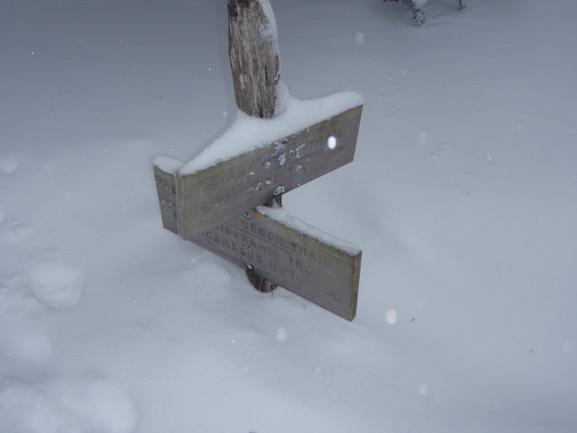
Pine Bend Brook Trail/Scaur Ridge Trail Junction - Roughly 3' Snow Pack

Another stop for some snacks and pictures (as Middle Tripyramid has the better views of the 2 peaks due to a couple small lookouts, though there was enough cloudiness that we really couldn't see much aside from occasional peeks), and we returned to North Tripyramid roughly 1 hour after we had left, crossing paths with a group of 3 and a dog (Bond the Black Lab) around the col between the peaks. We arrived to find MadRiver enjoying a hot drink, and after a while longer, we headed down.

This was the fun part. With the loose snowpack on the trail, we did some extensive snowshoe-skiing and butt-sliding down the steeper parts of the trail. At one point we had a continuous slide of possibly 1/4 mile coming down off the ridge into the valley. From there it was just a matter of hoofing it out the rest of the way, breaking out the headlamps about 1/4 mile from the road when visibility became just too dark.

It was a cold, windy at times, but wonderful winter hike. A good first entry into the 2012/2013 winter season for me. I was, however, rather tired from snowshoeing for the nearly 10 miles this hike encompasses, especially after not having worn them in over 9 months. In fact, I hardly wore the snowshoes last winter, like most other people. This winter seems to be off to a more normal start, which bodes well for the snow-dependent industries (mainly skiing). Thanks to Pam and MadRiver for a nice day out.

Summary:
Peaks: North Tripyramid (4180', NH4K), Middle Tripyramid (4140', NH4K)
Trails: Pine Bend Brook Trail, Mount Tripyramid Trail
Distance: 9.6 miles
Elevation Gain: 3500 feet