Pam, whom I last hiked with in Maine back in July, and I had been discussing either the Tripyramids or Passaconaway and Whiteface for this day, as both hikes were on our common list for this winter. Ultimately we decided on the Tripyramids and we had several others, mostly from Hike-NH, planning to join us. I say planning, since half bailed the day before the hike due to a snowstorm scheduled for most of the afternoon and evening the day before (and forecast to be heaviest in Southern NH and Massachusetts). I drove through the early parts of this storm on my way home from family, but the snow was forecast to end a couple hours before I would need to leave to head North so I was hopeful for the roads to be in decent shape. I left an hour earlier than I normally would for a meeting just off of I-93 on Route 49 in New Hampshire, and arrived all of 5 minutes earlier than I was supposed to be there. Roads weren't bad, just slow.
A second breakfast, and then the other 2 coming on this day arrived (in addition to Pam, MadRiver was coming on this hike). A quick discussion was had over route, and we scrapped the original plan to head in from the Waterville Valley side. Recent trip reports since heavy snow a couple days after Christmas all used the Pine Bend Brook Trail from the Kancamangus Highway to access these peaks, with no indication that the trails from the Waterville side were even broken out. With only 3 people, the chances of summitting were poor if we were to be breaking trail much of the way to the ridge, so the decision was easy to go with the shorter, known broken route.
As a result, we got started far later than planned, but off we went from the Pine Bend Brook Trail trailhead, where the parking is alongside the road in a generous-sized plowed pull-off area. There were several other cars already in line and empty, so we would not need to even break out the couple inches of snow that had fallen overnight.
Snowshoes on right from the road, we made good progress to the Wilderness Boundary, where the trail soon steepens significantly. Up to this point the only tricky things to contend with were the minor stream crossings which were steep-banked though not deep at all. As the trail begins to climb out of a valley and onto the sub-ridge it follows to the main ridge, I was reminded of how this section was this summer, as I was coming down from a traverse that started at Oliverian Brook Trail further down the Kanc and had topped Passaconaway, Whiteface, the Sleepers, and all 3 Tripyramids (only 2 count towards the 4000-footer list). I was not a fan, as in summer this trail in this section is essentially boulder-hopping a la Northern Presidentials, but below treeline. It was far from my favorite trail section, but now there was more than enough snow to bury all that unpleasant stuff.
MadRiver demanded that Pam and I continue ahead and go all the way to Middle Tripyramid, while he would take his time and stop at North Tripyramid (he has done these peaks in winter a couple of times apparently). After a while we relented and continued on, knowing that we'd be seeing him again on our way down in the worst case.
We ran into a couple small groups on their way down as we climbed, something like 7 total people and one dog (Kali), but for the most part it was a nice quiet day in the snow-covered woods. After reaching the ridge, we pressed on past the Scaur Trail which was our original ascent route (and was completely un-broken so a good call on final route choice), and eventually reached the main summit of North Tripyramid. A short stop for a couple pictures (discovering that my camera was rebelling against the 12-degree temperatures), and we were off for the short, roughly 1-mile jaunt over to Middle Tripyramid.
 |
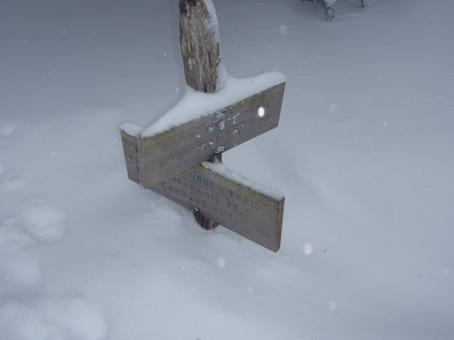
| Pine Bend Brook Trail/Scaur Ridge Trail Junction - Roughly 3' Snow Pack |
Another stop for some snacks and pictures (as Middle Tripyramid has the better views of the 2 peaks due to a couple small lookouts, though there was enough cloudiness that we really couldn't see much aside from occasional peeks), and we returned to North Tripyramid roughly 1 hour after we had left, crossing paths with a group of 3 and a dog (Bond the Black Lab) around the col between the peaks. We arrived to find MadRiver enjoying a hot drink, and after a while longer, we headed down.
This was the fun part. With the loose snowpack on the trail, we did some extensive snowshoe-skiing and butt-sliding down the steeper parts of the trail. At one point we had a continuous slide of possibly 1/4 mile coming down off the ridge into the valley. From there it was just a matter of hoofing it out the rest of the way, breaking out the headlamps about 1/4 mile from the road when visibility became just too dark.
It was a cold, windy at times, but wonderful winter hike. A good first entry into the 2012/2013 winter season for me. I was, however, rather tired from snowshoeing for the nearly 10 miles this hike encompasses, especially after not having worn them in over 9 months. In fact, I hardly wore the snowshoes last winter, like most other people. This winter seems to be off to a more normal start, which bodes well for the snow-dependent industries (mainly skiing). Thanks to Pam and MadRiver for a nice day out.
Summary:
Peaks: North Tripyramid (4180', NH4K), Middle Tripyramid (4140', NH4K)
Trails: Pine Bend Brook Trail, Mount Tripyramid Trail
Distance: 9.6 miles
Elevation Gain: 3500 feet


No comments:
Post a Comment