Route: Inner Basin Trail, Weatherford Trail
Mileage: ~10.5 miles
Elevation Gain: ~2900 feet
A day after a fun day
hiking to the highest point in Arizona, I stayed a bit lower (though not all that much lower it turned out). There is a network of other trails on Humphreys Peak besides the trail that goes to the summit, and one of them heads through the center of the caldera from the ancient volcano.From the summit the day before I could see tons and tons of green, rather unusual for a predominately desert state, and I was eager to see what was in there.
Heading up US 89 to a dirt road turn off across from the turn for Sunset Crater, I followed signs for Lockett Meadow, which is where the trailhead for the Inner Basin Trail is located. The last 3 miles are up a steep, narrow, winding mountain road with no guardrails and is a little rough and bumpy, but despite the sign saying it was not maintained for highway vehicles, I had zero trouble getting up there in my rental car (a sedan). This road is closed in winter and early Spring due to snow, but it was long open at this point of course. There are a large number of campsites scattered around the trailhead area (fee required), and it was a pretty nice looking area. There was no fee for day use parking.
In 2010, there was a massive fire in the lower elevations (the Schultz Fire) around Humphreys Peak, and it was barely stopped before it burned the Inner Basin. Along the first 1/4-mile or so of the trail, there was ample evidence that a fire had been in the area, and one area not far in was almost completely burned out, though the undergrowth had filled back in very nicely already.
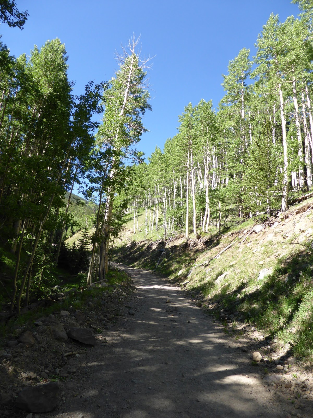
 |
| The start of the Inner Basin Trail |
 |
| An area burned almost completely out by the 2010 Schultz Fire |
In stark contrast to the Humphreys Trail but more like most Western Trails, this trail was gradual, had very few rocks sticking up in the trail, and offered some great walking. Pretty soon it entered some aspen glades, and switchbacked up through them for close to a mile. These woods were absolutely gorgeous, with the tall, straight trunks of the aspens towering high above and everything a bright shade of green aside from the trunks. It reminded me a lot of some of the extensive birch glades one finds in the White Mountains in New Hampshire, except a LOT bigger, and even more awesome! In many ways, this stretch was the highlight of the hike for me.


1.75 miles in, for the next 1/4-mile or so, the trail joins the Waterline Trail, which is really a gravel road that is closed to cars aside from Administrative vehicles. The Inner Basin provides a fair amount of the water supply for the town of Flagstaff, and the Waterline and Inner Basin Trails above this junction provide a way for servicing of the wells to occur. It did mean that I was essentially walking a road for a fair ways, but that was okay.
 |
| A well in the heart of the Inner Basin - in one of the large open fields visible from the summit of Humphreys Peak in fact. |
Well #9 (picture above) marked more or less the end of the "maintained" part of the road, though the trail continues up the old road bed a ways further. The fields here in the Inner Basin offered some cool views of the surrounding ridge (which of course is the old volcano's rim), along with more aspen fields. Continuing up past the fields, the trail re-entered the woods and began gradually climbing again.
 |
| The main ridge from the Inner Basin |
 |
| Agassiz Peak |
 |
| Fremont Peak |
 |
| The old road that the trail follows, deep into the Inner Basin |
 |
| There were lots of patches of snow still in the woods around 10,000 feet and up. |
When the old road ended, the trail swung left onto a more typical trail, and switchbacked its way up to its end, at the Weatherford Trail. This had been my goal for the day, but it was still early and I knew I wasn't too far from Doyle Saddle (11,370ft) so I headed up the Weatherford Trail to that saddle. This saddle is the one on the opposite side of Agassiz Peak from Humphreys Peak (if one is really ambitious, you can summit Humphreys Peak from here but I wasn't going that far). I was hoping for some good views from the saddle, but it was mostly treed-in, though the impressive bulk of the summit cone of Agassiz Peak, stretching 1000 feet above, is quite visible from the saddle.
 |
| Agassiz Peak from Doyle Saddle |
 |
| Officially camping is prohibited between Doyle and Fremont Saddles, but people clearly camp here anyway. |
 |
| Weatherford/Inner Basin junction |
I turned around here, though I had toyed with going another mile further up to the saddle where the Humphreys Trail comes in, as it was only a couple hundred more feet of climbing. But, with a couple of flights the next day, I didn't want to over-do it, so I headed down after a short break. The descent was easy. Also, unlike the ascent where I had seen only 2 people, I ran into many people just below the Inner Basin heading on their way into the Basin for exploring. Being a Friday and on what I assumed to be the quiet side of the mountain, I was a bit surprised, but I can also understand the attraction to the area. I would certainly go for a hike in there again!
 |
| Doyle (L) and Fremont (R) Peaks |
 |
| Aspen glade in the heart of the Inner Basin |
 |
| Of course I had to have one more Aspens shot! This was along the merged Waterline/Inner Basin Trails. |
 |
| This hike in red, the day before to Humpreys Peak in blue. |


No comments:
Post a Comment