With this in mind, Ian and I hatched a plan to nab all 7 of these peaks in a 3-day weekend. Ian had been sitting at 93/100 for a number of years now, with these 7 remaining but no motivation to go finish alone, and he had a pickup truck versus my low-clearance, not logging-road-friendly car, so it was a convenient arrangement for us both. Ultimately no one else was able to join us, but Ian, his dog Marlie, and I met early in the morning at Lincoln Woods to leave my car and head to Maine.
The Plan:
Saturday (7-12): Elephant Mountain, East Kennebago, and Cupsuptic Snow. Lots of driving, less than 10 miles of hiking.
Sunday (7-13): White Cap and North Kennebago Divide (a 2-peak hike), and Boundary Peak (from the US side at Cupsuptic Pond).
Monday (7-14): Snow (Chain of Ponds), then a long drive home.
Camping:
We stayed at the Cathedral Pines Campground, located off of Route 27 a few miles North of Stratton. The campground was clean, well-laid out, inexpensive, dog-friendly, nice fire pits, and the sites were all very large. We could have set up 4-5 3-person tents on our site without a problem, and that looked to be fairly common in the campground. On both nights we were there we arrived after the office closed (8PM), so we never got a keycard to the gate but the security person let us in both nights without issue. We ate at the site both nights, cooking/reheating simple meals.
Directions to peaks:
I've put most of the information in text form in this report, but there is also an interactive Google Map with the tracks of the driving and hiking routes that we took, and comments on each. In gathering information, Tim's (bikehikeskifish) report from a few years ago was very helpful, as were several other VFTT reports from recent years, and Peppersass's recent reports (only 2-3 weeks before our trip) for both Snows were invaluable (especially the Cup Snow one!). The AMC's NEHH packet of information was actually fairly helpful too, though mainly for the roads as it seems that their recommended routes differ from the typical routes folks use these days. The biggest mystery that the packet solved was the Lincoln Pond Road/Tim Pond Road game. Apparently they are the same road more or less, but the stretch East of Little Kennebago Lake is now usually called Tim Pond Road, and the West side Lincoln Pond Road. So thanks to all who post information on these peaks! In putting this report/information together, I shamelessly copied Tim's basic setup from his report, as I found the visual and all-in-one-place information quite helpful. A lot of the routes and roads are the same as his report in fact, not a whole lot has changed overall.
Roads:
The recent (2011?) Maine Delorme was extremely helpful, and was very accurate in its depiction of the main logging roads that we drove. We took both the Southern access via the Morton Cutoff and the usual Eastern access via Tim Pond Road to the peaks deep inside the logging territory. We had also read that the bridge off of Wiggle Brook Road near Bear Brook Road, crossing the Kennebago River to Kennebago River Road on the East side of the river, had been removed/broken/whatever. Imagine our surprise when we discovered late Saturday night, purely by accident (as we missed the turn down the Wiggle Brook Road to Tim Pond Road), that this bridge was in fact very much present, and it did not appear to be a new bridge either (it looked a couple years old at least). So, keep that in mind, it is now completely possible to drive a full circuit around the Little Kennebago Lake.
Most roads were in decent, but not tremendous shape, but with care now and then a low-clearance passenger car could make it to all the places we did. The main exception would be the road up East Kennebago as that had numerous washed out culverts and ditches that a low-clearance car would not like. Also, the last 1/2-mile up to Cupsuptic Pond was very overgrown and getting scratches on your car is pretty much assured, but you could definitely drive it if this didn't bother you.
There is active logging occurring, mostly along the E-W stretch of Wiggle Brook Road it appeared, though the trucks weren't running on the weekend. We saw several loaded trailers though in a couple places and plenty of evidence of recent cutting (particularly near Cupsuptic Snow).
Morton Cutoff: pretty good shape.
Lincoln Pond Road: decent shape, some bigger bumps here and there.
Wiggle Brook Road: bumpy but passable on the N-S stretch, recently graded on the E-W stretch from Oxbow Express to Kennebago River Road.
Kennebago River Road: recently graded, at least from Wiggle Brook Road to Tim Pond Road. It offered much faster travel than the parellel stretch of Wiggle Brook Road, so we used this access the rest of the weekend.
Tim Pond Road: decent shape, some bumps here and there as well as some boulders.
Bear Brook Road: Bumpy but passable up to about 1/4-mile from the normal logging landing parking spot. This stretch is covered in logging slash and while high-clearance cars could get up to the landing, we opted to just walk it as it was such a short stretch.
Oxbow Road/Cupsuptic Pond Road: decent shape up to the intersection ~1/2-mile from the pond, then very overgrown with 6" of standing water on one 200-foot stretch.
Elephant Mountain Road: bumpy but passable.
East Kennebago: a LOT of nailheads sticking up on the bridge at the start, but otherwise fine to the major split at 1 mile. After that, very bumpy and many somewhat deep ditches that low-clearance cars will not enjoy (not saying it isn't doable though).
North Road (COP Snow): pretty good shape.
For driving directions, and some hike directions, the interactive map below should be a big help:
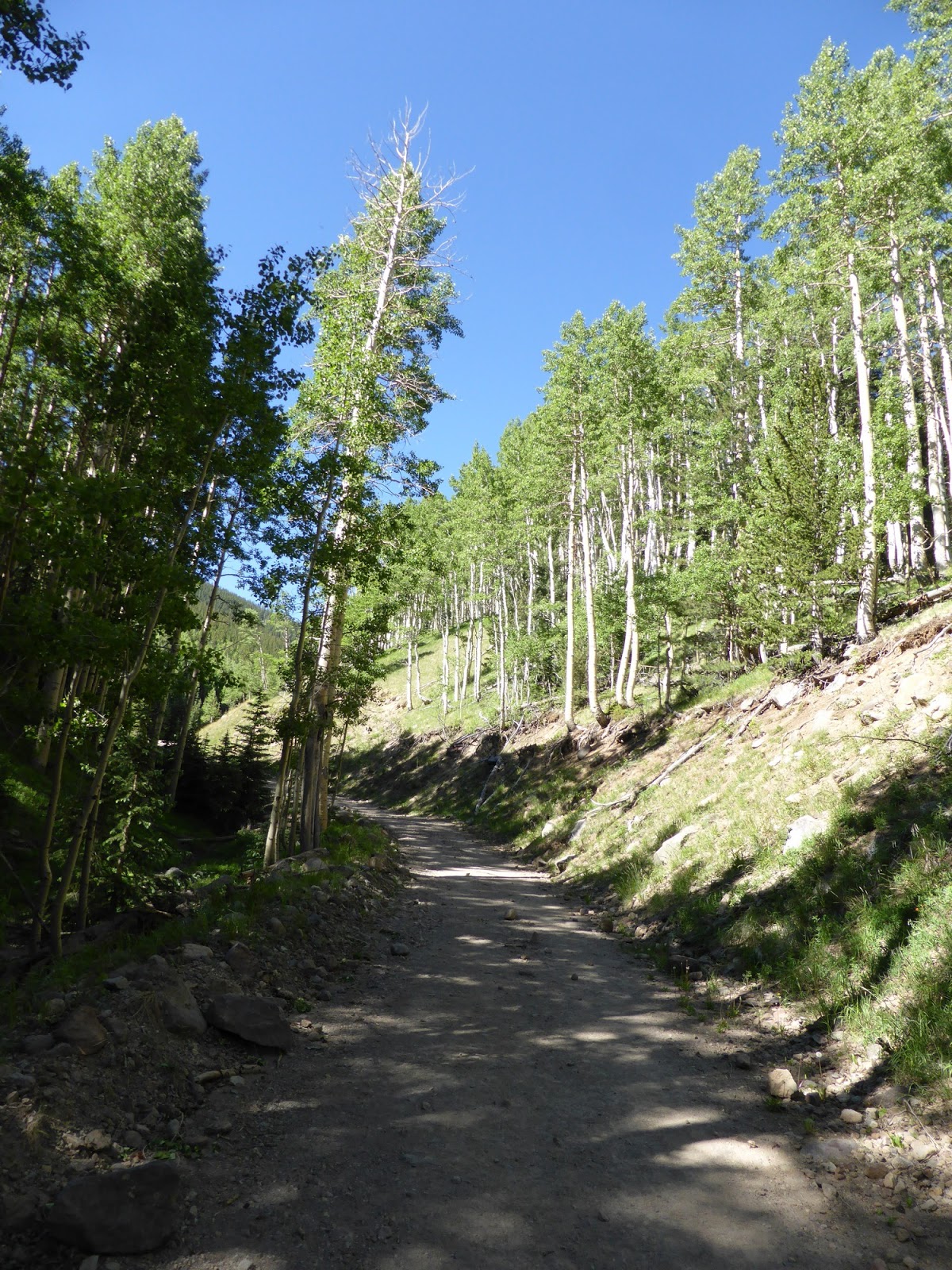
7-12-14, Hike 1: Elephant Mountain (~2.7 miles, 1175ft gain, 2.5 hours taken)
The drive in was simple enough. Following the main road from where we parked, we continued up past the usual skidder road (purely on accident mind you), and ended up several tenths of a mile past. We cut uphill there, at first along a rough, marked boundary cut of some sort, but this soon petered out and we bashed our way over to below the ledge of the upper ridge. From here we found a herd path or two that took us towards the ridge and then eventually along the ridge where we found the infamous blowdowns and scrappy woods. Near the summit the herd path became much more defined and mostly clear of blowdowns. We found the canister, signed in (the register had only a few empty pages left), and headed back out. We were able to mostly follow herd paths on the way down, with more open woods overall, favoring paths to the right usually, and we eventually found ourselves on the skidder road that we missed on the way up. Tough up, fairly easy down.
 |
| Elephant Mountain from the parking area. |
 |
| One of the few "open" areas we found on the way up. |

 |
| The right side of the loop was the ascent, the left the descent. |
Following the bumpy drive in to the usual parking area at the t-junction at 2500ft, we headed up the road for about 0.9 miles. Here we found the obvious boundary cut heading off to our left, and the yellow town boundary stake. One note: a short distance (<1/10 mile) before this boundary cut, there was a boundary cut coming in from the right marked by a couple cairns. Ignore this one! Following the narrow boundary cut uphill (blazed in faint yellow and sometimes blue paint) was easy as it is well-defined. A little before the height-of-land we saw 2 cairns and some herd paths heading uphill. We followed one, lost it briefly, then regained a better one a bit to our left and took it all the way to the canister. On the way back, the herd path led us to the boundary cut much closer to the height-of-land on the cut, and we passed the earlier cairns on the way down. A very easy in and out with hardly a tree touched, a nice change from Elephant in the morning.
 |
| Saddleback and Saddleback: The Horn from the logging landing by the East Kennebago parking area. |
 |
| Crockers, Redington, Spaulding, etc. |
 |
| The "yellow stake" in the woods to the right of the boundary cut towards East Kennebago. It appears to be a township boundary of some sort. |
 |
| The boundary cut heading towards East Kennebago. Note the faint yellow blazes. |
 |
| Marlie on East Kennebago |
 |
| This register was also nearing full. |

7-12-14, Hike 3: Cupsuptic Snow (~3.5 miles, 1250ft gain, 1hr 50min taken)
After getting slightly confused about the route that 2 different people took (we later figured out that one of them had gone up a skidder path from Wiggle Brook Road versus the logging landing), we set off on a grassy road from the logging landing. This road was initially pretty muddy and boggy, but soon dried up fine. After 1/3-mile, we took the left turn onto the first main logging road, and continued straight through the clearing/junction a few tenths of a mile later (a small cairn and a wooden arrow pointed the way). This road eventually bent to the left, passing over a few culverts along the way, and ended at a large clearing. Thanks to Peppersass's trip report, we knew to turn right and exit the clearing at the end over a small berm. We hung a left immediately after this (there was a small cairn or two in the logging slash in here) and headed uphill to a skidder road covered in logging slash which soon turned into a terrific herd path. This herd path led all the way to the summit with little navigational trouble except in a ferny area where we had to search for the pathway briefly. At the summit was a pretty new hand trowel on the ground under the canister. Heading back down, we stayed right at a couple different forks in the herd path, and soon were back at the clearing and then the car with about 30 minutes to dusk. Another easy up, easy down and a good day in the books.
 |
| Cupsuptic Snow from the clearing along the way. |
 |
| A trowel at the summit. Remember, 6" deep at least! |


7-13-14, Hike 1: White Cap and North Kennebago Divide (~4.75 miles, 1700ft gain, 3.5 hours taken)
Starting off from where we parked, we followed a main logging road which was covered in slash, staying on the right when it forked. It turns out that we missed the proper road thanks to the recent logging action, so for those coming later, just above the small landing that is the normal parking area, there is a grassy road heading straight while the logging slash-covered road swings slightly left. Take the grassy road! We ended up cutting up a drainage to get to the col area, then heading up towards White Cap where we met the grassy logging road near a small cairn. Following the road uphill, we took the herd path to the left at a larger cairn, and soon arrived at the summit. We returned to the lower cairn, and struck out directly towards the spine towards North Kennebago Divide, hitting the scratchy herd path shortly above the col. While it was an easy to follow path, many scratches resulted. Still, we reached the canister (a glass sauce jar), signed in, and briefly explored a herd path continuing along the ridge from the canister. We hoped it might drop down to a logging road, but it soon braided and faded, so we just turned back to the col (there was also another herd path at the summit heading more East which might have worked better but we had no concrete information about it and had another hike to do still). From the col we struck out slightly downhill towards the logging road we should have taken up to White Cap, hitting it about 200 feet below the col, and then followed it back to the truck.
 |
| Climbing up the logging slash (wrong road!) |


7-13-14, Hike 2: Boundary (Panther) Peak (~11.5 miles, 3200ft gain, 6 hours taken)
Since we were able to drive all the way to Cupsuptic Pond, we had chopped off about 1 mile from the expected hike, which was nice. Still, we knew we had a large 700+ foot PUD to climb in both directions. This hike, while long, was at least navigationally simple: follow the road to the boundary cut, hang a right, and follow it for 5+ miles. The last 1/4-mile from the pond to the boundary cut, however, was covered in many-limbed blowdowns, most of which required crawling underneath. If the next person through happens to bring a handsaw (none of the branches are big, just numerous), that would be awesome for those after you :). The boundary swath was interesting, especially seeing all of the hunting blinds and salt licks set up along the Canadian side, but we could also see the clouds building, and the bugs were nasty. In fact, we had to quickly break out the bug spray and I pulled out the head net, which I rarely do. Deer flies, black flies, and mosquitoes, they were all out in force! Marlie had fun chasing a couple of spruce grouse hanging out in the long grass of the swath.
Somewhere nearing the top of the main PUD that we started climbing right after hitting the swath, I wasn't feeling great. Food made it worse. But one foot in front of the other, and I was still moving so we kept at it, dropping steeply to a rather muddy area above Dennison Bog. Then the steep climb back up to the same elevation we just left, a few small PUDs after that, and as the rain was starting to fall somewhat steadily, we hit the summit. This was another quick sign in (no pictures this time as the camera was away due to the rain), though we did note that the canister's bottom had cracked and someone had attempted to tape it back in place. A new can is in order if no one has tended to it yet. The hike out was slightly faster, mostly due to the falling rain and the fact that we'd done 2/3 of the elevation already, the footing isn't great in a bunch of places on the boundary swath. The rain eventually ended as well, and we actually began to dry out, well above the knees at least (the long grass meant that our legs and boots were long since totally soaked through, squish squish!) Then we had to go through the carwash that was the blowdowns on the road back to Cupsuptic Pond. Soaked again! Still, we made good time on this one, especially considering how I was feeling most of the hike (luckily a good dinner and a good night's sleep cleared it up). I think we both agreed that were there to be a next time, we might look harder at the Canadian approach, but for simplicity this approach couldn't be beat.


 |
| Marlie looking for another spruce grouse |

 |
| One of the border monuments, which are spaced approximately every mile along the entire US-Canadian border. One of them was actually broken off just above the base, not sure what caused that as they are made of a fairly thick steel shell! |
 |
| Note that major, STEEP PUD! |
This was it, the final peak of the 7-peak, 6 hike, 3-day weekend, and the 100th New England Highest Peak for Ian! This one was supposed to be trailed/herd pathed all the way to the top, and we were looking forward to a "gimme" hike before the long drive home. We had good turn-by-turn directions, including a recent report, so we felt confident about this one. There were also supposed to be nice views from the top of the tower's ladder on the summit.
Starting out from the parking lot, we followed the ATV trail as it swung left over a bridge ~1/10 mile from the parking lot. The route to the top follows this road over a total of 3 bridges (the second is roughly a mile after the first), and then heads over a small berm past some large boulders where the main ATV trail swings left (yellow arrow sign here for the ATV trail). We followed the dry streambed behind the boulders (perhaps an old route of the road?) a short ways until a herd path diverged on the right into the woods, which led to a 4-way road intersection. Our directions had us go straight and then almost immediately take a right onto a short herd path to a logging road, but on the way down we found that taking a right turn at the 4-way intersection would put us onto the same logging road, with no distance or mud penalty and it avoids 2 more turns. The logging road soon climbed up a short steepish stretch, at the top of which a herd path left on the right at a small cairn (this turn could easily be missed). This herd path eventually led to the summit area and was well-defined and pretty clear of blowdowns (on the way down, bear left at a split shortly below the summit).
We hung out at the summit for a while, getting pictures from the top of the ladder, and enjoying a nice if hazy day. The register being in the bat box was a neat touch though it seems to be a less dry way of doing it (of course it was the driest of all the registers we saw on the weekend, so what do I know). With a long drive looming, we headed down after a nearly 40-minute stay. And with that, Ian was done with his New England 100 Highest at last! Congratulations again, and thanks for doing the driving all weekend! 3 more to go for myself.
 |
| The start of the ATV trail towards Snow, Chain of Ponds. |
 |
| The old warden's cabin |
 |
| Marlie watching Ian climb the tower |
 |
| The old cab of the fire tower in the woods next to the tower. |