After a fun but tiring day on the Baldfaces the day before, our group split ways for various goals. Pam, Mike, and I opted to head for a shorter hike on the way home, which ended up being Mount Chocorua. This was yet another 52-With-a-View peak, so I was excited to see the views from this summit that seemingly everyone I knew had been to, but I hadn't. There are a myriad of ways to summit this peak, but we opted to go with what we hoped would be the least icy option, or at least the least steep: the Champney Falls Trail from the Kancamagus Highway. This would be a "simple" out-and-back on this trail and then we would head home, getting back at a nice reasonable hour for once.
Owing to having to clean out the cabin and a variety of other chores, we didn't get an early start, but we were still on-trail by around 10. Right off the bat there is a water crossing at the site of an old bridge, which was easily rock-hopped thankfully. This trail started off gradually, and ice-free, but a short time before we reached the falls loop we had to put the traction on, which largely remained on until back to this spot again.
 |
| Part of Champney Falls |
 |
| Champney Falls |
We did take the falls loop, which re-connects back to the main trail in a few tenths of a mile. With the mid-fall water levels (low), but lack of abundant cold, the falls were neither flowing that impressively nor iced up nicely. Still, in the right conditions they look like they could be a nice sight. We also had a bit of a mini snow-squall blow overhead while we were ascending through this stretch, though it was short-lived and didn't leave much snow behind. So much for the sunny morning that was predicted!
 |
| Middle Sister |
 |
| Kearsarge North |
 |
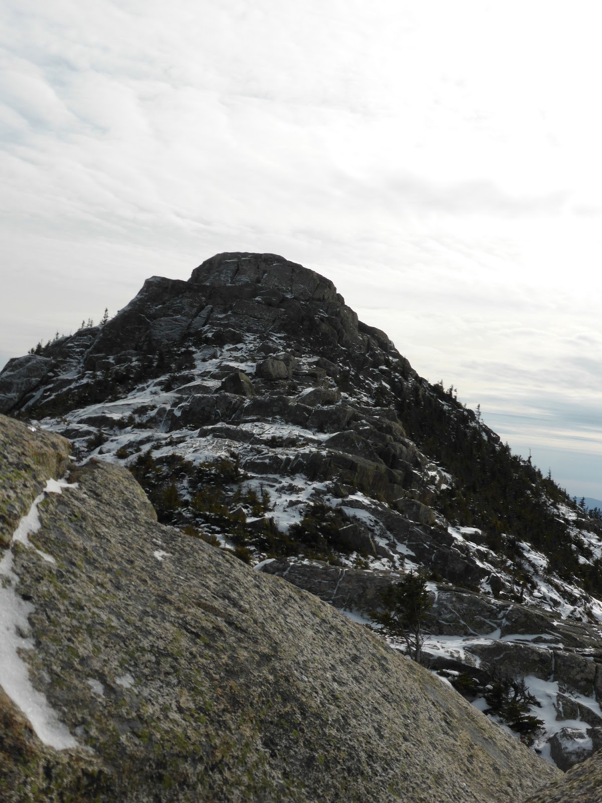
| Approaching the summit |
 |
| The Sandwich Range - Paugus in front, Passaconaway(R)/Whiteface(L) in back, Tripyramids and Sandwich Dome even further back. |
 |
| Passaconaway (R) and Whiteface (L) behind Paugus. |
While somewhat steep in places, this trail overall was relatively gradual, utilizing several (icy) switchbacks to gain the ridge. From there it was a series of intermittently icy and bare rock ledges to the summit. The skies had cleared some just as we got to treeline, and we were treated to a taste, though not the full picture, of what views can be had from this rocky summit.
 |
| The Chocorua Ridge |
 |
| Survey marker on the summit |
 |
| The Moats and Kearsarge North |
We found a spot down out of the wind to hang out for a short while, enjoying the views. But seeing clouds rolling in from the west and snow in the afternoon forecast, we headed down before too long to get a head-start on the drive home. Just as we got below treeline, the clouds socked things in pretty well, so it seems we hit the summit at exactly the right time for once! This is definitely a peak that I need to revisit on a nice day, and via some of the many other routes!
 |
| The Sisters from Chocorua |
 |
| Middle Sister's old firetower site |
 |
| Middle Sister's old firetower site |


No comments:
Post a Comment