Date of Hike: Jan. 2, 2015
Route: Bushwhack, Caribou Valley Road, Appalachian Trail, Bushwhack, Various logging roads
Peaks: South Crocker (4050', NE4K), North Crocker (4228', NE4K), Redington (4010', NE4K)
Mileage: ~16.4mi
Elevation Gain: 3900ft
Time Taken: 9hr 5min
On New Year's Day, a group of friends (see
Chris's report,
Tim's report) all headed to a rented cabin outside Stratton, ME. Our goal: peak-bagging some of the 10 4000-footers in the region over the weekend. Given solid snow conditions and recent (as in just a day or two before) information about the peaks surrounding the Caribou Valley Road, we opted to go for the long hike right out of the gate. Not needing to break trail (even those before us hadn't needed to really break trail due to rain and then freezing cold the previous week) made this a pretty easy decision!
On the way up, Tim and I scouted out the parking situation at the Sugarloaf Golf Course, looking for the golf cart bridge over the Carrabassett River that others had mentioned. We eventually found it at the bottom of a steep road next to the club house. Luckily Tim's car had 4-wheel drive! So, in the morning, we took Tim's car and Chris's Jeep to the bottom of the road, parking as out of the way as we could next to the pump house, strapped the snowshoes to the packs, and headed off across the bridge. Atop a small hill on the other side of the bridge is the tee box for the 11th hole, where after a few pictures, the 6 of us headed off into the woods. Our intent was to bushwhack through reportedly open woods to the Caribou Valley Road, hitting the road near mile marker 3, which would save us over 2 miles of walking the road in each direction. Ultimately, we came out a quarter mile or so below that point, but the 'whack was indeed through open woods, and was easy travel. From here it was a simple walk to the Appalachian Trail around mile marker 4.4, as the CVR and associated logging roads see a fair bit of snowmobile use in winter. We only saw 4 snowmobiles on our trek to the AT though.
 |
| At the 11th tee in the morning - clouded in at the moment |
 |
| Walking the Caribou Valley Road |
 |
| The sun behind Sugarloaf |
The trail up to the Crocker Cirque Campsite is fairly tame, and we were still able to progress in just microspikes. At the campsite though, with steep terrain ahead, we switched over to snowshoes and tackled the steep, seemingly relentless climb to the wooded summit of South Crocker. There was one open area where it took us a few minutes to find where the trail re-entered the woods, but otherwise navigation was fairly easy with the relatively low snow levels (2-3 feet). A fairly short mile away resided North Crocker, and so after a fairly quick shot out and back to that peak (crawling through a few blowdowns on the way), we found ourselves back at South Crocker, when we ran into the only other hiker we would see on these peaks on this day.
 |
| North Crocker across the cirque a bit above the campground |
 |
| Sugarloaf from the South Crocker viewpoint - much improved with a few feet of snow! |
 |
| Spaulding (L) and Abraham (R) from South Crocker |
 |
| Pano from South Crocker |
Now it was time for the second bushwhack of the day, the trek over to Redington. In summer there is a fairly well-defined herd path that leaves the viewpoint clearing on South Crocker, crosses the AT boundary cut, and continues down to a clearcut just below the col before climbing up a road and then a herd path, and then an ATV trail to the summit of Redington. With a couple of feet of snow on the ground, the herd path was naturally invisible, but both Tim and I had GPS tracks from our prior trips across the herd path. The woods were scratchy and the bushwhack was a bit obnoxious, but we had little navigational trouble; between the GPS track, occasional flagging, and the occasional visual look at our goal, it was fairly straight-forward.
 |
| In the clearcut on the bushwhack to Redington |
 |
| The Crockers from Redington (North on the left, South on the right) |
 |
| Redington summit clearing |
 |
| Redington from near Caribou Pond |
 |
| A peek at the back of Sugarloaf from the CVR |
 |
| Sugarloaf from the CVR |
Atop Redington, we signed in on the register (Redington used to be thought to be a few feet too short to be a 4000-footer and thus was on the New England 100-Highest List; it's elevation is now listed at 4000+ feet). With chilly weather and a good breeze, we didn't spend too much time on the summit, but headed back down the ATV trail, which was heavily grown-in with trees and frequent blowdowns. Instead of taking the bushwhack back to South Crocker, we opted to continue on the ATV trail down to the series of logging roads that lead to the Caribou Valley Road near the pond (mile marker 7). Once reaching the actual logging roads, we retired the snowshoes for the day. From there, it was an easy, albeit boring and seemingly endless, trek down the road to where we had exited the woods from the golf course in the morning. We got to the 11th tee just in time to see the last hints of daylight fade behind the Bigelow Range. It was a nice sunset, capping off a great hike bagging one of the harder New England 4000-footers to reach in winter (Redington)!
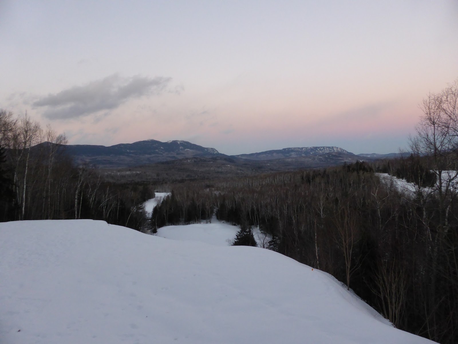
 |
| Sunset at the 11th tee overlooking the Bigelows |
 |
| Chris admires the view |


No comments:
Post a Comment