Route: Hancock Notch Trail, Cedar Brook Trail, Hancock Loop Trail
Peaks: Mount Hancock (4420', NH4K), South Hancock (4319', NH4K)
Mileage: 9.8 miles
Elevation Gain: 2700ft
Book Time: 6hr 15min (actual 5hr 20min)
After a day of mixed ground conditions the day before on Cabot, I was expecting more of the same on the Hancocks. A report from the day before had suggested the snow didn't really start until the Hancock Loop Trail, which if true would have made this an easier day. Gearing up for yet another solo trek out to these peaks though, I had my doubts. Sure enough, less than 1/4-mile of the way down the trail the snow started, and soon became a consistent, but not very tall monorail, so on went the microspikes. This worked well up to the Cedar Brook Trail junction. Cedar Brook Trail got severely damaged by Hurricane Irene in 2011, washing out entire portions of it. In fact, the whole 7/10-mile stretch that the usual trek to the Hancocks uses is very battered, eroded, and wet. It was made more "interesting" with the rotting Spring snow, and on 2 separate occasions I punched through the soft snow into shin-deep water underneath.
 |
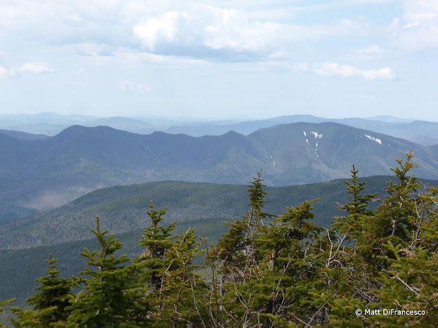
| The Osceolas and Scar Ridge from the Hancock Overlook, also the trailhead for this hike. |
 |
| The Osceolas from the parking lot. |
 |
| One of many water crossings on this hike. |
 |
| The Arrow Slide on North Hancock. Some day I'd love to climb this to the summit! |
 |
| Solid but high monorail (and another hiker's canine companion) approaching the Hancock Loop Trail split. |
The numerous crossings were also a little tricky with moderately high water levels, but I did manage to make it to the Hancock Loop Trail without too much overall trouble. Thankfully conditions improved dramatically once on the Hancock Loop Trail, with a fairly solid monorail up to the loop split. Here I opted to put the snowshoes on, knowing I'd likely want them soon anyway, and even if not the televators (heel lifts) would come in handy on the extremely steep ascent to the ridge. For some reason on every one of my prior 5 trips, and this one too, I've gone up the North peak first and down the South. Both sides are roughly equal in steepness, though the North link has a slightly steeper overall grade after the first 1/10-mile which descends 100 feet. Slow and steady is the rule to get up to the ridge on this hike, and as I did I noted that the snow was quickly increasing in depth. There was still 3 feet or so on the summit area and the ridge in fact!
 |
| South Hancock as seen from just below North Hancock |
 |
| South Hancock from North Hancock. See the white line heading straight down from the peak? Yes, that is the trail! |
 |
| Pano from North Hancock, with the Sandwich Range and South Hancock all visible. |
 |
| Moosilauke from North Hancock |
 |
| The Osceolas from North Hancock |
 |
| Passaconaway, Whiteface, and the Tripyramids (left to right) behind South Hancock. |
 |
| Mount Chocorua |
 |
| The trail-less Scar Ridge. |
 |
| Still a few feet of snow up here! |
After a short break at the North peak viewpoint, I crossed the ridge, where the snow was a little soft in places but overall pretty solid actually. The ridge hike, at least in this direction, is pretty easy, with a steady but not steep descent, then an ascent over a couple small knobs before reaching South Hancock. Shortly before the summit of South Hancock, the snow depth yielded some views back towards the North peak, and also over to Mount Carrigain, towering over the Sawyer River Valley to the Northeast. An interesting descent later, and a fairly easy trek out to the Cedar Brook Trail were next, where I retired the snowshoes and went back to the microspikes. Somehow managing to dodge the spots I got wet at in the morning, I made quick work of the exit hike.
 |
| South Hancock from the ridge on the way from North Hancock. |
 |
| North Hancock from near South Hancock |
 |
| Franconia Ridge |
 |
| Mount Carrigain from near South Hancock |
 |
| Another view of Carrigain from near South Hancock. |
 |
| Carrigain and the Sawyer River Valley from near South Hancock. |
 |
| Summit of South Hancock |
 |
| View from the South Hancock viewpoint. Someone has been (likely illegally) improving the view from here, it didn't used to be this open. |
 |
| Passaconaway from South Hancock's outlook. |
Despite it being early afternoon, it seemed most hikers in this area on this day were just getting going, as while I'd only seen 2 other people until the Cedar Brook Trail on my way out (plus a few more seen on North Hancock when I was on South Hancock), there was probably a dozen people in various pairs and trios heading in on the rapidly softening snow, none with snowshoes. Spring hiking 101: the snow is firmer in the morning, and might support you without snowshoes. In the afternoon, especially on a sunny day, all bets are off!
 |
| Arrow Slide on North Hancock during the descent from South Hancock. |
 |
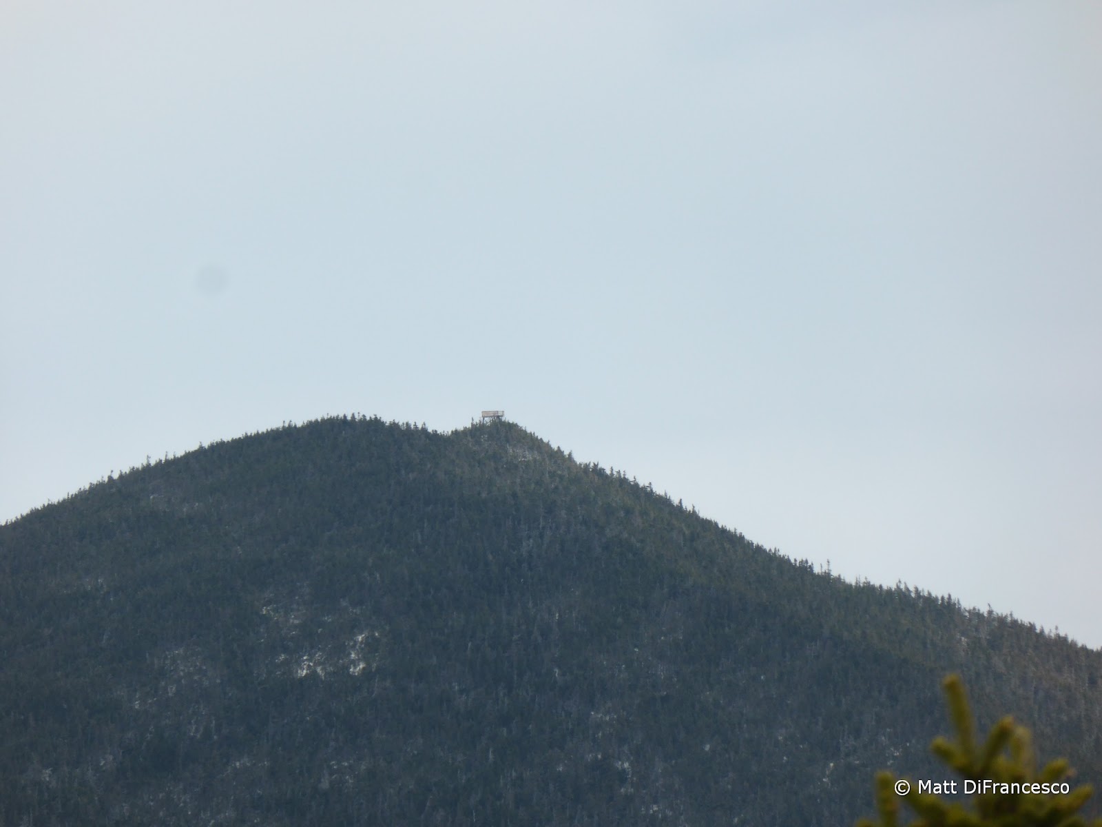
| Just visible, some hikers on the North Hancock viewpoint. |
 |
| Irene damage along the Hancock Notch Trail. |


No comments:
Post a Comment