Route: Glen Boulder Trail, Davis Path, Isolation Spur
Peaks: Slide Peak (4760', TW72), Isolation (4004', NH4K)
Mileage: 12.15 miles
Elevation Gain: 5300'
Book Time: 8hr 45min (actual 8hr 5min)
There are a couple ways to head to Mount Isolation, but none of them are short. The usual route involves about 14.5 miles of total hiking, heading up the Rocky Branch Trail from Route 16. This route has the least elevation gain, but involves a lot of walking along an always-wet, muddy, and rocky trail, and there are 5 stream crossings along the way that can be tricky. The other normal route to Mt. Isolation involves hiking up to just over 5000 feet before descending down to a little below 3000 feet for the final climb up to 4004 feet. This route does have the shortest mileage and best views, and it was the one I decided to do for the first time on this trip.
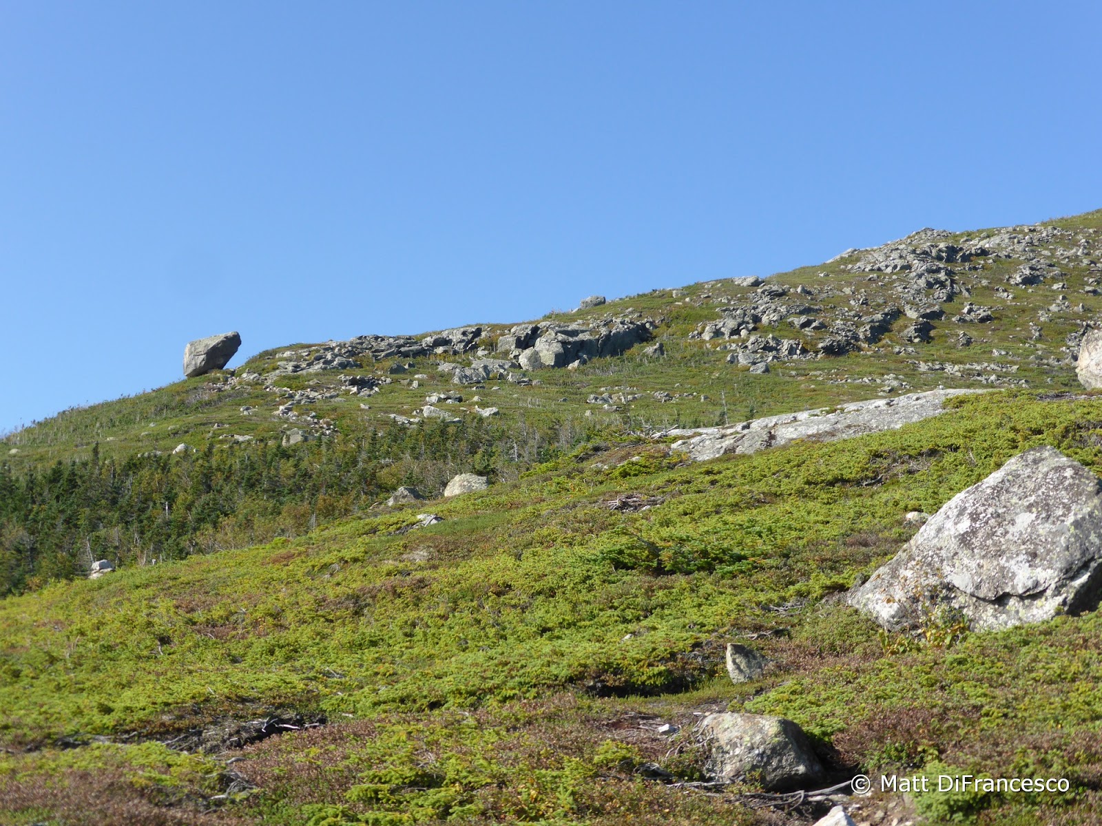
The Glen Boulder Trail doesn't mess around. It starts climbing almost immediately, steeply and rocky, before reaching treeline about 1.5 miles up, just below the namesake boulder. Glen Boulder is a giant glacial erratic seemingly precariously perched. It looks like it will tip over at the slightest bump, but it is actually very solidly there (for now). The views from here to treeline on the Davis Path are tremendous in all directions as it travels along the side of the Gulf of Slides, and I took numerous "views appreciation" breaks along the way. Thankfully, a little ways above Glen Boulder the trail grade eases up. It then enters the trees for a short ways, passing a signed Spring along the way, before re-emerging above the trees shortly before the cairn-topped peak known as Gulf (or Slide) Peak (on the Trailwrights 72 list).
 |
| Pinkham Notch from treeline on the Glen Boulder Trail |
 |
| Glen Boulder as viewed from treeline |
 |
| Glen Boulder. Several people could stand beneath it and be sheltered from rain, it's that big! |
 |
| Looking over to Boott Spur |
 |
| Spring along the Glen Boulder Trail above the boulder |
 |
| Summit of Slide Peak. Yes, it does not have a lot of prominence. |
 |
| Boott Spur from Slide Peak |
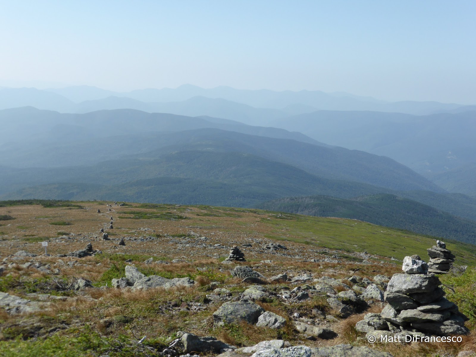
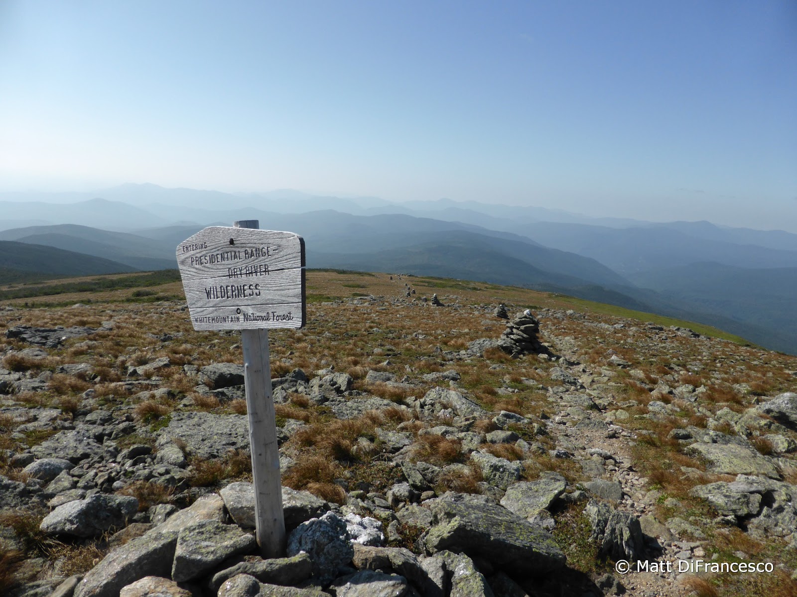
There is still several hundred feet of climbing, as the end of the Glen Boulder Trail, at the junction with the Davis Path, is around 5200 feet above sea level, but the final climb isn't terribly steep. From here, the Davis Path South runs above treeline for a short way, almost immediately entering the Dry River Wilderness, before dropping into the trees and steadilyu (but terribly steeply) descending down to below 4000 feet. Just before the first of 2 junctions with the Isolation Trail, the Davis Path climbs up to near the summit of "North Isolation", which is another Trailwrights 72 peak, but I didn't bother with the short bushwhack to the high point on this trip.
 |
| Davis Path/Glen Boulder Trail junction |
 |
| Follow the cairns. Isolation off in the haze dead center. |
 |
| Wilderness |
 |
| The remnants of Hurricane Sandy in 2012 made a mess in a few spots, including along the Davis Path North of Mt. Isolation |
Reaching the Isolation summit, it was time for a nice long break on the ledges near the summit. There were a number of people leaving just as I got there, and for most of my lengthy stay up top there were only 1-2 other people, and nice views and a light breeze to enjoy. Looking North, I could see the climb awaiting me, nearly 1500 feet of total elevation gain yet to go to get back to my car. So, eventually I tore myself away and set off on the trip back.
 |
| Monroe (L), Washington (C), Boott Spur (RC) and Slide Peak (R) from Mt. Isolation |
 |
| Washington and Boott Spur. The wooded peak in the center is "North Isolation". |
 |
| Wildcats and Carters |
 |
| Summit of Isolation |
The climb actually went fairly smoothly, despite it coming at the tail end of a lot of climbing on the second day of the weekend. The good footing and steady but not excessive grade had a lot to do with that, and in surprisingly decent time I was back up above treeline, and turning back onto the Glen Boulder Trail to head down. Descending the Glen Boulder Trail wasn't much easier than ascending it, at least once getting back to the steeps a little above the boulder. The worst part is a scramble right at treeline though, so once below that things eased up a little, and I did make reasonable time getting back to the car before heading home for the weekend. This is a tougher, but more rewarding route than the usual summer route, but I still prefer this mountain in winter, when one can snowshoe through the awesome birch glades on the side of Engine Hill. Still, it was nice to mix it up for my 6th trip to this mountain, and it was a terrific hike.
 |
| Eisenhower (C) and the Southern Presis from treeline on the Davis Path |
 |
| Looking back at Boott Spur from above Glen Boulder |


No comments:
Post a Comment