Wednesday, January 1, 2014

Breaking Out Mount Isolation - December 30, 2013

Once again this year I headed up to New Hampshire for a couple days of winter hiking ending one year and beginning a new one. On the day before this hike, most of the White Mountains received around a foot of new snow, which served to bury all of the ice that had been building up. Hopefully it will stay that way this time (lately it's been rain following the snow, causing more ice...). Mount Isolation was the only New Hampshire 4000-footer I had not summitted at least once in 2013, and it was also the only one I needed to finish a 3rd round. For about a month now (since Thanksgiving) I'd been trying to visit, but the weather and my schedule didn't want to cooperate. But this day the weather was for clearing skies, and the only thing standing in the way was that foot of snow! Snowshoes would naturally be the footwear of choice for this entire hike (and still will be for a while since the trail is not packed out).

A group of 5 in all met at the Rocky Branch trailhead off of Route 16 and began our trek: Whitney and Chris, who were part of the Flags on the 48 group I was a part of this year, Kyle (who I hiked Passaconaway and Whiteface with on New Year's Day 2013), and Denise, a friend of Chris and Whitney's who I'd not met before. It was clear from the start that this would be a tough day, but we were all determined to make it, and step by step, little by little, we did!


Newly-broken trail in our wake

Reaching the height-of-land on the Rocky Branch Trail, we hung a right at the usual start of the Engine Hill bushwhack. The normal winter route to Mount Isolation, this bushwhack saves over a mile (one-way), a couple hundred feet of climbing, and a couple stream crossings over taking the actual trails. This bushwhack also goes through what might just be the nicest, most open birch glade woods in all of New Hampshire!

Not sure what animal did this? Moose perhaps?

 Since we were the first ones up the trail since the snowstorm, we had to make our own route. Armed with the GPS track from my winter 2012 visit, and a few ideas on how to improve that route, we struck out, climbing gently a couple hundred feet to just over 3300 feet elevation. We had to bob downhill a short distance to skirt a thicker spot, but we regained the 3300 foot contour. The intent was to hold this elevation all the way into the Isolation Trail, which would avoid all but one stream crossing, but ultimately we ended up descending a bit and hit the trail a short distance before the 3rd crossing (of 5) on the Isolation Trail, in the vicinity of 3220 feet. Still, we traveled through 2 vast, open, and beautiful birch glades on this trek.

Chris taking pictures of the awesome Engine Hill birch glades
From there we had snow-bridged stream crossings, and followed the trails all the way to the summit spur. The final ascent is steep, and was tricky with the loose snow with ice underneath, but we made it up, into some very stiff wind gusts on the summit (we estimated the wind gusts to be somewhere in the 50mph range). Being 2PM, and it was also cold up top, we only stuck around for a couple minutes, long enough to get a couple summit pictures between wind gusts and to admire the beautiful view.

Kyle approaches the summit of Isolation

The Presis are hidden by clouds, but blue skies everywhere else

The Baldfaces

Kearsarge North

The Dry River Wilderness
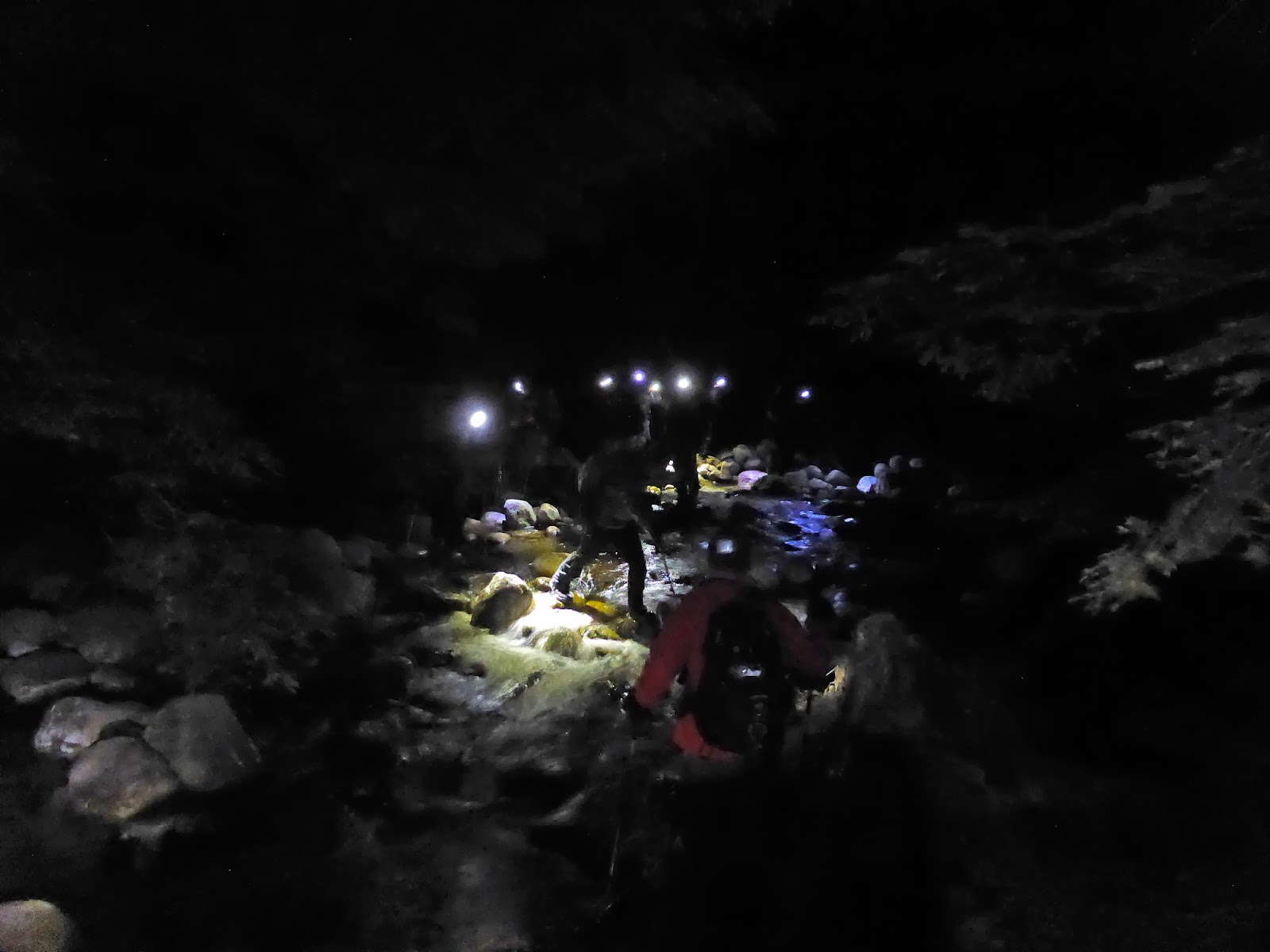
Then we reversed direction, which was dramatically easier now that all the trail-breaking was done! We caught the beginning of sunset over the mountains as we passed through the lower birch glade on the bushwhack, and less than an hour later we were under headlamps back to the trailhead. In just over half the time it took to ascend, we were back at the trailhead, all exhausted and totally spent, but it was an awesome day!

Sunset from the birch glades

Sunset over Stairs Mountain

Sunset from the birch glades of Engine Hill
For 3 people on this trip, it was their first winter visit to Mount Isolation, and they really earned it! Trailbreaking through that deep of a snowfall (which was a consistent 12", with many 2-foot drifts) is incredibly hard work, but the best part came the next evening when another group of fellow hikers went to Mount Isolation and thanked us profusely for breaking the trail out (one was even able to finally his Winter New Hampshire 4000-Footers that day!).

Thanks again Chris, Whitney, Denise, and Kyle for coming along and sharing in the trail-breaking fun. Hope to see you all out on the trails again! It was close, but I was able to do a full round of the New Hampshire 4000-Footers for the second year in a row, and this hike rates right near the top as one of my favorites!

Summary:
Route: Rocky Branch Trail, Engine Hill Bushwhack, Isolation Trail (East), Davis Path, Isolation Spur
Peaks: Isolation (4004, NH4K)
Mileage: ~13 miles
Elevation Gain: ~3200 feet
Book Time: ~8 hours (actual time of 9 hours)

Note the small PUD in the middle of the track, which was in the middle of the bushwhack. Oops!

Comparison of routes: Yellow is the actual trails, red is the 2012 route that was broken on my trip then, gray is the route we took on this trip.

A closer view of the Engine Hill bushwhacks I've taken on 2 winter visits to Isolation. Next time I'd like to keep the elevation at the end of the bushwhack and intersect the trail higher up. But, this was a great route anyway!

Sunday, December 15, 2013

Freezing on the Hancocks - Nov. 24, 2013

As the title suggests, this was a cold one. The weather all week long had been pointing towards this being a cold and windy day, so a sheltered hike was in order. The Hancocks are a good fit for such days, as 3/4 of the hike is down in the valleys with a short, steep climb up to the ridge, which is well-covered in trees. This hike was also one I was leading for the Northeast Peakbaggers Meetup group, a group I occasionally lead for (and it had been a while since I posted one). Coming along was Theresa, who I've hiked with a lot this year, and HossinNH even came out of a long no-hiking spell to join in on the fun. 2 other great folks I had never met before joined in as well, Jeff and Alexus, and so our merry band of 5 set off from the frigid Hancock overlook parking lot around 8:15.

The Hancocks provide a nice 2.5-mile flat warmup on old logging railroad beds (the Hancock Notch and Cedar Brook Trails mostly follow old railroads), and we moved right along to keep warm. The wind was virtually non-existent here as we were well-sheltered in a valley, and the 2 inches or so of snow that had fallen overnight was coating everything and looked magical as always. It's great to see winter coming, I'm ready for some winter hiking!

There are a number of stream crossings on this route, and just like the day before on the Downe's Brook Trail, there were ice-glazed rocks. However, the first couple of stream crossings offer plenty of rocks to hop on (and are far tamer than the Downe's Brook crossings), and we managed without trouble without adding the microspikes. Reaching the first major crossing on the Cedar Brook Trail (not the one right at the junction with the Hancock Notch Trail), we unanimously decided to take a herd path that bypasses that and the next crossing (only 1/10 mile later). This proved to be a good move as at the second crossing, when we intersected the trail, we saw offered little in the way of rocks to stand on.

The final couple crossings were fairly straight-forward too, and in decent time we were at the folk in the trail of the Hancock Loop Trail. Originally we intended to ascend the South peak first, a direction I have yet to do the loop in, but the wind seemed like it might be in our faces across the ridge if we did that, so we climbed the North link first. It is a steep route, but the trail was surprisingly ice-free, and we had little difficulty getting to the summit aside from the usual huffing and puffing from a really steep climb. We layered up just below the summit, and popped up to the sign were there were no views (as expected).

Hiking towards the Hancock Loop Trail split

A quick picture or two later, and we motored across the ridge to South Hancock. Nearing South Hancock, we were thrilled to see the terrific work done by trail crews this summer in installing a lot of wooden bog bridges through all of the massive mudpits that abound in this area. That will be really nice for those hiking in here throughout the non-snow season, as some of those mud pits were frequently multiple feet deep!

Winter Wonderland on South Hancock

At South Hancock, we all put on the microspikes for the descent, and found the temperature was a "balmy" 2 degrees above zero (and that's why there are only 2 pictures from this hike. My fingers didn't want to come out of the gloves)! Brrr, coldest day of the year so far! We also found that the wind was going to be a little bit in our faces for the first part of the descent, whereas we had hardly felt it at all crossing the ridge...can't win them all. We were all well-prepared for the conditions though, and made it down to the trail split again without any problems. The exit hike was basically a repeat of the entry hike, and in about 7 hours from when we left the cars, we were back. Maybe not the fastest day out on the Hancocks, but a very enjoyable hike with a great group, and we all stayed warm and comfortable all day. Most of us were headed West to Lincoln to get home, and had a quick bite at the Woodstock Inn (4000-footer IPAs!) before heading home.

Summary:
Route: Hancock Notch Trail, Cedar Brook Trail, Hancock Loop Trail
Peaks: North Hancock (4420', NH4K), South Hancock (4319', NH4K)
Mileage: 9.8 miles
Elevation Gain: 2700'
Book Time: 6hr 15min (actual 7hrs)


Tuesday, December 10, 2013

Another NEHH Finish - Tripyramids and Sleepers, Nov. 23, 2013

As the end of the year drew closer, there were 3 4000-footers in New Hampshire that I had yet to hike in 2013. The Tripyramids (North and Middle) were 2 of those (I had hiked them on Dec. 30, 2012) and so when I was invited along on a hike including those 2 peaks, I jumped at the opportunity. This hike was also going to include East (and West) Sleeper, which is a peak on the New England 100 Highest List. I had previously visited this trailed, but viewless, peak, however, East Sleeper was to be the final peak on the list for Scott Disnard, and so for my second trip in a row I'd be present at someone's finishing peak.

Our large group met in the morning at the trailhead for the Downe's Brook Trail, where we left a couple cars there and headed over to the Pine Bend Brook Trailhead. We made good time up to the top of the ridge, where a couple of us spent a few minutes clearing out a blowdown mess that obscured the trail while the rest of the group caught up a couple minutes later. From there it was time for the occasionally tricky (especially with hidden ice here and there - some folks put on microspikes here because of it) climb to North Tripyramid. This was my 4th time on the summit, but I believe the first where I actually went to the NorthEast viewpoint near the summit area.

A quick break down low

Doing some blowdown maintenance

Before we did this, there was a wall of spruce here!

The final steep climb to North Tripyramid

Mount Carrigain from near the summit of North Tripyramid

Nice view from the NorthEast viewpoint on North Tripyramid

The Eastern end of the Sandwich Range towards Mount Chocorua

Mount Chocorua from North Tripyramid


A short break later, and it was time for the jaunt over to Middle Tripyramid, where we stopped long enough to snap a couple pictures and immediately head off to South Tripyramid, a short distance away (it does not have enough prominence from Middle Tripyramid to count on the 4000-footer list). There we descended a short distance on the South Slide, before dodging into the woods onto the Kate Sleeper Trail. (Note: this trail turnoff is very easy to miss. The sign is small and on the opposite edge of the woods from the normal route down the slide and it is not hard to pass right on by it!)

Waterville Valley - Mount Tecumseh (L) and the Osceolas (Main and East peaks L->R)

Passaconaway (the pointy one on the right-center) and Whiteface (far R)

The double-peaked top of Sandwich Dome, another New England 100-Highest Peak (3980')

Descending the South Slide (carefully!)

Last peak at Mount Tecumseh from the Kate Sleeper Trail
The Kate Sleeper Trail, after briefly cutting into the woods alongside the main South Tripyramid slide, then drops 100 feet or so down a parallel slide before entering the woods for good. From there, the Kate Sleeper Trail is a pleasant walk in the woods, with gentle grades. It soon climbs to just a few yards from the summit of West Sleeper (unmarked, but a few herd paths meander over to a clearing where the likely summit is) and then drops before climbing up to the spur trail to East Sleeper. A short jaunt on the spur trail, and we were at the summit (marked by a sign). A couple people had brought up champagne, beer, cookies, cheese and crackers, and so we had a nice mini celebration.

Easy walking on the Kate Sleeper Trail

A blowdown blocked the spur trail to East Sleeper...

Scott on East Sleeper

Celebration time! Congrats Scott!

The whole group on East Sleeper
After packing everything up, we headed off for the final ~6 mile leg of the hike. The first mile took us through a stretch of forest that was completely leveled by Hurricane Sandy in 2012. Essentially the whole section of woods was knocked over on its side, and a huge amount of work was done by volunteers and various trail maintenance groups to clear it again, all with hand tools only (it is in a Wilderness Zone, so power tools are not permitted). Thanks again to everyone that worked on this stretch so we can enjoy it!


What a mess this must have been!

A whole section of woods alongside the trail on its side


But thanks to the effort of many, only a few inconsequential blowdowns were on the trail, and we were able to get through without any trouble. Then we just had the long descent on the Downe's Brook Trail. The first part of this trail is harmless enough, if a bit rough underfoot in places. But about halfway down, the stream crossings pick up in earnest, and we also ran out of daylight. The crossings (of which there are 10 major ones) were wide, fast, and littered with ice-glazed rocks. There also weren't many options for crossing locations, and it took a while to get the whole group across each one safely, especially with the last 6-7 coming after dark. In fact, someone did slip into the water, but luckily on the lat crossing which is just over 1/4-mile from the parking lot, and so we were able to get him to a warm car quickly. It took us over 3.5 hours to pick our way down the 5 miles of this trail!

The one picture taken during the descent - and assisted in Photoshop a little. Crossing one of the wide crossings of Downe's Brook (the group was all at least half-way across).

 Once again, a hearty congratulations to Scott for finishing the New England 100-Highest list!

Summary:
Route: Pine Bend Brook Trail, Mount Tripyramid Trail, Kate Sleeper Trail, East Sleeper Spur, Downe's Brook Trail
Peaks: North Tripyramid (4180', NH4K), Middle Tripyramid (4140', NH4K), South Tripyramid (4090', TW72), West Sleeper (3881'), East Sleeper (3860', NEHH)
Mileage: 13.25 miles
Elevation Gain: 4000'
Book Time: 8hr 40min (actual 11 hours)


Saturday, December 7, 2013

Bushwhack to Peak Above the Nubble - November 10, 2013

It turned out this weekend was going to be bushwhack weekend, which was OK for me because that's mostly what I have left on the New England 100 Highest list. Pam, Trey, and Philip stuck around overnight and the four of us tackled this peak on Sunday before heading home (we all needed it for our New England 100 Highest Lists). Peak Above the Nubble is the unofficial name for this peak, which is merely denoted " 3813' " on topo maps. The unofficial name, though, comes from the fact that it lies on the ridgeline above a small but prominent peak called "The Nubble" (or sometimes "Haystack Mountain") in the town of Twin Mountain, on the side of North Twin Mountain.

There is no trail to this mountain, but 2 routes have evolved over time for peak baggers heading to this peak. One route heads up on some old logging roads and a herd path from the Gale River Road extension to The Nubble before bushwhacking to a slide that heads up to near the summit of Peak Above the Nubble (aka "PAtN", pronounced "patton" like the famous US general). This was initially our intended route as it promised some great views along the way, but it snowed overnight and we were concerned about ice on the slide as well. Thus, we took the alternate, and more common, route from Haystack Road.

We started by hiking along Forest Road 304A, which departs Haystack Road about 1.75 miles in from Route 3 and has 3 large boulders blocking its start (room for parking a couple cars if you park each other in). About 1/4 mile in, we hung a right just past a large hill sitting on the left onto an obscure logging road running up a minor ridge. The road was not terribly obvious at its start, and in fact we walked ~10-15 minutes past it before we realized we missed it, and we went back looking harder. Once on it though, the road is easy enough to follow into an old logging clear-cut, which is now overgrown with tons of saplings, but with all the other undergrowth mainly dead, it wasn't too bad to push through (and in fact someone has hacked a few saplings here and there to form a rough herd path through the clearing). I wouldn't want to go through here in summer though, I'd probably opt to skirt the clearing instead.

Heading off on Forest Road 304A

Old birds nest along the old logging road

Near the top of the overgrown clearcut, looking Northward
From the upper end of the clearcut, we took a visual bearing to the slight col dead ahead (a false summit of PAtN was visible to the left, and a minor bump to the right - see the map at the end of this report for a visual aid) and climbed a couple hundred feet through mostly open woods (once leaving the fringes of the clearing) to the col. From there, we merely followed the ridgeline up, skirting a few thick spots, but largely finding easy woods up to the false summit 1/4 mile or so from the summit of PAtN. From there, an obvious (and apparently cut) herd path leads to the summit of PAtN, though there was a small ring of blowdowns to climb over near the summit.

Climbing through open woods up the ridgeline to PAtN

Still mostly open woods

Ice forming on the large rocks in the woods

On the herd path along the upper ridge to PAtN
The weather on this day was slightly threatening, though it was mostly clear below 4000 feet. The temperature was hovering around freezing all day, which led to wet snow and we actually donned the rain gear to push through some of the snow-covered trees in order to stay dry. I also found that my winter boots need to be waterproofed again, they soaked through after a few hours of hanging out in slushy snow.

The summit of PAtN offers a terrific viewpoint on a short herd path nearby; none of us expected this kind of view from a bushwhack summit!

Philip and Trey at the overlook near the summit of PAtN

The Presidentials in the clouds

A LONG, large, steep slide heading up North Twin Mountain. I believe this is the one known as the "checkmark slide".

Hale (L) and North Twin (Rish) from Peak Above the Nubble

Eisenhower briefly emerged from the clouds

Pano from PAtN

Us on Peak Above the Nubble (yes, a blowdown right by the summit.)
Heading down was easy and much quicker, as we merely followed our footprints until about halfway down to the initial col we had climbed to (where the snow had melted away), from which point we kept heading to the col until we reached where we had come up in the morning (we could see the clearcut too) and from there it was easy to return. Just as we loaded up into the cars, it started lightly raining, nice timing!

This was a surprisingly nice, and pretty easy bushwhack/hike. Having all the leaves on the ground and the various undergrowth all dead made for easy navigation (we could see our destinations most of the day), and the woods were pretty open until the upper ridge (where there is the herd path). That said, I (and I think the rest of the group) want to return (yes, return to a bushwhack!), but this time taking the other side up the slide. Maybe next summer?

This was peak #85 on the New England 100 Highest List for me. 1 remains in New Hampshire (Scar Ridge - a bushwhack), 3 in Vermont (all 1/2-day trailed hikes), and the remaining 11 in Maine, 7 of which are bushwhacks. I hope to finish these off by the end of 2014!

NOTE: The herd path we followed along the ridge top comes up from the valley nearer the North Twin Trailhead (I think it leaves FR304A about a mile from Haystack Road and ascends PAtN from the E). The entire route was cut by someone without permission (it is National Forest land) and it widely felt to be a major erosion hazard as it ascends to the false summit of PAtN. The AMC 4000-Footer committee requests that people do not use that route to ascend to the ridge so as to avoid causing environmental damage. The route we took did not use this herd path to ascend to the ridge, though we did use the portion from the false summit to PAtN (really there is no other option save pushing through dense spruce), which is not really an erosion risk. The worst part of our route honestly was the short stretch getting through the clearcut. You can see from the pictures above that the woods up to near the false summit are nice and open anyway, and it was an easy route that I'd have no qualms about doing exactly the same again.

Summary:
Route: FR 304A, unknown logging road, bushwhack, herd path
Peaks: Peak Above the Nubble (PAtN) (3813', NEHH)
Mileage: ~4.5 miles (estimated)
Elevation Gain: ~2100'
Time Taken: 5hr 45min (we lost ~30 minutes when we missed the second logging road on the way in)