Owl's Head. Possibly the most dreaded peak on the New Hampshire 4000-footer list. The only one without an official, maintained trail to its summit. The mountain itself is a mere 4025 feet tall. And there is an un-official, semi-official herd path to the summit that isn't harder to follow than many other maintained trails. But to dayhike this peak still requires an 8-mile approach hike to the base of the Owl's Head Path (the aforementioned "unofficial trail"), followed by a steep climb up a slide and then steep woods. A roughly 18.5 mile round trip, with several large water crossings that are often tricky, even accounting for wading across. The saving grace is that the hike has less than 3000 feet of total elevation gain, as the approach is mostly along old railroad grades. At the same time this can get monotonous.
However, Owl's Head is merely long, not particularly tough all said. And it was time to visit the Owl. The only other time I'd hiked this mountain was as a day hike from 13 Falls Campsite, which wasn't bad aside from the Lincoln Brook Trail between 13 Falls and the Owl's Head Path being tough to follow in a few spots. The lower half of this trail was supposed to be fine.
A few weeks before
Flags on the 48, I invited fellow Hike-NHer HossInNH along, as he'd been wanting to tackle it before he got too far into the 4000-footers (saving all the goodies for last!). He and I had met on the trails inadvertently a couple of times over the summer. He also participated in our group's 9-11 hike. He agreed (he'd wanted company for this, and not too many people hurry to the Owl!), though it would be his first back-to-back weekend that I'm aware of. And 2 tougher ones at that.
As there was heavy rain the night before the hike (roughly 1.5" fell between our finish of the Twins hike and about 4AM), I thought we would be better hiking via Black Pond and a roughly 1 mile bushwhack through what was supposed to be open woods to the Lincoln Brook Trail. This in fact would cut off about 1 mile each way and avoid what is normally the worst 2 river crossings. Hoss agreed, and we were off. We made good time to the end of the Black Pond Trail, which just sort of ends at its namesake, Black Pond, which has a nice view towards the Bonds.
 |
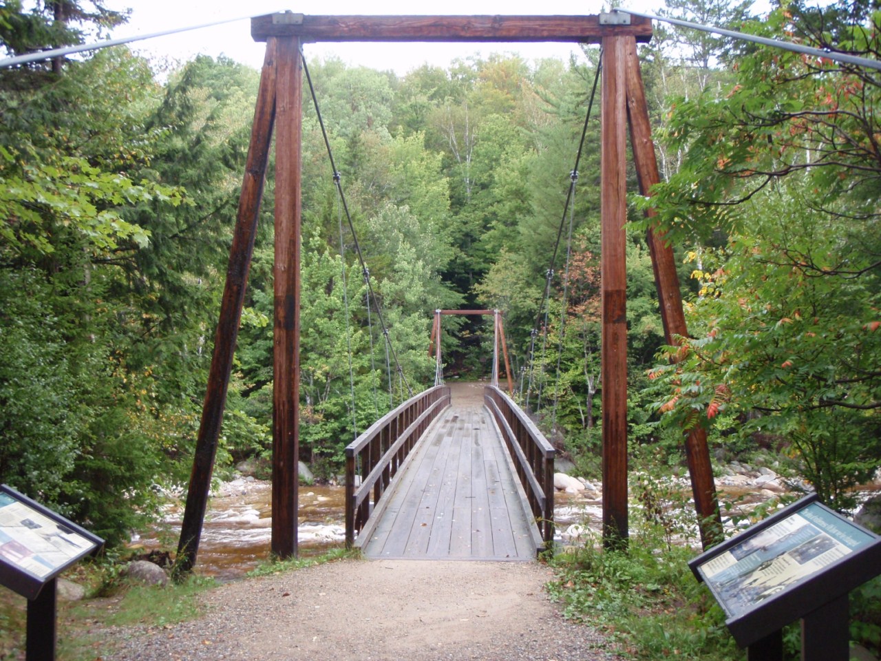
| Bridge at the Lincoln Woods area to begin the hike |
 |
| Irene washout on the Lincoln Woods Trail |
 |
| The Bonds over Black Pond |
Then for the bushwhack. I had many trail reports to work from, as this is the normal route in winter and whenever water is high. Most indicated gaining a few hundred feet of elevation would avoid the boggy areas, and a compass bearing of roughly 340 magnetic would take you through the birch woods versus spruce and co. Well, here was snafu #1 for the day. My compass didn't seem to want to point anywhere near North. We knew from the trail, Black Pond, and a few other landmarks roughly which way was North and it wasn't what my compass was pointing to. Guess that needs fixing. But the nice thing about this bushwhack is that you can more or less pick your own line North and slightly westward, and you will hit the Lincoln Brook Trail (or at least the river, which the trail follows and crosses a few times).
Off we headed, scrambling up a bank near the pond and meandering our way NorthWest, somewhat following a couple tracks I traced from Google Earth into my GPS. We did a lot of sidehilling early, which wasn't pleasant for my bum knee (the one that had been bothering me since before Baxter State Park) or Hoss either. So we gained more elevation earlier than intended, to about 2000 feet, where we hit some better woods too. We kept this elevation for a while, slowly making our way through a few patches of thicker spruce and undergrowth. Eventually we started to drop some of the elevation in favor of better woods, and after way too long, we popped out onto the Lincoln Brook Trail, about 100 feet past the second stream crossing we were trying to avoid (yeay!). We were slow through the bushwhack, taking roughly 1.5 hours. We didn't quite follow the line envisioned, but it did do the job. We decided to give the main trails a go all the way back after summitting.
 |
| Fungus on a log on the Black Pond Bushwhack |
The Lincoln Brook Trail from here was straight-forward enough. A couple more stream crossings, the last of which we waded. The cold water felt wonderful on the feet. A quick dry-off and re-application of boots and we were at the base of the slide in short order.
 |
| Start of the Owl's Head Path |
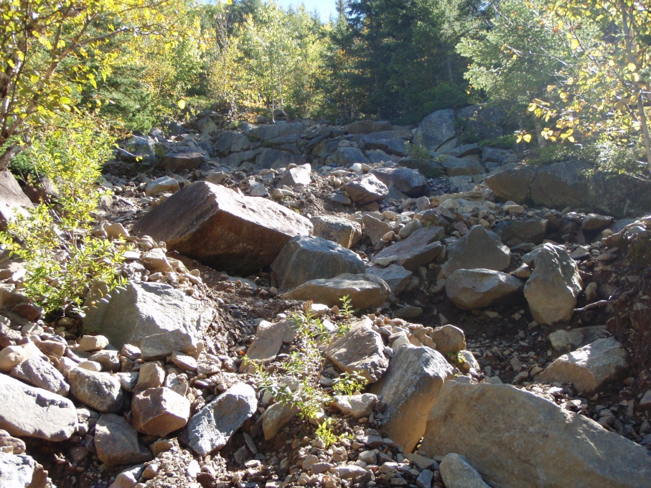
The carin marking the herd path is sometimes not there, but it was on this day, and it seems for the most part it is being left (Wilderness Regulations technically prohibit marking of unofficial trails). The path quickly opens up onto the gravelly slide, which ascends 700 feet in 3/10 of a mile, before entering the woods and continuing at a steep rate until the ridge is reached. On this day the sky was nearly perfectly clear, and there was a slight chill in the air, the first real fall-like day of the year (fall hiking is wonderful!). The views of the back of Franconia Ridge from the slide are tremendous, and really the only views to be had on this hike.
 |
| Heading up the Owl's Head Path, which goes up a rock slide |
 |
| Lincoln, Lafayette |
 |
| Lincoln |
 |
| Northward up the valley |
 |
| No trickery here, it IS that steep! |
It reaches the ridge, then levels out, and soon reaches the "old" summit of Owl's Head, which was the recognized one at the time of my previous visit in 2003.
 |
| At the "old" summit - follow the arrow! |
 |
| Remnants of old signage at the "old" summit |
 |
| The "new" summit |
At the old summit, a couple of beaten herd paths lead to the new, slightly higher summit, marked by a large carin. We followed the most beaten-looking paths to the summit, but there were several others, and we briefly got off-track on the way back, but not long. We headed down to the slide to get a snack at the views.
 |
| Liberty from Owl's Head slide |
 |
| Franconia Ridge |
 |
| We still have to get down there! |
We eventually made our way down, returning to the Lincoln Brook Trail just over 3 hours from leaving it. We were slow up the steep climb, and not much faster down, though my knee contributed to the delays coming down. Probably not a great idea to hike 18.5 miles into the middle of the Wilderness on a very sore knee...but it was fine on the flats so all was good.
 |
| Arrow carved in a tree marking the start of the Owl's Head Path |
We ran into a dozen or so people on the mountain on our way down, and we spoke to several who said that the main trail stream crossings were fine, though one or two would need wading. No problem, our feet were looking forward to it. We made our way back to Lincoln Woods with no incidents, wading both of the lower crossings on the Lincoln Brook Trail (as well as the one near the Owl's Head Path as before), but rock-hopping everything else. The lower 2 crossings on the Lincoln Brook Trail are less than 1/2 mile apart, so I kept my water shoes on and just walked in those to the second one, which was a great change from my boots. It took 11 hours, well over the 8-9 I was figuring on, but we got it done! Slow time on the bushwhack and on the herd path contributed. #45 of 2012 for me, and #18 for Hoss. Congrats dude!
 |
| Second-lowest crossing on Lincoln Brook Trail |
 |
| Current was pretty strong here, aside from this spot we could have rock-hopped |
 |
| Remnant from a railroad bridge? At the lower Lincoln Brook Trail crossing |
 |
| Lower stream crossing on Lincoln Brook Trail |
 |
| Random pink rock in the stream |
 |
| Hoss comes across the last crossing |
 |
| Old railroad path |
 |
| Wilderness boundary - 3 miles to the cars! |
 |
| Crossing onto the Lincoln Woods Trail, 3 miles to go |
 |
| The big bump in the middle is Owl's Head up and down the herd path... |
 |
| Trails are the upper loop, stretch from the pond North on the lower loop was the bushwhack |
It is long, but actually not that bad. 18.5 miles by trail, about 18 the way we went. I would not take the Black Pond 'whack again unless there was good snow coverage, or the streams were known to be dangerously high. We were about 30 minutes slower via the bushwhack despite 1/2-3/4 miles shorter.
Summary:
Peaks: Owl's Head Mountain (4025', NH4K)
Trails: Lincoln Woods Trail, Black Pond Trail, bushwhack, Lincoln Brook Trail, Owl's Head Path, Lincoln Brook Trail, Franconia Brook Trail, Lincoln Woods Trail
Mileage: 18 miles
Elevation Gain: 3200 feet
Time: 11 hours


No comments:
Post a Comment