Date of Hike: August 23, 2014
Route: Lonesome Lake Trail, Dodge Cutoff, Hi-Cannon Trail, Kinsman Ridge Trail, Fishin' Jimmy Trail
Peaks: Cannon (4100', NH4K), NorthEast Cannonball (3769', NEHH), North Kinsman (4293', NH4K), South Kinsman (4358', NH4K)
Mileage: 12.9 miles
Elevation Gain: 4900ft
Book Time: 9hr
Cannon Mountain and I have a bit of history. I'd hiked the mountain 3 times before this hike, and also taken the tram up once years back on a family vacation, and I've yet to get much of a view from the summit. Of the 3 hikes specifically, I've been up there in the rain, while it was snowing, and while it was trying to snow (it never did that day). Only once did I even see the tram building from the summit (which is maybe 150 feet away or so). And I've managed to hurt myself on every hike there too. Long story short, Cannon and I haven't had a great time over the years and I was anxious to finally get some views off this mountain, which is supposed to have great views in fact. I also wanted to do the Kinsmans and Cannonballs with Cannon, since my father and I had chickened out of doing all 3 in one day years back and I've never gotten around to doing all 3 since.
So, the plan was set, and I was solo on this one due to my inability to make hike decisions more than a couple days out. Right off the bat I changed plans and decided to take the Lonesome Lake Trail all the way to the lake and then take the Dodge Cutoff over to the Hi-Cannon Trail instead of taking the Hi-Cannon Trail from the bottom as the usual loop would go. Shameless red-lining, yup! It turned out just as well as the sign for the Hi-Cannon Trail off the bottom of the Lonesome Lake Trail was missing and I never saw the trail until the end of the day on the way down. A couple of quick pictures at the lake were in order, especially since blue skies seemed to be dominating. Dodge Cutoff was actually a nice trail in some ways, as it was fairly level and had softer footing than the usual rocky and eroded trails that are prevalent in Franconia Notch, but the start was tricky to determine as there were herd paths all over the place at its start, and not a blaze to be seen. Still, once finding the right route it was a quick trek over to the Hi-Cannon Trail.
 |
| North Kinsman over Lonesome Lake |
 |
| Lonesome Lake Hut and its small beach area dead center below North Kinsman |
The Hi-Cannon Trail is infamous for one reason: a ladder section near the top. The one time I did this trail (last Spring), we didn't even realize we were on the ladder until halfway up due to all the snow present that day. Today, I got a good look at the ladder, which seemed a little sketchy in how it was secured, but it was solid enough on the way up. There are some nice views across Franconia Notch from the top of the ladder, and I could see that it was shaping up to be a pretty nice day, albeit a touch cloudy. Cool, I should actually get views today!
 |
| The Hi-Cannon ladder. It's more solid than it looks. |
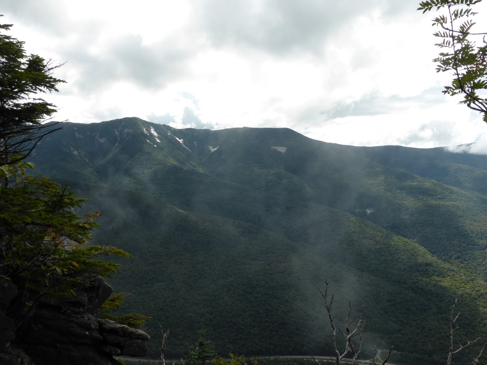 |
| Little Haystack at the center of Franconia Ridge |
 |
| Shining Rock below Little Haystack |
 |
| Yup, the ladder is a little steep |
 |
| View down the notch from just past the ladder |
 |
| Lonesome Lake from high on Cannon Mountain |
Finishing up the final ascent to the Kinsman Ridge Trail, the clouds rolled in, and by the time I reached the tower, it was socked in and I could barely see the tram building from the summit once again... I stuck around on the tower for 45 minutes or so hoping it would clear, and while I did get a few peeks through the clouds here and there towards the end, I never got the nice sweeping views I had anticipated a mere hour before. Strike four Cannon Mountain!
 |
| The tram building was just barely visible from the summit tower at first... |
 |
| A brief hole in the clouds towards Mount Liberty |
 |
| A clearer shot towards Liberty - pretty much the best view I had from Cannon this day |
As can be seen, I did get some views for once, so at least I could see that the potential is there. Still, when the clouds decided to roll back in, I opted to head off for the Cannonballs. As I remembered from previous trips, the descent into the col between Cannon and the Cannonballs (Coppermine Col) was tedious owing to it being steep, slippery and bouldery. Thankfully, once I hit the col, the trail got considerably better in footing, even if it was still rough and rugged. Next up was the Northeast Cannonball, the lowest peak on the New England 100 Highest, and the only one on that list that I had not visited in the last 3 years (I had visited it on that same rainy day on Cannon in 2007). On the way up to and just past the summit are a few view points, but the summit itself is in the trees (and it wasn't clear which of 2 different small bumps near each other is the summit).
 |
| The descent into Coppermine Col from Cannon looks like this most of the way... |
 |
| Looking back towards Cannon on the way to the Cannonballs |
 |
| Of course, now the summit is in the clear... |
 |
| I believe this was the summit of the Northeast Cannonball. There was another spot a few yards down the trail that could be it too. |
 |
| Mount Liberty from the Cannonballs |
 |
| The Kinsmans from the Cannonballs |
From here it was down and up, up and down, across the series of bumps known as the Cannonballs. I saw a mere two people on this trail segment (and in fact I hadn't seen any other hikers except on the Lonesome Lake Trail and at the summit of Cannon so far), and the views were lacking, but it was a fun trek to be honest. Some folks hate the Cannonballs, for me it was a better stretch than any of the rough and rocky trails up to Cannon Mountain itself.
 |
| The Kinsman Ridge Trail over the Cannonballs - one of the rougher sections, still not terrible |
 |
| Blowdown patch near the top of the final PUD near Kinsman Junction |
From Kinsman Junction, I had a decision: continue on to the Kinsmans, or head down and maybe do a little red-lining. Since the skies had cleared and the legs were still feeling good, I headed for the views on the Kinsmans. I made quick work of the push up to North Kinsman, and immediately headed down to the lower view ledge that sits right above Kinsman Pond, which nobody was sitting at (others above me were curious how I got down there though! - hint: there is a path from the upper view ledge).
 |
| The ridge of the Cannonballs over to Cannon (tower) |
 |
| Franconia Ridge from North Kinsman |
 |
| South Kinsman from North Kinsman |
 |
| Kinsman Pond, the Cannonballs, and Franconia Ridge. Love the views from this ledge! |
 |
| Kinsman Pond shelter on the North end of Kinsman Pond |
The trek over to South Kinsman from North Kinsman isn't too bad and is only about a mile. There is debate over which of the two bumps of South Kinsman (which are about 1/10 mile apart) is the true summit. I've always held that the Southern one, which has the better, more open views, is the summit, and it seems the AMC is agreeing with me as the side path that folks took to the Northern bump has now been blocked off with a rock wall. Do yourself a favor, go the extra few feet to the South summit, it has nicer views anyway!
 |
| The town of Lincoln and the Southern high peaks of the White Mountain region |
 |
| Moosilauke from South Kinsman |
At this point I was getting ready for dinner and there were still 5 miles to go out. So, off I went, passing over North Kinsman and picking my way carefully down the ledges back to Kinsman Junction. From there is everyone's "favorite" trail, the Fishin' Jimmy Trail, affectionately referred to as the "F-ing Jimmy Trail" in the hiking community. The first mile descends down over steep, always wet ledges with numerous wooden steps pinned to the rock. But whoever put those steps in seemed to have a wierd sense of humor, as there are 2-3 step gaps on a few of the ledges between steps for some odd reason. But, once down this section which wasn't as bad as I expected (I'm loving these new Oboz boots I bought this Spring, they're super grippy!), there is still another mile to the Lonesome Lake Hut, going up and down over several minor ridges before finally getting there. The hut was predictably a zoo, so I headed off fast, stopping briefly on the bridge over the lake outlet for some pictures of Cannon and the Northeast Cannonball, before motoring out to the car, and off to Lincoln for dinner! Once again Cannon's views had largely eluded me, but at least I got some limited ones, and I didn't seem to injure myself for once either!
 |
| Franconia Ridge from Lonesome Lake |
 |
| Cannon (R) and the Northeast Cannonball (L) from Lonesome Lake |


I feel your pain Matt, the views from Cannon also eluded me for quite some time. The first two times, the summit was firmly socked in. The third time, the summit was just below the cloud deck, providing so-so views of everything under them. It wasn't until this past March that I was amply rewarded for my patience. Give it a fifth try, it's definitely no slouch in the views department!
ReplyDeleteMatt,
ReplyDeleteGreat trip report! Not to add insult to injury but this past summer we took the tram up Cannon Mtn. The views were stunning. I'm going to have to hike it someday. https://flic.kr/p/oq9tqk
Joe
Someday Joe, someday I'll get those views :) Pretty much everyone I know has gotten views from that peak, but I've gotten views from a peak or two that have eluded them, so it all evens out in the end I suppose. Since I'm slowly working on the grid, I've got at least 8 more trips to Cannon to get views!
DeleteLooking forward to seeing those views right here Matt!
ReplyDelete