Route: Stoney Brook Trail, Carter-Moriah Trail
Peaks: Moriah (4049', NH4K)
Mileage: 10.1 miles
Elevation Gain: 3450ft
Book Time: 6hr 45min (Actual 6hr 30min)
This was a nice hike for the second day of a 3-day hiking weekend. Originally I had grand plans for doing a large loop from the Wild River Campground, but with a long day on tap for the next day, I opted for my usual route to Moriah: the Stoney Brook Trail. While about a mile longer round-trip than the approach from the Northern terminus of the Carter-Moriah Trail, I like this approach more, as it has a long series of ledges with tremendous views to the Presidential and Carter Ranges, and across the Wild River Wilderness into Maine.
I started off from the trailhead off of Route 16 as usual, a bit later than normal as this was a short hike for me these days, and I didn't have to drive very far to get back to my campground (in Shelburne, NH). I was in no rush, but still made fairly short work of the climb up to the junction with the Carter-Moriah Trail. The first 2 miles of the Stoney Brook Trail are gentle and moderate in grade, with a steady but not steep final push up to the ridge. Once at the junction, it is only a short bit until the first ledge, which mainly looks into the Wild River Valley, and was the site of my first of many breaks. I fully intended to enjoy the nice weather and lack of a need to be anywhere later to enjoy all the views.
 |
| There was some nice fall color right across the street from the trailhead. |
 |
| The Stoney Brook Trail has one major crossing down low, and a couple of lesser crossings up high, like this one. |
 |
| The upper crossing on the Stoney Brook Trail |
 |
| Looking across the Wild River Valley to the Baldface Range |
 |
| Looking up along the cliffy ridge to come |
From the first ledge, the trail dips in and out of the trees, passing over a set of steadily nicer ledges with views in nearly all directions in the first mile from the junction. After that, there is a short dip and stretch in the woods, before reaching the junction with the Kenduskeag Trail a short scramble from the summit spur. Just before this dip, I ran into Hiker Ed, who I've met a few times before, and is a bit of a White Mountains hiking legend: he has completed the New Hampshire Grid (all 48 4000-footers in each calendar month) FIVE times! He was on his way down, but it was nice to chat for a few minutes before we went our separate ways.
 |
| Pine Mountain in Gorham, with the Crescent Range and then the Kilkenny Range behind it. |
 |
| The Carters from the ledges en-route to Moriah |
 |
| The top of Washington, along with Clay, Jefferson, Adams, and Madison - the Northern Presidentials |
 |
| Mt. Washington |
 |
| Looking down into the Moriah Brook drainage towards the Wild River |
 |
| The summit of Moriah from one of the ledges - note the people on the right side standing on the summit rock. |
 |
| There's still a little ways to go to get to the summit though. |
 |
| Jericho Mountain wind farm in Berlin, NH |
 |
| Ledges. Love them! |
 |
| Ledges on the side of trail-less Imp Mountain, near the Imp Campsite |
 |
| Wild River Wilderness |
 |
| The Baldface Range |
 |
| The summit is getting closer. |
The summit rock was clearing out just as I arrived, and I ended up having it to myself for 10-15 minutes before a small Meetup group arrived, with several familiar faces from the group I ran into on the Kilkenny Range the day before! We all hung out for quite a while, a total of roughly 1 hour for me, simply enjoying the beautiful weather (the temperature was about perfect, with a slight breeze and mostly clear skies).
 |
| Shelburne Moriah from Moriah's summit |
 |
| The Northern Presis from Moriah |
 |
| Summit benchmark |
 |
| Old Speck Mountain in the distance - over the border into Maine |
On the way down, I hung out at several of the ledges for a little while again. There are a ton of places one can stop along this route, and it was great to stop at nearly all of them. Once back to the trail junction with the Stoney Brook Trail, I didn't really stop until I was back to the car. Despite all of the breaks along the ledges and the hour-long stop on the summit, I still did this hike in slightly under book time! All that was left was to return to the campground and prepare for an early (pre-dawn) departure in the morning.
 |
| Looking back at the summit on my way down |
 |
| I think this is Rogers Ledge in the Northern Kilkenny Range |
 |
| Percy Peaks |
 |
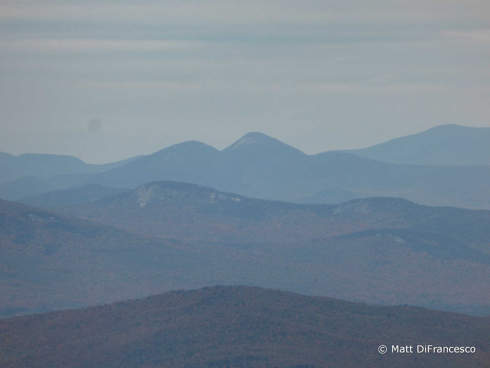
| In the background, the Northern end of the Kilkenny Range - Cabot, The Bulge, The Horn, Unknown Pond Peak, Roger's Ledge (L -> R). |
 |
| The Southern end of the Kilkenny Range behind the Crescent Range - Starr King, Waumbek and the Weeks (L -> R) |


No comments:
Post a Comment